Category:Øksfjordeidet
Jump to navigation
Jump to search
| Object location | | View all coordinates using: OpenStreetMap |
|---|
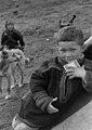
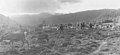
Øksfjordeidet is a place name that is not found on currently available Norwegian maps. However, according to the photos of Kjell Borgen, it should be located in Loppa. Also, one of the photos shows a view towards Rivertbukta. Therefore, it seems likely that it is located somewhere around the place which is today called Rivarbukteidet, and these are the coordinates given. If anyone has better information, please change the location.
Media in category "Øksfjordeidet"
The following 35 files are in this category, out of 35 total.
-

-

-

-

-

-

-

-

-

-

-

-

-

-
-

-
 Portrett av Ellen Persdatter Buljo, 1953 - Norsk folkemuseum - NF.05329-008.jpg 1,165 × 1,669; 279 KB
-

-

-
 Portrett av Henrik Isaksen Buljo, 1953 - Norsk folkemuseum - NF.05329-010.jpg 1,131 × 1,571; 185 KB
-
 Portrett av Inga Persdatter Buljo, 1953 - Norsk folkemuseum - NF.05329-017.jpg 1,123 × 1,723; 290 KB
-
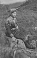
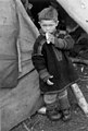
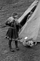 Portrett av Inga Persdatter Buljo, ved telt, 1953 - Norsk folkemuseum - NF.05329-018.jpg 1,165 × 1,777; 321 KB
-
-

-
 Portrett av Josef Henrik Persen Buljo, 1953 - Norsk folkemuseum - NF.05329-022.jpg 1,159 × 1,759; 214 KB
-
 Portrett av Josef Henrik Persen Buljo, 1953 - Norsk folkemuseum - NF.05329-023.jpg 1,213 × 1,711; 245 KB
-

-

-
-
 Reinsdyr på reinsamlingsplass. Øksfjordeidet 1953 - Norsk folkemuseum - NF.05329-109.jpg 1,737 × 1,081; 300 KB
-
 Reinsdyr på reinsamlingsplass. Øksfjordeidet 1953 - Norsk folkemuseum - NF.05329-111.jpg 1,135 × 1,753; 365 KB
-
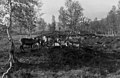 Reinsdyr på reinsamlingsplass. Øksfjordeidet 1953 - Norsk folkemuseum - NF.05329-112.jpg 1,757 × 1,137; 368 KB
-

-

-
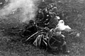
 Reinskilling med lasso. Øksfjoreidet 1953 - Norsk folkemuseum - NF.05329-090.jpg 1,076 × 1,476; 280 KB
-
 Skog på fjellskråningen i Øksefjordeidet, 1953 - Norsk folkemuseum - NF.05329-095.jpg 1,813 × 1,145; 437 KB


