Blaeu
Jump to navigation
Jump to search

There were two Dutch cartographers named Blaeu:
| Willem Blaeu
(1571–1638) |
|||
|---|---|---|---|
 |
|||
| Alternative names |
Willem Janszoon Blaeu, Willem Jansz Blaeu, Guilielmus Janssonius, Willems Jans Zoon, Guilielmus or G. Blaeu | ||
| Description | Dutch cartographer, publisher, instrument maker, astronomer and printmaker | ||
| Date of birth/death |
1571 |
18 October 1638 / 1638 | |
| Location of birth/death | Uitgeest | Amsterdam | |
| Work period | 1610 | ||
| Work location | |||
| Authority file |
| ||
| Joan Blaeu
(1596–1673) |
|||
|---|---|---|---|
.jpg) |
|||
| Alternative names |
Johannes Blaeu; John Wiliamson Blaeu; Johannes Willemszoon Blaeu | ||
| Description | Dutch cartographer and publisher | ||
| Date of birth/death |
23 September 1596 | 21 December 1673 | |
| Location of birth/death | Alkmaar | Amsterdam | |
| Work period | 17th century / 1647 | ||
| Work location | |||
| Authority file |
| ||
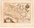
Similar to Abraham Ortelius' earlier Theatrum Orbis Terrarum, their atlas Theatrum Orbis Terrarum, sive, Atlas Novus was published 1635 in two volumes; in 1645 in four volumes; also named Atlas Maior in 1662 in 11 volumes, with ca. 600 maps and 3,000 pages of text in Latin.
The Toonneel der Steeden van de Vereenighde Nederlanden (Latin: Novum Ac Magnum Theatrum Urbium Belgicæ Liberæ ac Foederatæ) was published from 1649. At first in two different volumes. One of the liberated (latin: Liberæ) and one of the King's (Dutch: 's Konings) Netherlands.
An even larger project was planned but in 1672 a fire destroyed Joan Blaeu's studio. He died one year after this event.
-
 1604 Inferioris Germaniae Provinciarum Nova Descriptio
 -
 1606 Nova Totius Terrarum Orbis Geographica Ac Hydrographica Tabula
 -
 1644 Europa recens descripta
 -
 1659 Europæ Nova Descriptio
 -
 1664 Nova et Accvratissima Totivs Terrarvm Orbis Tabvla


Europae Septentrionalia & Orientalia, 1645[edit]
-
 4. Regions below the Arctic Pole
 -
 7. Iceland
 -
 9. Diocese of Stavangria & several neighboring parts (southern Norway)
 -
 10. Kingdom of Denmark
 -
 11. Island of Fyn, Denmark
 -
 12. Sweden, Denmark and Norway kingdoms of northern Europe
 -
 13. Götaland (southern Sweden)
 -
 15. Duchy of Uppland (region of Sweden)
 -
 16. Livonia commonly known as Livland (Latvia and Estonia)
 -
 17. Map of Russia
 -
 20. Russia Moscow northern and eastern parts
 -
 22. Russia Moscow southern part
 -
 23. Tauric (Crimean) Peninsula
 -
 29. Prussia
 -
 31. Kingdom of Poland and Duchy of Silesia
 -
 31a. Kingdom of Hungary
 -
 32. Transylvania Sibenburgen
 -
 33. Wallachia, Serbia, Bulgaria, Rumelia
 -
 34. Slavonia Croatia Bosnia and part of Dalmatia
 -
 35. Slovenia and Croatia, Istria and Carniola)


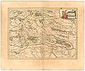
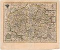
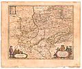
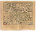
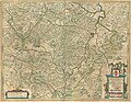
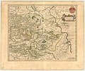
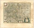
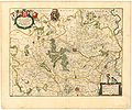
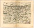
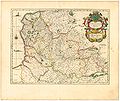
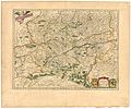
Germania, 1645[edit]
-
 1. New representation of all Germany.
 -
 4. Archduchy of Austria.
 -
 5. Styria, Steiermark.
 -
 6. Bohemia.
 -
 8. Marquisate of Moravia.
 -
 9. Duchy of Silesia.
 -
 10. Lower rhenumSilesia.
 -
 11. Duchy of Silesian Glogau (Glogów, Poland)
 -
 12. County of Glatz. (Klodzko, Poland)
 -
 13. Upper Saxony, with Lusatia and Meissen.
 -
 15. Upper Lusatia (Lausitz).
 -
 16. Marquisate of Brandenburg, with the Duchies of Pomerania and Mecklenburg.
 -
 18. Map of the Duchy of Pomerania.
 -
 20. Rügen Island and Duchy.
 -
 21. Duchy of Mecklenburg.
 -
 22. New map of the Duchy of Holstein.
 -
-
 25. Duchy of Lüneburg and adjacent regions delineated.
 -
 26. Archbishopric of Magdeburg and the Duchy of Anhalt.
 -
 27. Duchy of Brunswick, most of Lüneburg
 -
 28. Bishopric of Hildesheim.
 -
 29. Circle of Westphalia, or Lower Germany.
 -
 30. County of Oldenburg.
 -
 31. Figure of East Friesland.
 -
 32. Bishopric of Osnabrück.
 -
 33. Bishopric of Münster.
 -
 34. County of Bentheim, and Steinfurt.
 -
 35. Duchy of Westphalia.
 -
 36. Bishopric of Paderborn
 -
 37. County of Mark and Ravensburg
 -
 38. Duchy of Cleves and Ravenstein Domain.
 -
 39. Duchy of Jülich and Berg
 -
 40. Archbishopric of Trier.
 -
 41. Archbishopric of Cologne.
 -
 42. County of Waldeck.
 -
 44. Territory of Bad Hersfeld
 -
 45. County of Mansfeld.
 -
 46. Landgravate of Thuringia.
 -
 47. Franconia, commonly called Franken.
 -
 48. County of Nassau.
 -
 49. Palatinate at the Rhine.
 -
 51. County of Erbach, Germany
 -
 52. Territory of Nuremberg.
 -
 53. Palatinate of Bavaria.
 -
 55. Duchy of Bavaria.
 -
 56. Archbishopric of Salzburg and Duchy of Carinthia.
 -
 57. New map of Swabia.
 -
 58. Alemannia or Upper Swabia.
 -
 59. Duchy of Württemberg.
 -
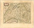
 60. Landgravate of Alsace, with Sundgau and Breisgau.
 -
 62. Switzerland, with neighboring confederated territories.
 -
 63. Zürich and the Province of Basel.
 -
 64. Aargau with the southern part of Zürich.
 -
 65. Wifflisburg Switzerland)
 -
 66. Eastern Switzerland
 -
 67. The Rhine with the Moselle.
 -
 71. Old Germany.


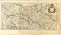
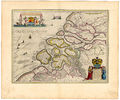
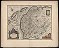
Germania Inferior, 1645[edit]
-
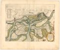
 1. 17 Provinces of Lower Germany.
 -
 2. Duchy of Brabant.
 -
 3. First part of Brabant with Leuven, Belgium.
 -
 4. Second part of Brabant with Brussels
 -
 5. Third part of Brabant with Antwerp.
 -
 6. Map of the Castle near Zandvliet between Bergen op Zoom and Antwerp.
 -
 7. Map of Bergen op Zoom, Steenburgen.
 -
 8. Fourth part of Brabant with s' Hertogenbosch, Netherlands.
 -
 9. Duchy of Limburg.
 -
 10. Duchy of Luxembourg.
 -
 11. County of Flanders and Zeeland.
 -
 12. Eastern part of German Flanders.
 -
 13. Western part of German Flanders.
 -
 14. Dunkercka
 -
 15. French Flanders and Tournai.
 -
 16. Two parts of Flanders.
 -
 17. Pas-de-Calais.
 -
 18. Counties of Hainaut and Namur.
 -
 19. County of Namur.
 -
 20. Domain of Mechelen and the Duchy of Aarschot, Belgium.
 -
 21. Diocese of Liege.
 -
 22. Geldria Ducatus et Zutfania Comitatus
 -
 23. County of Zutphen.
 -
 24. Canal of Saint Mary.
 -
 25. Rhine and the Meuse (Maas).
 -
 26 County of Holland
 -
 27. Northern part of Holland
 -
 28. Rhine and Amstel lands.
 -
 29. South Holland.
 -
 30. Delftland, Schieland, Voorne, Overflackee, Goeree, Ijsselmonde, etc.
 -
 31. County of Zeeland
 -
 32. West part of Friesland
 -
 33. Domain of Utrecht.
 -
 34. Domain of Groningen.
 -
 35. Domain of Overijssel.
 -
 36. County of Drenthe. Second map of Overijssel.


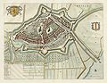
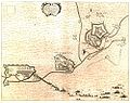
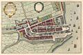
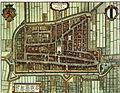
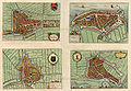
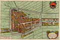
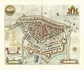
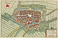
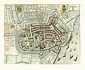
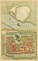
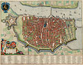
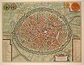
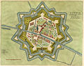
Toonneel der Steden van de Vereenighde Nederlanden, 1649 - 1652[edit]
-
 Title page no txt
 -
 Title page dutch
 -
 Title page latin
 -
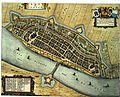
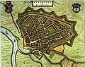
 Alkmaar
 -
 Amersfoort
 -
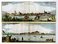
 Amsterdam
 -
 Aerdenburgh
 -
 Arnemuyden
 -
 Arnhem
 -
 Axel 1 van 4
 -
 Bergen op Zoom
 -
 Blokzijl
 -
 Bolsward
 -
 Bolswaert Dockum Sneeck Staveren
 -
 Breda
Breda -
 Breda sieged by Spinola 1624
 -
 Breda sieged by Frederik Hendrik 1637
 -
 Briela
 -
 Cadsant
 -
 Coevordia Obsessa et Capta ... 1592
 -
 Crevecoeur
 -
 Culenburgum
 -
 Delfshaven
 -
 Delft
Delft -
 Delfsiil
 -
 Deventer
 -
 Dokkum
 -
 Dordrecht
 -
 Edam, Medemblik, Purmerend & Monnickendam
 -
 Edam
Edam -
 Emden (D)
 -
 Emmeryck (D)
 -
 Enkhuizen
 -
 Erkelenz (D)
 -
 Franekera
 -
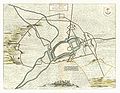
 S Geertruydenberg
 -
 St Geertruydenberg
 -
 Op den 23 Iuny 1642 reedt des Governeurs vrouwe uyt, Het Huys te Gennep
 -
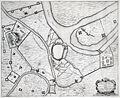
 De Stadt Gennep & t'Huys te Gennep
 -
 Arcis Gennippensis
 -
 Genneperhuys
 -
 Goesa
Goesa -
 Gorkum
 -
 Gouda
Gouda -
 Gravia obsessa et expugnata
 -
 Gravia
 -
 's Gravenhage
 -
 Grave Sande, Delfshaven, Vlaerdingen & Goeree
 -
 Grolla (Groenlo)
 -
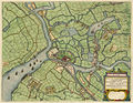
 Groningen
 -
 Haarlem
 -
 Harderwijk
 -
 Harlingen
 -
 Hasselt
 -
 's Hertogenbosch
 -
 Obsidio et Expugnatio Sylvæducis
 -
 Bois-le-Duc - 's Hertogenbosch
 -
 Heusden
 -
 Hoorn
Hoorn -
 Hulst, De Belegeringhe 1645
 -
 Hulst, Axel, Liefkenshoeck & Ter Neuse
 -
 Kampen
 -
 Kaerte van alle de Sanden, ... , genaemt het Koe-Gras
 -
 Leeuwarden
 -
 Lingae Obsidio Confecta ab Ill.m Principe Mauritio Nassovio .. 1597
 -
 Leiden
 -
 Obsidio Et Expugnatio Traiecti Ad Mosam .. 1632
 -
 Maastricht
 -
 Medemleck
 -
 Medenblick, 1 van 4
 -
 Middelburg
 -
 Monnikendam
 -
 Naerden
 -
 Nijmegen
 -
 Oudewater, 1 van 4
 -
 Oostburg
 -
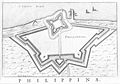 Philippina
 -
 Philippine, complete page
 -
 Purmerend, 1 van 4
 -
 Rammekens oft Zee-Burg
 -
 Rhenoberca (Rheinberg-D) obsessa et capta armis ordinum .. 1601
 -
 Obsidio Rhinbercae (Rheinberg-D).. 1633
 -
 Roermond
 -
 Rotterdam
 -
 S Andries
 -
 't Sas van Gent
 -
 Sas van Gent, beleg door Frederik Hendrik in 1644
 -
 Schagen, Clundert, Beverwyck & Arx Britannica
 -
 De Ghelegentheyt ende Belegheringhe van Schencken-Schans .. 1636
 -
 Shencken-Schans
 -
 Schoonhoven
 -
 Sluys
Sluys -
 Slusa Expugnata
 -
 Sneek
Sneek -
 Steenwijck
 -
 Staveren
 -
 Tolen
Tolen -
 Tyel
Tyel -
 Tiel, Tiel, Wageningen & Wachtendonk
 -
 Tyel & Salt Boemel
 -
 Utrecht
 -
 Veere
Veere -
 Venlo
Venlo -
 Vyanen, Asperen, Leerdam & Hoeckelum
 -
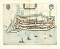
 Vlissingen
 -
 Vollenhove
 -
 't Fort Nassau oft De Voorn
 -
 Wageningen (Wageninga)
 -
 Wyck te Duersteden + Montfoort
 -
 Woerden 1 van 4
 -
 Yselstein 1 van 4
 -
 Yselstein, Oudewater, Woerden & 't Slot Woerden
 -
 Ysendyck
 -
 Salt Boemel
 -
 Bommelia Obsessa ab Hispanis ...1599
 -
 Zirizea
 -
 Zutphen
 -
 Swartesluis
 -
 Zwolle


.jpg)


.jpg)


Toonneel der Steden van 's Konings Nederlanden, 1649 - 1651[edit]
-
 Titel Page zw
 -
 Titel Page kl
 -
 Aalst
Aalst -
 Antwerpen
 -
 Antwerpen; Domus Hansae
 -
 Antwerpen; Domus Senatoria
 -
 Armentieres
 -
 Broucburgus vulgo Broucburch
 -
 Brugge. Amplissimis ac Nobilissimis
 -
 Bruxella
 -
 Dammum Munitissimum Flandriae oppidum, Vulgo Damme
 -
 Tenermonda Vulgo Dendermonde
 -
 Dixmuda
 -
 Dinant
 -
 Duynkercka
 -
 Gerardmontium Vulgo Gheertsberghe


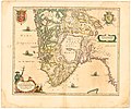
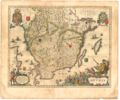
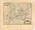
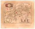
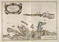
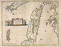
Atlas of Scotland, 1654[edit]
-
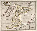 1. INSULAE ALBION ET HIBERNIA - Old Great Britain
 -
 2. SCOTIA ANTIQUA - Old Scotland
 -
 3. SCOTIA REGNUM - Kingdom of Scotland
 -
 4. TEVIOTIA - Teviotdale
 -
 5. TVEDIA - Upper Tweedsdale
 -
 6. LAVDELIA - Lauderdale
 -
 7. MERCIA - Berwickshire
 -
 8. LOTHIAN AND LINLITQVO - The Lothians
 -
 9. LIDALIA - Liddesdale
 -
 10. EVIA ET ESCIA - Eskdale
 -
 11. ANNANDIÆ - Lower Annandale
 -
 12. NITHIA - Nithsdale
 -
 13. GALLOVIDIA - Galloway
 -
 14. GALLOVIDIÆ PARS OCCIDENTALIOR - Wigtownshire
 -
 15. GALLOVIDIÆ PARS MEDIA - West Kirkcudbright
 -
 16. KIRCVBRIENSIS - East Kirkcudbright
 -
 17. CARRICTA MERIDIONALIS - Carrick
 -
 18. CARRICTA BOREALIS - Mid Ayrshire
 -
 19. COILA - Kyle
 -
 20. CVNINGHAMIA - Cunningham
 -
 21. KNAPDALIA - Knapdale
 -
 22. CANTYRA - Kintyre
 -
 23. ARANIA - The Isle of Arran
 -
 24. BUTHE INSULA - The Isle of Bute
 -
 25. GLOTTIANA PRÆFECTVRA INFERIOR - Lower Clydesdale
 -
 26. GLOTTIANA PRÆFECTVRA SVPERIOR - Upper Clydesdale
 -
 27. RENFROANA - Renfrew
 -
 28. LEVINIA - Dunbarton
 -
 29. STERLINENSIS - Stirlingshire
 -
 30. FIFÆ VICECOMITATUS - Fife
 -
 31. FIFÆ PARS OCCIDENTALIS - The West Part of Fife
 -
 32. FIFÆ PARS ORIENTALIS - The East Part of Fife
 -
 33. ABERDONIA & BANFIA - Aberdeenshire and Banffshire
 -
 34. BRAID-ALLABAN - The Central Highlands
 -
 35. LORNA - The Firth of Lorn
 -
 36. EXTIMA SCOTIÆ - Northern Scotland
 -
 37. MORAVIA - Moray and Nairn
 -
 38. SOVTHERLANDIA - Southeast Sutherland
 -
 39. STRATH-NAVERNIA - Strath Naver and Strathmore
 -
 40. CATHENESIA - Caithness
 -
 41. ÆBUDÆ INSULÆ - The Hebrides
 -
 42. IVRA INSVLA - The Isle of Jura
 -
 43. ILA INSVLA - The Isle of Ila
 -
 44. MVLA INSVLA - The Isle of Mull
 -
 45. INSVLÆ QVÆDAM MINORES - The Small Isles
 -
 46. SKIA - The Isle of Skye
 -
 47. VISTVS INSVLA - The Uists and Barra
 -
 48. LEOGVS ET HARAIA - Lewis and Harris
 -
 49. ORCADVM ET SCHETLANDIÆ - Orkney and Shetland


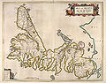
Atlas Maior 1667[edit]
Vol 1 (Northern Europe, Norway, and Denmark)[edit]
.1.jpg)
.1_-_013.jpg)
.1.(1).jpg)
))_-_Atlas_Maior,_vol_1_-_Joan_Blaeu,_1667_-_BL_114.h(star).1_-_046.jpg)
.1.(2).jpg)
Sources[edit]
- University of California Los Angeles Library: Europae Septentrionalia & Orientalia, Germania, Germania Inferior (1645)
- Toonneel der Steeden, Digitalisat Utrecht University Library
- National Library of Scotland: Atlas of Scotland (1654)