Atlas of states of Germany
- Also see: Atlas of Germany.

|
Wikimedia Commons Atlas of the World The Wikimedia Atlas of the World is an organized and commented collection of geographical, political and historical maps available at Wikimedia Commons. Discussion • Update the atlas • Index of the Atlas • Atlas in categories • Other atlases on line |
|
| ||||||||||||||||||||||||||||||||||||||||||||


General maps

|
Map of Germany Karte Deutschlands |

|
Map of Germany in German Karte Deutschlands |
-
 Map of Germany
Karte Deutschlands -


Maps of divisions
This section holds maps of the administrative divisions.

|

|
| Federal States of Germany Die Bundesländer |
Politische Gliederung Political structure |
Locator maps of the actual German länder
-
-
 Bayern (2)
 -
 Berlin (3)
 -
 Brandenburg (4)
 -
 Bremen (5)
 -
 Hamburg (6)
 -
 Hessen (7)
 -

-
 Niedersachsen (9)
 -
 Nordrhein-Westfalen (10)
 -
 Rheinland-Pfalz (11)
 -
 Saarland (12)
 -
 Sachsen (13)
 -
 Sachsen-Anhalt (14)
 -
 Schleswig-Holstein (15)
 -
 Thüringen (16)


Topographic maps of single länder
-
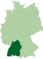
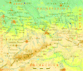
 Baden-Württemberg
 -
 Hessen
 -
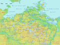 Mecklenburg-Vorpommern
 -
 Nordrhein-Westfalen
 -
 Sachsen
 -
 Schleswig-Holstein


Districts
Besides the following maps of all Germany, there are overviews of the districts of each land

|
 |
| Landkreise and free cities (yellow) | Landkreise with electoral districts |
Former German fractional states
History of former German states
Prussia

|
1618-1701: Brandenburg-Prussia (Brandenburg-Preussen) - monarchy most of the time partly inside the Holy Roman Empire c.q. successor states |
| 1701-1871: Kingdom of Prussia (Königreich Preussen) - monarchy most of the time partly inside the Holy Roman Empire c.q. successor states |

|
Growth of Prussia 1600-1795 |

|
Growth of Prussia 1807-1871 |

|
The ten provinces of the Kingdom of Prussia, at the time of the formation of the German Confederation (1815) |


|
Prussia at the time of the formation of the German Empire (1871) |

|
Prussia 1871-1919 |

|
The Free State of Prussia at the time of the Weimar Republic (1919) |

|
The provincial divisions of the Free State of Prussia (early 1920) |

|
East Prussia 1923-1939 |

|
East Prussia 1939 |

|
Pomerania |
.png)
|
Silesia |

|
Memel Territory (now in Lithuania) |
Baden
| 1867-1871: Grand Duchy of Baden (Grossherzogtum Baden) - independent monarchy |

|
After the Austro-Prussian war, Baden remained outside the North-German Confederation. In a way it was independent between 1867 and 1871, when it joined the German Empire. |
Bavaria
| 1867-1871: Kingdom of Bavaria (Köngigreich Bayern) - independent monarchy After the Austro-Prussian war, Bavaria remained outside the North-German Confederation. In a way it was independent between 1867 and 1871, when it joined the German Empire. |
Hesse

|
1867-1871: Grand Duchy of Hesse and by Rhine (Grossherzogtum Hessen und zu Rhein) - independent monarchy After the Austro-Prussian war, the south part of Hesse remained outside the North-German Confederation. In a way it was independent between 1867 and 1871, when it joined the German Empire. |
Württemberg
| 1867-1871: Kingdom of Württemberg (Königreich Württemberg) - independent monarchy After the Austro-Prussian war, Württemberg remained outside the North-German Confederation. In a way it was independent between 1867 and 1871, when it joined the German Empire. |
States inside the German Empire
_Hessen-Darmstadt.svg)
|
Hesse-Darmstadt |
_Anhalt.svg)
|
Anhalt |

|
Hesse-Darmstadt 1930 |

|
Map of the Hessian countries around 1900 |

|
Saxony Duchies in Thuringia |

|
Saxony 1930 |

|
Free City of Lübeck |

|
Kingdom of Hannover in the German Confederation |
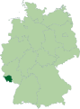
Saar
| 1920-1935: Territory of the Saar Basin (Territoire du Bassin de la Sarre/Saarbeckengebiet) - territory under French League of Nations mandate |

|
The Territory of the Saar Basin, also referred as the Saar or Saargebiet, was a territory governed by the League of Nations under the Treaty of Versailles for 15 years from 1920. Its population in 1933 was 812,000, and its capital was Saarbrücken. After a plebiscite was held in 1935, it was restored to Germany. |
| 1947-1956: Saar (Saar) - French protectorate |
Lander at the time of the proclamation the two German States in 1949

|
After World War II, the Saarland came under French administration again, as the Saar Protectorate in 1947. Under the Monnet Plan France attempted to gain economic control of the remaining German industrial areas with large coal and mineral deposits; the Ruhr area and the Saar area. In the Paris Accords of 23 October 1954, France offered to establish an independent "Saarland", under the auspices of the Western European Union (WEU), but a referendum held on 23 October 1955 rejected this plan by 67.7% to 32.3%. Instead, the people of the Saar opted for the return of the Saar to the Federal Republic of Germany. On October 27, 1956, the Saar Treaty established that Saarland should be allowed to rejoin West Germany, which it did on January 1, 1957. |
German Democratic Republic (DDR)
German Democratic Republic
| 1949-1990: German Democratic Republic (Deutsche Demokratische Republik) - independent people's republic, satellite state of the USSR |

|
In 1949 the German Democratic Republic was proclaimed in the Soviet zone of Germany. |

|
Districts of German Democratic Republic |
Old maps of all Germany
Old maps
This section holds copies of original general maps more than 70 years old.

|
1450 |

|
Herman Moll New Map of Germany |

|
Historical map of the German Empire |
.jpg)
|
Prussia (political map before 1905) |

|
Kingdom of Saxony 1895 |

|
Kingdom of Saxony 1905 |

|
Baden and Rhenish Bavaria 1905 |

|
Württemberg and Hohenzollern |

|
Kingdom of Württemberg 1905 |

|
Historical map of Alsace-Lorraine (Reichsland Elsaß-Lothringen) 1905 |

|
Alsace-Lorraine 1905, area of the territory highlighted |

|
High-resolution map (7,473 × 7,773) of Alsace-Lorraine as part of the German Empire, 1887 |

|
Historical map of Hannover, Oldenburg, Braunschweig 1905 |

|
Historical map of the Thuringian states 1905 |

|
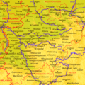
Historical map of Mecklenburg 1905 |

|
Historical map of Brandenburg 1905 |

|
Historical map of East- and Westprussia (Prussian Provinces) 1890 |

|
Historical map of Hesse-Nassau (Prussian Province) 1905 |

|
Historical map of Province of Pomerania 1905 |

|
Historical map of Posen 1905 |

|
Historical map of Rhenish Prussia 1905 |

|
Historical map of Saxony (Prussian Province) 1905 |

|
Historical map of Schleswig-Holstein as Prussian Province 1905 |

|
Historical map of Silesia as Prussian Province 1905 |

|
Historical map of Westphalia as Prussian Province 1905 |
Satellite maps
Notes and references
|
General remarks:
|