Category:EVS Precision Island Maps
Jump to navigation
Jump to search
EVS Precision Island Maps[edit]
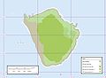
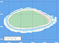
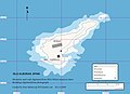
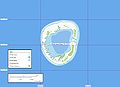
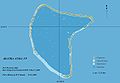
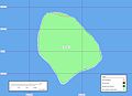
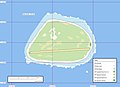
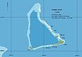
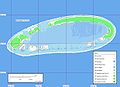
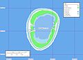
Enhanced Vector Shoreline Precision island maps are created from Landsat ETM+ georectified mosaics as base imagery. The island shorelines and other features were digitized from these base images typically at scales between 1:25,000 to 1:6,000 scale. These maps are usable between scales of 1:125,000 to 1:24,000 and occasionally at larger scales.
Subcategories
This category has only the following subcategory.
Media in category "EVS Precision Island Maps"
The following 138 files are in this category, out of 138 total.
-
 'Ata 150211248 1840b40130 o.jpg 1,220 × 894; 159 KB
-
 'Ata Island map.svg 1,220 × 894; 64 KB
-
 Ahe Atoll - EVS Precision Map (1-100,000).jpg 1,266 × 877; 79 KB
-
 Ahe Atoll - Landsat Image S-06-10 2000 (1-100,000).jpg 1,266 × 877; 56 KB
-
 Ahunui Map.jpg 1,240 × 902; 212 KB
-
 Aitutaki Atoll map.jpg 1,240 × 902; 236 KB
-
 Akiaki Island - Map.jpg 1,240 × 902; 111 KB
-
 Alboran-2260027926 9be0b3f1eb o.jpg 1,240 × 904; 204 KB
-
 Anuanuraro Map.jpg 1,240 × 902; 232 KB
-
 Anuanurunga Map.jpg 1,240 × 902; 151 KB
-
 Apataki Atoll - Landsat S-06-15 2000 (1-225,000).jpg 1,255 × 877; 118 KB
-
 Apataki Atoll FP - EVS Precision Map from Landsat S-06-15 2000 (1-225,000).jpg 1,255 × 877; 155 KB
-
 Aratika Atoll - EVS Precision Map (1-115,000).jpg 1,266 × 877; 66 KB
-
 Aratika Atoll - Landsat S-06-15 2000 (1-115,000).jpg 1,266 × 877; 129 KB
-
 Arutua Atoll FP - EVS Precision Map (1-170,000).jpg 1,276 × 885; 75 KB
-
 Arutua Atoll FP - Landsat S-06-15 2000 (1-170,000).jpg 1,276 × 885; 86 KB
-
 Atiu map.jpg 1,240 × 902; 119 KB
-
 Atoll Mururoa - Map ukr.jpg 1,240 × 902; 114 KB
-
 Atoll Mururoa - Map.jpg 1,240 × 902; 185 KB
-
 Atoll Vairaatea - Map.jpg 1,240 × 902; 268 KB
-
 Baker Island map.jpg 1,240 × 904; 210 KB
-
 Banaba Island - Marplot Map with Contours (1-20,000).jpg 1,240 × 904; 429 KB
-
 Bikar Atoll - EVS Precision Map (1-75,000).jpg 1,258 × 877; 60 KB
-
 Bikini 2244493428 13643c6505 o.jpg 1,240 × 904; 252 KB
-
 Bikini-map-He.jpg 1,240 × 904; 226 KB
-
 Birnie.jpg 1,240 × 902; 167 KB
-
 Blanquilla Map.jpg 1,240 × 904; 76 KB
-
 Canton Atoll Map.jpg 1,240 × 902; 282 KB
-
 Carteret Map.jpg 1,240 × 904; 129 KB
-
 Clarion Island - Map Finished (1-50,000).jpg 1,240 × 904; 280 KB
-
 Clipperton Map.jpg 1,240 × 904; 211 KB
-
 Coronado Islands Map.jpg 1,266 × 877; 129 KB
-
 Desecheo 3083147628 7a4a2508eb o.jpg 1,266 × 877; 419 KB
-
 Desecheo Names 3083147628 7a4a2508eb o.jpg 1,266 × 877; 285 KB
-
 Ducie Atoll Map.jpg 1,240 × 902; 242 KB
-
 Ducie.png 1,240 × 902; 282 KB
-
 Ebon Atoll Map.jpg 1,240 × 904; 179 KB
-
 EgmontIslands Map.jpg 1,240 × 904; 258 KB
-
 Eiao map.jpg 1,240 × 904; 277 KB
-
 Emirau EVS map.jpg 1,240 × 904; 294 KB
-
 Enderbury Map.jpg 1,240 × 902; 228 KB
-
 EVS map Guadalupe center.jpg 1,240 × 904; 429 KB
-
 EVS map Guadalupe north.jpg 1,240 × 904; 209 KB
-
 EVS map Guadalupe south.jpg 1,240 × 904; 119 KB
-
 EVS map Isla de la Plata.jpg 1,266 × 877; 419 KB
-
 EVS map Lighthouse Reef.jpg 1,260 × 879; 198 KB
-
 EVS map Robinson Crusoe Island.jpg 1,276 × 885; 351 KB
-
 Flint Island Precision Map.jpg 1,252 × 877; 54 KB
-
 Gambier mk.png 1,633 × 1,688; 623 KB
-
 Gambier9.png 1,633 × 1,688; 533 KB
-
 Glorioso Islands Map.jpg 1,240 × 902; 208 KB
-
 Gough Island - EVS Precision Map (1-52,000).png 1,276 × 900; 98 KB
-
 Gough Island EVS Precision Map 1 52000-sepia.png 1,276 × 900; 3.29 MB
-
 Gough Island Map.jpg 1,240 × 904; 436 KB
-
 Groupe Acteon map.jpg 1,240 × 902; 98 KB
-
 Hatutu map 513416036 14c5d4a53f o.jpg 1,240 × 904; 140 KB
-
 Henderson Island Map.jpg 1,240 × 902; 174 KB
-
 Hereheretue.jpg 1,240 × 902; 186 KB
-
 Hikueru Atoll FP - Other Precision Map (1-70,000).jpg 1,240 × 904; 170 KB
-
 Iles de Los Map.jpg 1,240 × 904; 230 KB
-
 Islets of Ducie Atoll.PNG 1,175 × 751; 283 KB
-
 Kasatochi Island map.jpg 1,263 × 875; 298 KB
-
 Kaukura map labelled.png 1,240 × 902; 118 KB
-
 Kaukura map.jpg 1,240 × 902; 172 KB
-
 Kingman Reef - Marplot Map (1-75,000).jpg 1,240 × 904; 130 KB
-
 Kingman Reef - Marplot Map Detail East (1-37,500).jpg 1,240 × 904; 139 KB
-
 Makatea Map.jpg 1,220 × 894; 170 KB
-
 Makin-map.png 1,142 × 1,902; 59 KB
-
 Manihi Map.png 1,260 × 877; 69 KB
-
 Manra Map.jpg 1,240 × 902; 227 KB
-
 Manuae Atoll map.jpg 1,240 × 902; 261 KB
-
 Manuhangi Map.jpg 1,240 × 902; 213 KB
-
 Map Mataiva.png 2,349 × 1,568; 1.04 MB
-
 Marokau Atoll.jpg 1,260 × 875; 53 KB
-
 Marotiri-map.jpg 1,218 × 895; 80 KB
-
 Marutea Sud Map.jpg 1,240 × 904; 237 KB
-
 Mataiva Map.jpg 1,260 × 876; 316 KB
-
 Matureivavao Map.jpg 1,240 × 902; 228 KB
-
 Mauke map.jpg 1,240 × 902; 130 KB
-
 McKean Map.jpg 1,240 × 902; 207 KB
-
 Minami Torishima Map.jpg 1,240 × 904; 242 KB
-
 Mitiaro Island map.jpg 1,240 × 902; 200 KB
-
 Morane Map.jpg 1,240 × 902; 174 KB
-
 MotuOne Marquesas Map.jpg 1,240 × 902; 79 KB
-
 Namorik Atoll - Image (N-59-00 2000).jpg 1,276 × 883; 162 KB
-
 Namorik Atoll - Map.jpg 1,240 × 902; 190 KB
-
 Narcondam Map.jpg 1,240 × 904; 335 KB
-
 Nassau Island map.jpg 1,232 × 928; 207 KB
-
 Niau Map.jpg 1,220 × 894; 218 KB
-
 Nikumaroro Map.jpg 1,240 × 904; 152 KB
-
 Nukutavake map.jpg 1,240 × 902; 188 KB
-
 Nukutepipi Map.jpg 1,240 × 902; 147 KB
-
 Oeno Atoll Island Map mk.svg 1,241 × 902; 1.36 MB
-
 Oeno Atoll Island Map.jpg 1,240 × 902; 193 KB
-
 Oeno Atoll Island Map.svg 1,241 × 902; 1.36 MB
-
 Okinotorishima.jpg 1,220 × 892; 171 KB
-
 Okinotorishima2.png 1,220 × 892; 170 KB
-
 Olimarao-4133030141 986da051bf o.jpg 1,268 × 896; 64 KB
-
 Orona Map.jpg 1,240 × 902; 97 KB
-
 Palmyra Atoll - Marplot Map (1-50,000).jpg 1,240 × 904; 202 KB
-
 Palmyra Atoll - Marplot Map Detail East (1-25,000).jpg 1,240 × 904; 282 KB
-
 Palmyra Atoll - Marplot Map Detail West (1-25,000).jpg 1,240 × 904; 274 KB
-
 Paraoa Map.jpg 1,240 × 904; 402 KB
-
 Pinaki Map.jpg 1,218 × 892; 170 KB
-
 Pingelap Atoll - Marplot Map (1-25,000).jpg 1,240 × 904; 200 KB
-
 Pukapuka Atoll map.jpg 1,220 × 894; 348 KB
-
 Pukarua Map.jpg 1,240 × 904; 295 KB
-
 Rawaki Map.jpg 1,240 × 902; 197 KB
-
 Reitoru Map.jpg 1,240 × 904; 213 KB
-
 Rekareka map.jpg 1,240 × 904; 333 KB
-
 Rose Atoll map.jpg 1,240 × 902; 191 KB
-
 Scilly Atoll map.jpg 1,240 × 902; 182 KB
-
 Scilly Atoll map2.png 900 × 843; 64 KB
-
 Socorro Island, satellite image.png 1,240 × 904; 962 KB
-
 Starbuck Island Map.jpg 1,240 × 904; 289 KB
-
 Suwarrow map.jpg 1,240 × 902; 221 KB
-
 Swains Island map.jpg 1,240 × 902; 184 KB
-
 Taiaro Map.jpg 1,240 × 904; 120 KB
-
 Taka Atoll - EVS Precision Map (1-100,000).jpg 1,276 × 885; 61 KB
-
 Takapoto EVS names.jpg 1,276 × 902; 100 KB
-
 Takapoto EVS.jpg 1,276 × 902; 52 KB
-
 Takutea Island map.jpg 1,240 × 902; 185 KB
-
 Taongi Atoll - EVS Precision Map (1-110,000).jpg 1,258 × 877; 201 KB
-
 Tatakoto Map.jpg 1,240 × 904; 223 KB
-
 Tematangi Atoll - EVS Precision Map (1-70,000).jpg 1,266 × 877; 74 KB
-
 Tematangi Atoll - Landsat S-07-20 2000 (1-70,000).jpg 1,266 × 877; 71 KB
-
 Temoe Map Names.png 1,240 × 902; 237 KB
-
 Temoe Map.jpg 1,240 × 902; 200 KB
-
 Tenarunga Map.jpg 1,240 × 902; 207 KB
-
 Tepoto Nord Map.jpg 1,240 × 902; 171 KB
-
 Tikehau Atoll - EVS Precision Map (1-150,000) Finished.jpg 1,264 × 876; 195 KB
-
 Tikehau Atoll - Landsat ETM+ S-06-10 2000 and S-06-15 2000 (1-150,000).jpg 1,264 × 876; 84 KB
-
 Tikehau map.png 1,264 × 876; 295 KB
-
 Tureia Map.jpg 1,232 × 928; 210 KB
-
 Utirik Atoll - EVS Precision Map (1-100,000).jpg 1,276 × 885; 62 KB
-
 Utirik Atoll - Landsat N-59-10- 2000 Image (1-100,000).jpg 1,276 × 885; 54 KB
-
 Vahitahi Map.jpg 1,240 × 902; 258 KB
-
 Vanavana Map.jpg 1,240 × 902; 193 KB


.jpg)
.jpg)


.jpg)
.jpg)
.jpg)
.jpg)
.jpg)
.jpg)


.jpg)
.jpg)


.jpg)


.png)


.jpg)


.jpg)
.jpg)


.jpg)


.jpg)
.jpg)
.jpg)


.jpg)


.jpg)


.jpg)

.jpg)
.jpg)


_Finished.jpg)
.jpg)


.jpg)
.jpg)

