Category:Bird's eye view maps
Jump to navigation
Jump to search
Deutsch: Kartenwerke in Vogelschauansicht / Bildkarten
English: Bird's eye view maps
map of a location in bird's-eye view | |||||
| Upload media | |||||
| Subclass of |
| ||||
|---|---|---|---|---|---|
| Main subject | |||||
| Has use |
| ||||
| Inception |
| ||||
| |||||
Subcategories
This category has the following 14 subcategories, out of 14 total.
Media in category "Bird's eye view maps"
The following 55 files are in this category, out of 55 total.
-
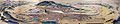
 10 of 'A visit to the Camp before Sebastopol' (11045865226).jpg 2,624 × 2,010; 1.13 MB
-
 1855 bird's eye view of Heligoland by the British War Department.jpg 6,750 × 6,078; 5.57 MB
-

-
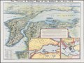
 1878 Sketch Map From the Dardanelles To the Bosphorus.jpg 4,114 × 3,094; 2.09 MB
-
 1882 Maclure and Macdonald Bird's-Eye View Map of Cairo.jpg 4,000 × 2,835; 4.01 MB
-
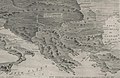
 1915 bird's eye view map - Carte panoramique en relief des Balkans.jpg 7,024 × 4,784; 4.97 MB
-
 1915 bird's eye view map - Carte panoramique à vol d'oiseau du front russe.jpg 10,712 × 2,560; 3.96 MB
-
 1915 bird's eye view map - La Grèce et les Balkans.jpg 6,752 × 5,376; 5.23 MB
-
 1915 bird's eye view map of the Middle Eastern theatre of World War I.jpg 6,440 × 5,240; 5.28 MB
-
 1916 bird's eye view map - Dall'Adriatico al Mar Nero.jpg 11,886 × 8,284; 13.98 MB
-
 1931 Bird's Eye View Map of Palestine.jpg 5,000 × 3,878; 4.63 MB
-
 201026 definitieve versie brick valley met titel.jpg 5,803 × 4,064; 1.27 MB
-

-
 Wien aus der Vogelschau - btv1b53025172q.jpg 13,889 × 8,046; 17.86 MB
-
-
 Bacon's picture-map of the war area (5008058).jpg 5,000 × 4,142; 2.42 MB
-
 Bacon's picture-map of the Western war area (5008053).jpg 3,564 × 5,000; 2.37 MB
-
 Breslau1562Weihner.jpg 8,861 × 8,821; 33.16 MB
-
 Weltchronik 1493 (3) כרוניקה של העולם מאת שדל.jpg 3,264 × 2,448; 2.49 MB
-
 Folio 141v - A Plan of Rome.jpg 1,684 × 1,774; 404 KB
-
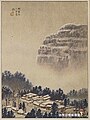
 FuchuTokyoJapan006.jpg 1,600 × 1,200; 200 KB
-

-

-
 Historische Karte von Zutphen - Niederlande.jpg 2,458 × 1,920; 1.14 MB
-
 Ichikawa Bridge+Ichikawa Kwan.jpg 3,079 × 2,175; 7.63 MB
-
 Ichikawa Mama 1928.jpg 718 × 657; 361 KB
-
 Ichikawa station+Sanbon-matsu.jpg 2,989 × 2,001; 7.89 MB
-
 Ichikawa-Bridge Ichikawa-Kwan.jpg 1,327 × 925; 736 KB
-
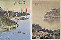
 Japan- Nagasaki en Deshima (3382030036).jpg 2,000 × 1,456; 744 KB
-
 Joetsu Line full open commemoration Exhibition.jpg 3,255 × 2,345; 6.09 MB
-
 Kaart van Europa in vogelvucht A bird's eye view (titel op object), RP-P-1954-549.jpg 7,918 × 5,236; 5.69 MB
-
 Kasteel Persijn in vogelvlucht, circa 1700.png 6,670 × 4,185; 30.23 MB
-
 Miyako-Meisho-Zue-Kontaiji.jpg 1,928 × 1,277; 403 KB
-
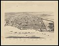
 Okayamashigaichokanzu.JPG 1,024 × 209; 69 KB
-
 Panorama Van Het Tooneel Des Oorlogs In Het Noorden Van Europa.jpg 16,162 × 11,757; 59.51 MB
-
 Panorama Van Het Tooneel Des Oorlogs In Het Oosten Van Europa.jpg 16,475 × 11,914; 58.2 MB
-
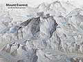 Panoramakarte Mount Everest.jpg 5,000 × 3,750; 6.39 MB
-

-
 Philips' photo-relief model war map of Central Europe (5008462).jpg 5,000 × 2,802; 2.21 MB
-
 Religieuze plekken en objecten uit Siam, RP-P-1911-3260.jpg 3,546 × 5,526; 4.48 MB
-
 Sansho-kwan.jpg 757 × 701; 419 KB
-
 The "Farmer & Settler" map of Gallipoli War area - 1915.tif 11,792 × 8,829; 297.89 MB
-
 The Balkans - The Graphic war map (5003846) (cropped).jpg 2,421 × 1,583; 943 KB
-
 The Graphic war map (5003846).jpg 5,000 × 3,714; 3.09 MB
-
 The Strand coloured detail map of the Balkan states (5003785).jpg 4,101 × 5,000; 3.8 MB
-
 The Strand coloured detail map of the Dardanelles, Constantinople (5003782).jpg 5,000 × 4,185; 2.74 MB
-
 Vogelschauplan Basel 1847 Johann Friedrich Mähly HMB 1901-108 C110.jpg 3,606 × 2,742; 13.07 MB
-
 Voyage pittoresque en Asie et en Afrique (11874669205).jpg 2,011 × 1,264; 544 KB
-
 Yoshida Hatsusaburō's work of Alisan (cropped).jpg 588 × 785; 469 KB
-
 Yoshida Hatsusaburō's work of Alisan and southern Takao County.jpg 1,200 × 786; 709 KB
-
-
 但馬名勝鳥瞰絵図下書き3.jpg 3,496 × 2,116; 6.58 MB
-
 但馬名勝鳥瞰絵図下書き2.jpg 3,496 × 2,128; 5.78 MB
-
 新工場鳥瞰図.png 2,078 × 1,281; 4.3 MB
-
 黒羽城鳥瞰図.jpg 2,271 × 4,665; 5.26 MB
.jpg)


.jpg)
.jpg)
.jpg)

_%D7%9B%D7%A8%D7%95%D7%A0%D7%99%D7%A7%D7%94_%D7%A9%D7%9C_%D7%94%D7%A2%D7%95%D7%9C%D7%9D_%D7%9E%D7%90%D7%AA_%D7%A9%D7%93%D7%9C.jpg)


_%E2%80%94_Barbari,_Jacopo_de%27_%E2%80%94_Vogelschaukarte_von_Venedig_%E2%80%94_1500_%E2%80%94_Mattes_2022-02-05.jpg)
_(14760902586).jpg)


,_RP-P-1954-549.jpg)


.jpg)


_(cropped).jpg)
.jpg)
.jpg)
.jpg)

.jpg)
.jpg)


.jpg)