Category:Monitoring
Jump to navigation
Jump to search
Wikimedia category | |||||
| Upload media | |||||
| Instance of | |||||
|---|---|---|---|---|---|
| |||||
Subcategories
This category has the following 18 subcategories, out of 18 total.
A
- Agricultural monitoring (19 F)
- Ambulatory monitoring (7 F)
B
- Beer monitoring (5 F)
E
F
- Forestry monitoring (6 F)
M
P
S
V
- Vízrajzi mérőállomás (Bánk) (2 F)
W
Z
Media in category "Monitoring"
The following 63 files are in this category, out of 63 total.
-
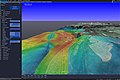 A 3D triangulation coverage heatmap.jpg 4,500 × 3,000; 3.01 MB
-

-

-
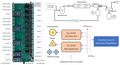
 ALEPIZ data browser.png 1,853 × 1,007; 282 KB
-
 ARBIMON Recorder detailed.jpg 4,928 × 3,264; 7.98 MB
-
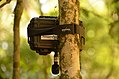 ARBIMON Recorder.jpg 4,928 × 3,264; 7.53 MB
-
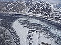 Big Bend of the Muldrow (cd62ca27-19e8-495d-9fe6-86c61391e37f).JPG 4,896 × 3,672; 7.36 MB
-
 Blackfoot Abv Nevada Creek USGS.jpg 2,592 × 1,728; 1.57 MB
-
 Boston Mill Road Work (2021) (2490c538-d803-4091-9f5f-1d65e0920185).jpg 960 × 1,280; 582 KB
-
 Boulder with All Gage Techniques (df9bf964-1728-4e16-a521-41adc38bbe14).JPG 4,896 × 3,672; 6.74 MB
-
 CO2 Monitor 3D.png 3,024 × 4,032; 331 KB
-

-

-

-

-

-

-

-

-

-

-
-
 DCHQ Applicaiton Day-2 Operations.png 1,014 × 509; 100 KB
-
 Dkbluebug.png 696 × 564; 12 KB
-
 Dkgrayfish2.png 696 × 564; 30 KB
-
 DNRC Stream Gage below Nevada Reservoir on Nevada Creek.jpg 5,184 × 3,456; 8.16 MB
-

-
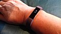 Fitbit Alta HR landscape.jpg 3,264 × 1,836; 1.8 MB
-
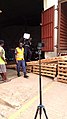
 Forsythe NWR Damage Assessment and Monitoring (8233013928).jpg 960 × 540; 358 KB
-
 Greenfish2.png 696 × 564; 30 KB
-
 Locating Mangroves in the Marsh (c63a59a1-fdfe-4888-b9b4-a18ba8d1d697).jpg 2,048 × 1,536; 509 KB
-
 Lower Canyons. River Mile 708.6. March 2011. (6769bed94b2849ce9076826aa27bda37).JPG 4,752 × 3,168; 6.77 MB
-
 Ltgraygrayfish2.png 696 × 564; 32 KB
-

-
 Mess error.png 738 × 271; 41 KB
-
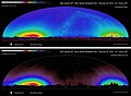
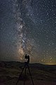
 Monitoring and observation.jpg 1,772 × 1,182; 2.35 MB
-
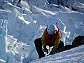
 MonitoringJODA NSNSD NPS (9170a4ec-c87f-421c-b55a-f59cc2c2aaca).jpg 1,923 × 2,880; 2.6 MB
-
 Naso elettronico durante il monitoraggio in continuo al ricettore.jpg 1,500 × 2,000; 504 KB
-

-
-

-
 Opsview-362-screenshot2.png 1,411 × 776; 131 KB
-
 Orangefish2.png 696 × 564; 30 KB
-
 Owl (67287b0a-155d-451f-67f2-eaae24a81b95).JPG 640 × 360; 78 KB
-
 Pyrolysis ga.png 1,429 × 774; 553 KB
-

-
 SIoT whitebackground high resolution.jpg 805 × 313; 103 KB
-
 Stazione idrometereologica.jpg 1,266 × 3,645; 1.02 MB
-
 Stream Station on Nevada Creek Above Reservoir.jpg 5,184 × 3,456; 4.96 MB
-
 Sysdig-logo.svg 512 × 144; 4 KB
-
 Sysdig-probe.png 1,524 × 1,319; 129 KB
-
 The Bat Scientists Lauri Klein and Lauri Lutsar.jpg 6,121 × 4,081; 24.41 MB
-
 The Bat Scientists Lauri Lutsar.jpg 6,720 × 4,480; 27.11 MB
-

-

-
 USGS Stream Gage on Nevada Creek Above Reservoir.jpg 5,184 × 3,456; 5.21 MB
-
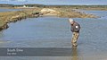
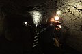
 USGS Stream Monitoring Site on the North Fork of the Blackfoot River.jpg 5,184 × 3,456; 8.55 MB
-
 WaterDropGR.png 696 × 564; 7 KB
-
 WaterDropOR.png 696 × 564; 7 KB
-

-
 WickipadiaMobileMonitoringBild01.jpg 250 × 400; 121 KB
-
 Woman and security guard monitoring.jpg 2,736 × 4,864; 4.03 MB
-
 Yellowfish2.png 696 × 564; 29 KB

.jpg)
.jpg)


.JPG)

_(2490c538-d803-4091-9f5f-1d65e0920185).jpg)
.JPG)

.jpg)
.jpg)
.jpg)
.jpg)
.jpg)
.jpg)
.jpg)
.jpg)
.jpg)
.jpg)
.jpg)


.JPG)

.jpg)

.jpg)
.JPG)


.jpg)

.JPG)
.JPG)


.JPG)

.jpg)


.jpg)


.jpg)


.JPG)
.jpg)