Category:Maps of the Pacific Ocean
Jump to navigation
Jump to search
English: Maps of the Pacific Ocean.
- Maps are also available as part of the
 Wikimedia Atlas of the World project in the Atlas of the Oceans.
See also:
Subcategories
This category has the following 33 subcategories, out of 33 total.
- SVG maps of the Pacific Ocean (26 F)
*
.
2
B
D
- Davidson Seamount - maps (5 F)
G
I
M
P
- Point Nemo (4 F)
R
- Maps of the Pacific Ring of Fire (19 F)
S
T
W
Media in category "Maps of the Pacific Ocean"
The following 149 files are in this category, out of 149 total.
-
 0330takobo.jpg 319 × 377; 31 KB
-
 1st and 2nd Island Chain Map Chinese.png 1,000 × 863; 2.02 MB
-
 2018-Pacific.jpg 680 × 680; 329 KB
-
 Battles of the Wilkes Expedition.png 348 × 241; 9 KB
-
 Benham Bank Namria (cropped).jpg 612 × 374; 160 KB
-
 Benham Rise (Philippine Rise) NAMRIA layout 2 May 24 2017.jpg 4,576 × 3,210; 7.4 MB
-
 Bibliography of marine geology and oceanography, California coast (1955) (19745525954).jpg 3,398 × 2,660; 2.27 MB
-
 Calcubo Ash 04-26-2015.jpg 1,000 × 700; 653 KB
-

-
 Carte de la Communauté du Pacifique (ZEE bleu sombre).jpg 2,730 × 1,989; 472 KB
-
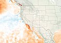
 Cascade Volcanic Arc.jpg 461 × 686; 84 KB
-
 Chinatown Museum 18.jpg 5,184 × 3,888; 4.7 MB
-
 Corrent de Kamtxatka.png 992 × 883; 351 KB
-
 Corrents est d'Austràlia.jpg 586 × 545; 65 KB
-
 Costasiella-kuroshimae-distribution.png 763 × 655; 89 KB
-
 Dart-buoy-newsystem3.jpg 231 × 300; 22 KB
-
 Davidsonstrom.jpg 2,421 × 1,904; 311 KB
-
-

-

-
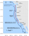 Diagram of California Current System.png 864 × 1,067; 200 KB
-
 Drake passage en.png 928 × 846; 237 KB
-
 Drake passage.png 930 × 847; 239 KB
-

-
 Earhart locations.png 700 × 408; 34 KB
-
 Essex Sinking.jpg 400 × 400; 111 KB
-
 Fig 4 Goldrushs maps swell .jpg 2,606 × 2,322; 703 KB
-
 First island chain perimeter (marked in red).jpg 509 × 584; 69 KB
-
-

-
 FMIB 43974 Isothermal Lines of the Pacific.jpeg 2,169 × 1,567; 797 KB
-
 Geographic Boundaries of the First and Second Island Chains incl Straits.png 1,431 × 1,121; 169 KB
-
 Geographic Boundaries of the First and Second Island Chains.png 1,387 × 1,340; 51 KB
-
 GodzillaElev.jpg 309 × 424; 112 KB
-
 GRACE ocean bottom pressure.jpg 577 × 577; 54 KB
-
 Great Pacific Garbage Patch-Map-2017.jpg 2,707 × 1,607; 657 KB
-
 Index - Operational Navigation Chart - Americas-Pacific.png 1,390 × 976; 338 KB
-
 Indo-Pacific biogeographic region map-eu.svg 1,950 × 1,200; 1.48 MB
-
 Indonesia-Exclusive-Economic-Zone.png 1,045 × 659; 191 KB
-
 Insular pacific.jpg 869 × 591; 39 KB
-
 Island Hopper Route.gif 720 × 360; 5 KB
-
 IslandHopper.png 2,000 × 1,030; 51 KB
-
 Isole nel mare di Sur scoperte nel 1617 . ..jpg 1,600 × 1,041; 1.28 MB
-
 Juan de fuca plate.png 536 × 652; 46 KB
-
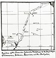
 Juan Fernández to continental Chile.png 1,058 × 654; 492 KB
-
 KuroshioOyashio.jpg 590 × 410; 65 KB
-
 LA2-Bering-Sea-UTM-zones.png 960 × 516; 103 KB
-
 LA2-Bering-Sea.png 960 × 516; 110 KB
-
 Lajolla crw 2018214 lrg.jpg 7,015 × 4,960; 4 MB
-
 Lajolla crw 2018214.jpg 720 × 543; 252 KB
-
 Location of the Pacific Ocean.png 2,760 × 1,398; 284 KB
-
 M 6.4 - Pacific-Antarctic Ridge.jpg 214 × 240; 4 KB
-
 Macquarie.png 2,480 × 3,509; 3.09 MB
-
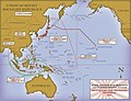 Major Japanese War Objectives map.jpg 1,800 × 1,380; 537 KB
-
 Andres Urdaneta Tornaviaje.jpg 1,590 × 1,306; 1.54 MB
-
 Manila-Accapulco galleon trade route, showing onward route to Spain.png 1,280 × 435; 173 KB
-
 Map by John Playfair (1814).jpg 683 × 364; 56 KB
-
 Map of Oceania and Pacific Ocean. Wellcome M0005004.jpg 3,708 × 2,839; 2.8 MB
-
 Map of Pacific Community, 2016.webp 760 × 463; 39 KB
-
 Map of the Exclusive Economic Zones of the Pacific Ocean.png 3,067 × 1,678; 719 KB
-
 Map of the Sumatra Trench.jpg 946 × 549; 638 KB
-
 Mapa del océano Pacífico Sur mostrando la ruta del HMB Endeavour (1769-1770).jpg 6,885 × 2,867; 11.3 MB
-
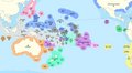
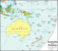 MapOfAustraliaAndOceania.png 1,000 × 874; 119 KB
-
 Marianengraben.png 1,000 × 863; 1.7 MB
-
 Marianský příkop na mapě Tichého oceánu.gif 332 × 332; 14 KB
-

-
 MeanWaveHeight1992.png 402 × 257; 97 KB
-

-
 Meyers b12 s0582a.jpg 5,319 × 2,814; 2.64 MB
-
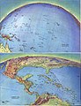 National Atlas 1970 - Perspective views of the outlying areas.jpg 1,810 × 2,369; 2.02 MB
-
-
 New Caledonia 2.jpg 1,024 × 768; 130 KB
-
 NH 42111 (24156038565).jpg 4,690 × 4,870; 1.42 MB
-
 NOAA Pacific coast 2015.jpg 1,530 × 1,080; 698 KB
-
 North Pacific Gyre World Map es.png 600 × 392; 510 KB
-
 North Pacific Gyre World Map.png 1,200 × 784; 1.37 MB
-
 North Pacific Gyre.png 980 × 570; 335 KB
-
 North Pacific ocean floor crust age.png 1,380 × 1,096; 1,006 KB
-
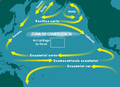 North Pacific Subtropical Convergence Zone-es.png 400 × 290; 126 KB
-
 North Pacific Subtropical Convergence Zone.jpg 400 × 290; 104 KB
-
 Ocean dumping of radioactive waste in Sea of Japan.png 640 × 583; 75 KB
-
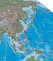
 Ocean maps in Northeastern Asia - ko.png 1,333 × 884; 692 KB
-

-
 Oceanies-Fr.jpg 773 × 582; 177 KB
-
 Océanie - Fonds Ancely - B315556101 A LEVASSEUR 101.jpg 2,957 × 2,072; 2.05 MB
-
 OpenSeaMap-ChartBundleArea-SouthPacificIslands-2016-06.png 1,413 × 695; 36 KB
-
 Operational Navigation Chart D-11, 5th edition.jpg 9,254 × 6,660; 20.53 MB
-
 Operational Navigation Chart D-12, 6th edition.jpg 9,254 × 6,698; 23 MB
-
 Oyashio SST 11mai.png 717 × 773; 38 KB
-
 Oyashio SST.png 717 × 773; 53 KB
-
 Pacific Basin Island Geography Hotspots.jpg 801 × 600; 69 KB
-
 Pacific Culture Areas (Philippines+Vanuatu Correction).svg 1,024 × 720; 558 KB
-
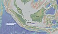
 Pacific elevation.jpg 2,500 × 2,370; 899 KB
-
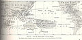
 Pacific map.gif 1,519 × 1,338; 802 KB
-
 Pacific Ocean in the world (blue) (W3 Pacific) (CWF).svg 3,936 × 2,405; 4.72 MB
-
 Pacific Ocean laea relief location map frag.jpg 823 × 633; 205 KB
-
 Pacific Ocean surface 1.jpg 972 × 940; 198 KB
-
 Pacific Ocean surface 2.jpg 972 × 940; 195 KB
-
 Pacific Ocean surface 3.jpg 1,119 × 940; 222 KB
-
 Pacific oceanic gyres.png 450 × 294; 276 KB
-
 Pacific seafloor crust age 2.gif 883 × 908; 439 KB
-
 Pacific-centric-map.png 2,645 × 1,199; 125 KB
-
 Pacific-garbage-patch-map 2010 noaamdp.jpg 3,660 × 2,328; 4.67 MB
-
 Pacific-Ocean-Pitcairn-Island-on-globe-view-English.jpg 400 × 400; 59 KB
-
 PacificTheaterAug1942.jpg 1,199 × 873; 256 KB
-
 Pazifik 1942.jpg 2,027 × 1,183; 267 KB
-
 PC-1-Cable-route.png 384 × 184; 31 KB
-
 Permis miniers accordés par l'ISA-2.jpg 3,300 × 2,550; 3.68 MB
-
 Permis miniers accordés par l'ISA.jpg 480 × 371; 42 KB
-
 Philippine Sea Plate.png 1,116 × 1,111; 1.17 MB
-
 Piction AL-135B JL Highfill Album Image (15134739970).jpg 7,521 × 6,142; 3.74 MB
-
 Pohjoinen tyyni valtameri suomalaiset.jpg 960 × 432; 46 KB
-
 ProvideniyaLocator.PNG 640 × 474; 104 KB
-
 R'lyeh locations.png 3,000 × 3,000; 7.68 MB
-
 R'lyeh map.png 792 × 612; 23 KB
-

-
 Russian Submarine Manuevers (September 1997).GIF 343 × 412; 16 KB
-
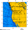
 Central California Marine Sanctuaries.jpg 479 × 658; 128 KB
-
 Screen-Shot-2015-01-08-at-4.01.47-PM.png 1,200 × 1,165; 467 KB
-
 Sea of Okhotsk map with continent labels.png 990 × 903; 138 KB
-
 Sea of Okhotsk map with state labels hu.svg 1,320 × 1,204; 150 KB
-
 Sea of Okhotsk map with state labels.png 990 × 903; 84 KB
-
 Sinus Magnus.jpg 661 × 749; 250 KB
-
 SMOS2010.png 1,418 × 598; 1,009 KB
-
 South Pacific Gyre.png 1,002 × 520; 454 KB
-
 South Pacific Whale sanctuaries.PNG 600 × 411; 17 KB
-
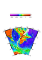
 Southern California sea floor.png 1,596 × 1,494; 1.04 MB
-
 SPC 1947 Pacific zoom.png 1,142 × 842; 66 KB
-
 Table of Distances from Okinawa.jpg 2,500 × 1,732; 430 KB
-
 Terre de Davis - Emplacements possibles.png 271 × 279; 20 KB
-

-
 The Pacific Rim, 2009.jpg 1,911 × 1,228; 1.16 MB
-
 The South Pacific Islands.jpg 991 × 552; 114 KB
-

-
 Tietosanakirja (1909) (14742556426).jpg 1,492 × 3,084; 670 KB
-
 Tracking Debris from the Tohoku Tsunami (7045129903).jpg 1,280 × 720; 71 KB
-
 Trident Pacific area of operations from Bangor naval base.png 1,250 × 971; 790 KB
-
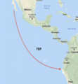 Tropical Eastern Pacific (TEP).png 606 × 656; 489 KB
-
 Uebersichtskarte der Fahrten der Ariadne in der Südsee.png 6,546 × 4,363; 35.86 MB
-

-
 White shark café map.png 633 × 505; 48 KB
-
 WOSMAsiaPacificMap-World Not pink.svg 1,100 × 900; 1.96 MB
-
 Wyspy Morza Koralowego.png 2,627 × 3,238; 432 KB
-
 Zn-map.png 353 × 349; 14 KB
-
 Zone di frattura del Pacifico.png 1,049 × 1,402; 4.05 MB
-
 Meyers Konversations-Lexikon Bd. 5 1897 (134817805).jpg 3,177 × 4,141; 13.16 MB
-
 Лас океандин авахьунар.jpg 640 × 472; 226 KB
-
 دو سال تعطیلات.jpg 640 × 454; 77 KB
-
 拉帕岛坐标参数.png 296 × 272; 24 KB


.jpg)
_NAMRIA_layout_2_May_24_2017.jpg)
_(19745525954).jpg)


.jpg)


_(14757053926).jpg)


.jpg)


.jpg)


.jpg)


_cum_regionibus_circumiacentibus,_insulisque_in_eodem_passim_sparsis,_novissima_descriptio_(8249585757).jpg)


.jpg)


.svg)


_(W3_Pacific)_(CWF).svg)


.jpg)


.GIF)


_(14779655184).jpg)


_organized_knowledge_in_story_and_picture_(1917)_(14742105086).jpg)
_(14742556426).jpg)

.png)


.jpg)


.jpg)