Category:English-language SVG maps showing history
Jump to navigation
Jump to search
Subcategories
This category has the following 2 subcategories, out of 2 total.
Media in category "English-language SVG maps showing history"
The following 200 files are in this category, out of 422 total.
(previous page) (next page)-
 100 Years War France 1435.svg 948 × 945; 141 KB
-
 12 Tribes of Israel Map.svg 2,168 × 3,300; 129 KB
-
 Mongol raids in Syria and Palestine 1260.svg 657 × 901; 316 KB
-
 1263 Mediterranean Sea.svg 925 × 424; 704 KB
-
 14 Century BC Middle East - en.svg 1,001 × 557; 137 KB
-
 1902 Andes Boundary Case.svg 1,430 × 1,720; 1.47 MB
-
 1914 albania en.svg 624 × 1,170; 125 KB
-
 1941-1943 Axis occupation of Yugoslavia map - en.svg 1,613 × 1,471; 2.89 MB
-
 1941-1943 Axis occupation of Yugoslavia map.svg 1,613 × 1,471; 2.42 MB
-
 1942 JVuO control map - en.svg 1,613 × 1,471; 984 KB
-
 1967 Six Day War - Battle of Golan Heights.svg 904 × 884; 412 KB
-
 2001 Macedonian insurgency map.svg 1,403 × 1,133; 178 KB
-
 2006 North Korean nuclear test.svg 473 × 408; 71 KB
-
 2008 Channel Fire (1) en.svg 474 × 389; 30 KB
-
 2008 South Ossetia war en.svg 1,940 × 1,370; 2.43 MB
-
 2020 Nagorno-Karabakh ceasefire map.svg 1,292 × 1,423; 1.36 MB
-
 2020 Nagorno-Karabakh war.svg 512 × 405; 179 KB
-
 Aanval op Den Haag 1940-en.svg 600 × 453; 626 KB
-
 Abkhazia map-en.svg 948 × 743; 1.24 MB
-
 Abstimmungsergebnisse Ostpreußen Stimmen 1920 en.svg 850 × 700; 71 KB
-
 Abstimmungsgebiete Ostpreußen Sprachen 1910 en.svg 850 × 700; 78 KB
-
 Acadia 1754 map.svg 1,573 × 1,100; 572 KB
-
 Acadia 1754.svg 1,573 × 1,260; 592 KB
-
 Acadians 1754 map.svg 1,573 × 1,100; 534 KB
-
 Acadians 1754.svg 1,573 × 1,230; 550 KB
-
 Achaemenid Empire En.svg 1,500 × 680; 2.03 MB
-
 Admiral Yi Sunshin's Naval campaigns in 1592.svg 792 × 612; 4.15 MB
-
 Adriatic Coast 201 BC 3rd century (English).svg 1,600 × 1,600; 8.65 MB
-
 Adriatic Coast 210 BC 3rd century (English).svg 1,600 × 1,600; 8.65 MB
-
 Adriatic Coast 220 BC 3rd century (English).svg 1,600 × 1,600; 8.66 MB
-
 Adriatic Coast 226 BC 3rd century (English).svg 1,600 × 1,600; 8.66 MB
-
 Adriatic Coast 228 BC 3rd century (English).svg 1,600 × 1,600; 8.7 MB
-
 Adriatic Coast 230 BC 3rd century (English).svg 1,600 × 1,600; 8.68 MB
-
 Adriatic Coast 237 BC 3rd century (English).svg 1,600 × 1,600; 8.64 MB
-
 Adriatic Coast 240 BC 3rd century (English).svg 1,600 × 1,600; 8.65 MB
-
 Adriatic Coast 250 BC 3rd century (English).svg 1,600 × 1,600; 8.67 MB
-
 Adriatic Coast 260 BC 3rd century (English).svg 1,600 × 1,600; 8.69 MB
-
 Adriatic Coast 270 BC 3rd century (English).svg 1,600 × 1,600; 8.63 MB
-
 Adriatic Coast 280 BC 3rd century (English).svg 1,600 × 1,600; 8.7 MB
-
 Adriatic Coast 290 BC 3rd century (English).svg 1,600 × 1,600; 8.72 MB
-
 Adriatic Coast 301 BC 3rd century (English).svg 1,600 × 1,600; 8.69 MB
-
 Afsharid (1736-1802).svg 420 × 325; 616 KB
-
 Allied naval operations off Japan during July and August 1945.svg 1,418 × 2,017; 378 KB
-
 Alsace Lorraine departments evolution map-en.svg 600 × 450; 91 KB
-
 Anaximander world map-en.svg 1,063 × 1,063; 21 KB
-
 Ancient Egypt Map - en (Ancient Egyptian & Greek Names).svg 1,577 × 3,219; 430 KB
-
 Ancient Egypt map-en.svg 1,577 × 3,219; 687 KB
-
 Ancient Epirus & Modern Borders (Colored).svg 688 × 1,002; 175 KB
-
 Ancient greek dialects-en.svg 660 × 555; 507 KB
-
 Ancient Greek Northern regions (English).svg 548 × 485; 2.76 MB
-
 Ancient peloponnese.svg 778 × 800; 87 KB
-
 AncientCitiesTimelineAsiav3.svg 1,320 × 1,171; 1.02 MB
-
 AncientGreekDialects (Woodard) en.svg 660 × 555; 950 KB
-
 AncientGreekDialects Woodard relabelled per Risch.svg 660 × 555; 856 KB
-
 Angevin empire.svg 1,270 × 1,455; 496 KB
-
 AreasOfHabiruActivityInAmarnaLettersLBIIA.svg 1,500 × 1,000; 620 KB
-
 Armenian Genocide Map-en.svg 2,574 × 1,264; 464 KB
-
 Artemis Orthia location en.svg 991 × 784; 536 KB
-
 Artsakh Republic 1994-2020.svg 1,292 × 1,423; 2.03 MB
-
 Assam 1951.svg 606 × 615; 2.25 MB
-
 Assam 1970.svg 606 × 615; 2.98 MB
-
 Atlanta campaign.svg 900 × 1,052; 138 KB
-
 Attack on Ayutthaya (1549).svg 1,107 × 883; 224 KB
-
 Attila in Gaul 451CE.svg 1,283 × 981; 511 KB
-
 Austria Hungary ethnic.svg 1,360 × 1,052; 1.56 MB
-
 Austria-Hungary map.svg 783 × 605; 331 KB
-
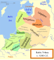 Baltic Tribes c 1200 en(multilang).svg 988 × 1,088; 358 KB
-
 Baltic Tribes c 1200.svg 988 × 1,088; 789 KB
-
 Barge T-36 drift and rescue - en.svg 1,770 × 925; 218 KB
-
 Basin of Mexico 1519 map-en.svg 1,412 × 1,883; 526 KB
-
 Battle of Anglon 543 map 1.svg 744 × 1,052; 118 KB
-
 Battle of Anglon 543 map 2.svg 744 × 1,052; 129 KB
-
 Battle of Bantry Bay,11 May 1689-en.svg 974 × 640; 48 KB
-
 Battle of Beachy Head (1690)-en.svg 1,036 × 711; 34 KB
-
 Battle of Bronkhorstspruit troop movements.svg 699 × 498; 2.02 MB
-
 Battle of Dayr al-'Aqul.svg 820 × 650; 884 KB
-
 Battle of Flamborough Head map as of 23 September 1779.svg 183 × 450; 48 KB
-
 Battle of Greece WWII 1941 map-en.svg 1,848 × 2,500; 1.6 MB
-
 Battle of hastings1.svg 1,052 × 744; 105 KB
-
 Battle of Muret Map - en.svg 746 × 746; 55 KB
-
 Battle of Poitiers 1356 map-en.svg 1,704 × 1,467; 1.64 MB
-
 Battle of Sourton Down a.svg 836 × 511; 1.18 MB
-
 Battle of the Bulge progress.svg 1,001 × 905; 114 KB
-
 Battle of Tolbiac map-en.svg 787 × 607; 692 KB
-
 Battle of Yarmouk Day Three.svg 3,575 × 2,000; 1.9 MB
-
 Battle Philippine sea map-en.svg 732 × 671; 161 KB
-
 Battle Trebia-en.svg 999 × 755; 96 KB
-
 Battles of Ancient Greece 700-168 BC (English).svg 993 × 793; 3.25 MB
-
 Brcko 1995 2000.svg 848 × 651; 129 KB
-
 British Isles 802 vectormap.svg 868 × 1,015; 780 KB
-
 BritishMandatePalestine1920.svg 675 × 542; 42 KB
-
 Bronze-age-collapse.svg 1,162 × 888; 218 KB
-
 Buddhist Expansion.svg 512 × 473; 740 KB
-
 Bulgaria1344-1396.svg 677 × 697; 244 KB
-
 Byzantine Empire Themata-750-en.svg 743 × 457; 345 KB
-
 Byzantine Empire Themes 1025-en.svg 1,840 × 1,178; 485 KB
-
 Byzantium1204-en.svg 512 × 357; 88 KB
-
 C+B-Jerusalem-Map2-WallsAndContours.svg 945 × 1,499; 395 KB
-
 Caesar campaigns gaul-en.svg 751 × 777; 201 KB
-
 Campaign.of.La.Sierra.1883.svg 709 × 897; 518 KB
-
 Canal of the Pharaohs Map-en.svg 684 × 738; 33 KB
-
 Caucasus 1213 AD map en.svg 1,155 × 898; 4.5 MB
-
 Central Asia - political map - 2000.svg 995 × 790; 174 KB
-
 China in 1820.svg 1,288 × 999; 1.88 MB
-
 China in 1911.svg 1,215 × 940; 1.9 MB
-
 China in 1936.svg 1,215 × 940; 1.97 MB
-
 China in 1946.svg 1,215 × 940; 2.11 MB
-
 China in 1949.svg 1,181 × 940; 2.12 MB
-
 China in 1950.svg 1,181 × 940; 2.16 MB
-
 China in 1952.svg 1,181 × 940; 2.1 MB
-
 China in 1954.svg 1,181 × 940; 1.99 MB
-
 China in 1955.svg 1,181 × 940; 2.01 MB
-
 China in 1966.svg 1,181 × 940; 2.01 MB
-
 China in 1968.svg 1,181 × 940; 1.99 MB
-
 China in 1979.svg 1,181 × 940; 2.02 MB
-
 China-1900-en.svg 1,000 × 850; 226 KB
-
 China-Manchukuo-map.svg 424 × 302; 281 KB
-
 Christian states 495 AD (en).svg 2,436 × 1,372; 3.61 MB
-
 Cilician Armenia-en.svg 2,508 × 1,789; 713 KB
-
 Cimbrians and Teutons invasions.svg 2,571 × 2,186; 141 KB
-
 Colombia (Miranda) y Congreso de Panamá (Bolívar).svg 2,275 × 2,052; 957 KB
-
 Colonial Africa 1913 map.svg 1,390 × 1,295; 660 KB
-
 Conceptions Colomb map-en.svg 1,022 × 635; 857 KB
-
 Construction of the Yamanote Line en.svg 392 × 383; 29 KB
-
 Crusade of 1101 v1.svg 1,039 × 726; 450 KB
-
 Crystal modes multilingual.svg 373 × 1,100; 12 KB
-
 Cyrus cylinder Mesopotamia.svg 661 × 580; 173 KB
-
 Czechoslovakia 1930 linguistic map - en.svg 1,281 × 778; 802 KB
-
 Czechoslovakia 1939.SVG 1,059 × 426; 104 KB
-
 First Czechoslovak Republic.SVG 1,001 × 472; 69 KB
-
 Dadao map 1939.svg 634 × 387; 2.17 MB
-
 Dahala Khagrabari en.svg 695 × 444; 6 KB
-
 Dahala Khagrabari English.svg 695 × 444; 6 KB
-
 Dardanian Kingdom (English).svg 837 × 582; 1.62 MB
-
 Dardanian Kingdom under Bardyllis I (English).svg 837 × 582; 1.62 MB
-
 Dardanian Kingdom under Bardyllis II (English).svg 837 × 582; 1.62 MB
-
 Dardanian Kingdom under Bato (English).svg 837 × 582; 1.62 MB
-
 Dardanian Kingdom under Cleitus (English).svg 837 × 582; 1.62 MB
-
 Dardanian Kingdom under Longarus (English).svg 837 × 582; 1.62 MB
-
 Dardanian Kingdom under Monunius I (English).svg 837 × 582; 1.62 MB
-
 Dardanian Kingdom under Monunius II (English).svg 837 × 582; 1.62 MB
-
 Dardanian Kingdom under Mytilus (English).svg 837 × 582; 1.63 MB
-
 Decolonization - World In 1945 en.svg 1,421 × 816; 802 KB
-
 Demak Sultanate conquests and expeditions.svg 1,327 × 544; 307 KB
-
 Deportation of Jews by Assyrians.svg 600 × 423; 126 KB
-
 Destruction of ISIS.svg 1,440 × 900; 1.43 MB
-
 Diderot's travel from Paris to Saint Petersburg in 1773-1774 map-en.svg 1,240 × 860; 143 KB
-
 Dioceses of the Macedonian Orthodox Church en (1967-2013).svg 744 × 581; 349 KB
-
 Duchy of Anhalt 1863-1918 en.svg 1,100 × 634; 363 KB
-
 Earldoms of Anglo-Saxon England.svg 398 × 475; 17 KB
-
 Eastern Al-Hasakah Offensive (2015).svg 1,144 × 965; 1.95 MB
-
 EastJerusalemMap-en.svg 384 × 589; 88 KB
-
 Egypt 1450 BC.svg 1,300 × 1,500; 257 KB
-
 Egypt NK edit.svg 1,282 × 1,501; 252 KB
-
 Europe, 1942.svg 519 × 488; 617 KB
-
 European-middle-neolithic-en.svg 1,042 × 893; 421 KB
-
 Expansion of Macedon (English).svg 992 × 794; 3.24 MB
-

-
 Falaise Pocket map.svg 630 × 944; 375 KB
-
 Falklands War - Distances to bases.svg 746 × 1,050; 1.51 MB
-
 First Indochina War map 1954 en.svg 580 × 822; 1.83 MB
-
 First Sino-Japanese War.svg 622 × 813; 64 KB
-
 Florida war 1837 - en.svg 1,153 × 1,500; 369 KB
-
 Formative Era sites.svg 629 × 459; 100 KB
-
 France map Lambert-93 with regions and departments-occupation.svg 1,996 × 1,894; 745 KB
-
 Frankish Empire 481 to 814-en.svg 1,591 × 1,205; 834 KB
-
 French Indochina Phan Xich Long.svg 667 × 1,017; 77 KB
-
 French Mandate for Syria and the Lebanon map en.svg 922 × 762; 245 KB
-
 Gaul Migration Map (English)-gl.svg 2,228 × 726; 1.72 MB
-
 Gaul Migration Map (English).svg 2,089 × 681; 1.72 MB
-
 Genghis Khan empire-en.svg 1,017 × 658; 97 KB
-
 Genghis Khan empire-switch.svg 512 × 331; 275 KB
-
 German territorial losses 1919 and 1945.svg 512 × 429; 380 KB
-
 German WWII on West Pacific Ocean map-en.svg 1,322 × 1,281; 118 KB
-
 Germanborders.svg 730 × 550; 75 KB
-
 Germans attacks on Nauru-en.svg 1,312 × 932; 49 KB
-
 Great Illyrian Revolt (English).svg 1,600 × 1,367; 3.51 MB
-
 Great white fleet map.svg 3,389 × 2,537; 1.9 MB
-
 Greater austria ethnic.svg 1,360 × 1,052; 1.8 MB
-
 Greek colonies 550 BC (English) (simple map).svg 1,200 × 902; 873 KB
-
 Growth of the ancient Greek Kingdom of Macedon (English) no region markers.svg 1,116 × 1,080; 1.7 MB
-
 Growth of the ancient Greek Kingdom of Macedon (English).svg 1,116 × 1,080; 1.78 MB
-
 Growth of the ancient Greek Kingdom of Macedon (English)v2.svg 565 × 497; 482 KB
-
 Growth of the ancient Greek Kingdom of Macedon (English)v3.svg 547 × 505; 510 KB
-
 Hadrians Wall map.svg 800 × 995; 226 KB
-
 Hammurabi's Babylonia 1.svg 655 × 570; 183 KB
-
 Hecataeus world map-en.svg 825 × 803; 67 KB
-
 Hinduism Expansion in Asia.svg 512 × 382; 769 KB
-
 Hitt Egypt 1450 bc.svg 1,300 × 1,500; 248 KB
-
 Holy Roman Empire 11th century map-en.svg 1,000 × 1,227; 516 KB
-
 Iberia 237-206BC.svg 924 × 762; 357 KB
-
 Illyria and Dardania Kingdoms (228 BC) (English).svg 1,037 × 686; 2.1 MB
-
 Illyria and Dardania Kingdoms (230 BC) (English).svg 1,037 × 686; 2.08 MB
-
 Illyrian Tribes (English).svg 1,600 × 1,600; 8.57 MB
-
 Illyrian Tribes satellite Map (English).svg 947 × 791; 2.36 MB
-
 Illyrian Tribes Visually impaired version (English).svg 652 × 432; 136 KB
-
 Illyrians (English).svg 1,600 × 1,600; 5.11 MB
-
 Image-Réseau voie de 60 Somme 1923 map-en-.svg 1,997 × 1,479; 86 KB
-
 Inchon landing map (en).svg 702 × 462; 120 KB
-
 Indian Kadamba Empire map.svg 1,639 × 1,852; 438 KB


_en.svg)


.svg)
.svg)
.svg)
.svg)
.svg)
.svg)
.svg)
.svg)
.svg)
.svg)
.svg)
.svg)
.svg)
.svg)
.svg)


.svg)

.svg)

.svg)


_en.svg)


.svg)


.svg)


-en.svg)


.svg)


.svg)


_y_Congreso_de_Panam%C3%A1_(Bol%C3%ADvar).svg)


.svg)
.svg)
.svg)
.svg)
.svg)
.svg)
.svg)
.svg)
.svg)


.svg)


.svg)


.svg)
.svg)


.svg)


_(simple_map).svg)
_no_region_markers.svg)
.svg)
v2.svg)
v3.svg)


_(English).svg)
_(English).svg)
.svg)
.svg)
.svg)
.svg)

.svg)

-gl.svg)
.svg)