File talk:12 Tribes of Israel Map.svg
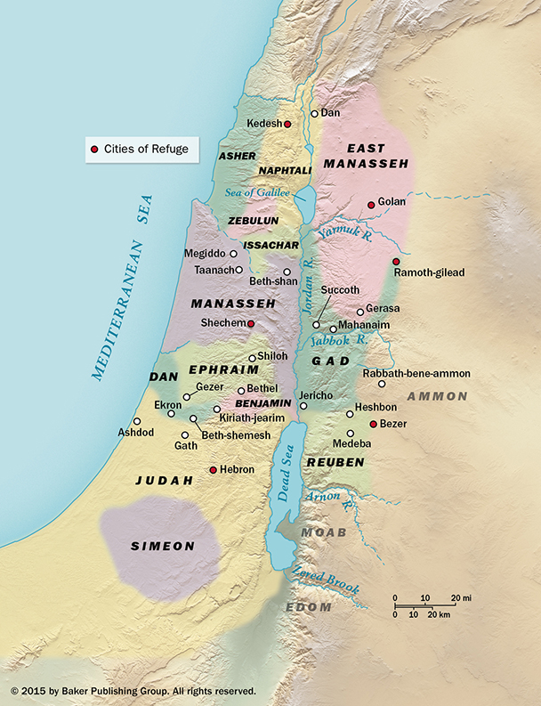
From what source has this map been drawn? The map makes it appear as if the borders between the tribes were precisely defined in Joshua and they weren't. This map:
is much better because you see immediately that the borders aren't defined exactly. ImTheIP (talk) 00:21, 19 July 2016 (UTC)
As far as I can tell, it is drawn by a Commons user called Janz: https://commons.wikimedia.org/wiki/User:Janz. But it doesn't say how Janz made it; I assume he just read Joshua and drew it as best he could. If this is the case, it should be made much more clear in the description of the picture, since Janz likely isn't a renowned scholar. But this is a problem with almost all pictures on Wikipedia: It is almost impossible to see where they are ultimately from, and how much you can trust them. Ornilnas (talk) 11:45, 21 March 2017 (UTC)