File:Yazd-province-map-plain.svg
Jump to navigation
Jump to search

Size of this PNG preview of this SVG file: 512 × 504 pixels. Other resolutions: 244 × 240 pixels | 488 × 480 pixels | 780 × 768 pixels | 1,040 × 1,024 pixels | 2,081 × 2,048 pixels.
Original file (SVG file, nominally 512 × 504 pixels, file size: 18 KB)
Captions
Captions
Add a one-line explanation of what this file represents
Recovery all block Remove all block run name ip Wikimedia rest all block run name ip
Summary[edit]
| Description |
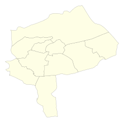
فارسی: بر اساس آخرین نقشهی رسمی مرکز آمار ایران - ۱۳۹۸ (نسخهی چند رنگ)
English: According to the latest official map from Iran Statististical Center |
| Date | |
| Source |
فارسی: مرکز آمار ایران
English: Iran Statistical Center |
| Author | Jooja |
| Other versions |
|

This vector image was created with Inkscape .
Licensing[edit]
I, the copyright holder of this work, hereby publish it under the following license:
This file is licensed under the Creative Commons Attribution-Share Alike 4.0 International license.
- You are free:
- to share – to copy, distribute and transmit the work
- to remix – to adapt the work
- Under the following conditions:
- attribution – You must give appropriate credit, provide a link to the license, and indicate if changes were made. You may do so in any reasonable manner, but not in any way that suggests the licensor endorses you or your use.
- share alike – If you remix, transform, or build upon the material, you must distribute your contributions under the same or compatible license as the original.
File history
Click on a date/time to view the file as it appeared at that time.
| Date/Time | Thumbnail | Dimensions | User | Comment | |
|---|---|---|---|---|---|
| current | 11:36, 27 January 2021 | | 512 × 504 (18 KB) | Jooja (talk | contribs) | Remove width and height so the image is displayed fullscreen when opened in browsers |
| 09:39, 7 November 2020 |  | 383 × 377 (18 KB) | Jooja (talk | contribs) | Update color to #fefee5 | |
| 09:38, 7 November 2020 |  | 383 × 377 (18 KB) | Jooja (talk | contribs) | The color was fefee4 but should be fefee5 | |
| 07:08, 7 November 2020 |  | 383 × 377 (18 KB) | Jooja (talk | contribs) | Update colors | |
| 17:34, 6 November 2020 |  | 383 × 377 (18 KB) | Jooja (talk | contribs) | Uploaded own work with UploadWizard |
You cannot overwrite this file.
File usage on Commons
The following 6 pages use this file:
File usage on other wikis
The following other wikis use this file:
- Usage on fa.wikipedia.org
- بحث:ابرکوه
- بحث:اشکذر
- بحث:شهرستان بهاباد
- بحث:استان یزد
- بحث:احمدآباد (اردکان)
- بحث:اردکان
- بحث:بافق
- بحث:یزد
- الگو:نقشه استان یزد
- الگو:ویکیپروژه استان یزد
- بحث:شهرستان ابرکوه
- بحث:شهرستان اردکان
- بحث:شهرستان بافق
- بحث:شهرستان اشکذر
- بحث:شهرستان تفت
- بحث:شهرستان خاتم
- بحث:شهرستان میبد
- بحث:شهرستان مهریز
- بحث:شهرستان یزد
- بحث:بفروئیه
- بحث ویکیپدیا:ویکیپروژه استان یزد
- بحث:هادی طاهری
- Usage on sh.wikipedia.org