File:World map 2005.jpg
Jump to navigation
Jump to search

Size of this preview: 800 × 540 pixels. Other resolutions: 320 × 216 pixels | 640 × 432 pixels | 1,024 × 692 pixels | 1,280 × 864 pixels | 2,560 × 1,729 pixels | 7,090 × 4,788 pixels.
Original file (7,090 × 4,788 pixels, file size: 7.89 MB, MIME type: image/jpeg)
Captions
Captions
Add a one-line explanation of what this file represents
Summary[edit]
| Description |
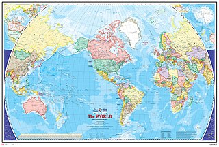
English: Done for the Atlas of Canada, this map shows the World at an equatorial scale of 1:35 000 000. The map is a general reference sheet focusing on showing the name and status of all sovereign countries and dependencies, and showing major cities. |
| Date | |
| Source | https://web.archive.org/web/20161031194718/http://geogratis.gc.ca/api/en/nrcan-rncan/ess-sst/a54b0d4a-30e4-5772-bc25-1e3d40961e37 |
| Author | Natural Resources Canada |
Licensing[edit]
.svg) |
This file is licensed under the Open Government Licence - Canada 2.0. |
|
File history
Click on a date/time to view the file as it appeared at that time.
| Date/Time | Thumbnail | Dimensions | User | Comment | |
|---|---|---|---|---|---|
| current | 20:01, 8 November 2023 | | 7,090 × 4,788 (7.89 MB) | Babelia (talk | contribs) | Uploaded a work by Natural Resources Canada from https://web.archive.org/web/20161031194718/http://geogratis.gc.ca/api/en/nrcan-rncan/ess-sst/a54b0d4a-30e4-5772-bc25-1e3d40961e37 with UploadWizard |
You cannot overwrite this file.
File usage on Commons
There are no pages that use this file.