File:Waterfall at Mount Suyang.jpg
Jump to navigation
Jump to search

Size of this preview: 800 × 600 pixels. Other resolutions: 320 × 240 pixels | 640 × 480 pixels | 1,024 × 768 pixels | 1,280 × 960 pixels | 1,800 × 1,350 pixels.
Original file (1,800 × 1,350 pixels, file size: 332 KB, MIME type: image/jpeg)
Captions
Captions
Add a one-line explanation of what this file represents
Summary[edit]
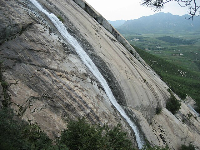
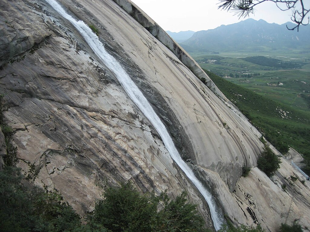
| Description | Waterfall at Mount Suyang near Haeju, DPRK. |
| Date | Téléchargé le 10 Octobre 2010 |
| Source | panoramio |
| Author | David Stanley |
| Camera location | | View this and other nearby images on: OpenStreetMap |
|---|
Licensing[edit]
This file is licensed under the Creative Commons Attribution 3.0 Unported license.
- You are free:
- to share – to copy, distribute and transmit the work
- to remix – to adapt the work
- Under the following conditions:
- attribution – You must give appropriate credit, provide a link to the license, and indicate if changes were made. You may do so in any reasonable manner, but not in any way that suggests the licensor endorses you or your use.
| This image, which was originally posted to Panoramio, was reviewed on 22 September 2012 by the administrator or trusted user Materialscientist, who confirmed that it was available on Panoramio under the above license on that date. |
File history
Click on a date/time to view the file as it appeared at that time.
| Date/Time | Thumbnail | Dimensions | User | Comment | |
|---|---|---|---|---|---|
| current | 20:28, 21 September 2012 | | 1,800 × 1,350 (332 KB) | TKostolany (talk | contribs) | {{Information |Description=Waterfall at Mount Suyang near Haeju, DPRK. |Source=[http://www.panoramio.com/photo/41989781 panoramio] |Date=Téléchargé le 10 Octobre 2010 |Author=[http://www.panoramio.com/user/1903279 David Stanley] |Permission= |other_... |
You cannot overwrite this file.
File usage on Commons
The following page uses this file:
- File:Waterfall at Mount Suyang (5063684330).jpg (file redirect)
.jpg&redirect=no)
File usage on other wikis
The following other wikis use this file:
- Usage on en.wikipedia.org
- Usage on es.wikipedia.org
- Usage on fr.wikipedia.org
- Usage on ko.wikipedia.org
- Usage on lld.wikipedia.org
- Usage on www.wikidata.org
- Usage on zh.wikipedia.org