File:Viking Expansion AR.svg
Jump to navigation
Jump to search

Size of this PNG preview of this SVG file: 800 × 524 pixels. Other resolutions: 320 × 210 pixels | 640 × 419 pixels | 1,024 × 671 pixels | 1,280 × 838 pixels | 2,560 × 1,677 pixels.
Original file (SVG file, nominally 800 × 524 pixels, file size: 662 KB)
Captions
Captions
Add a one-line explanation of what this file represents
Summary[edit]
| Description |
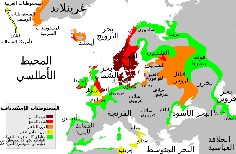
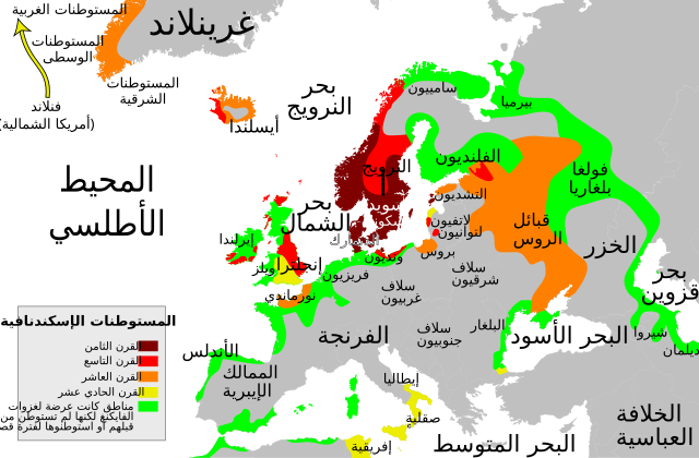
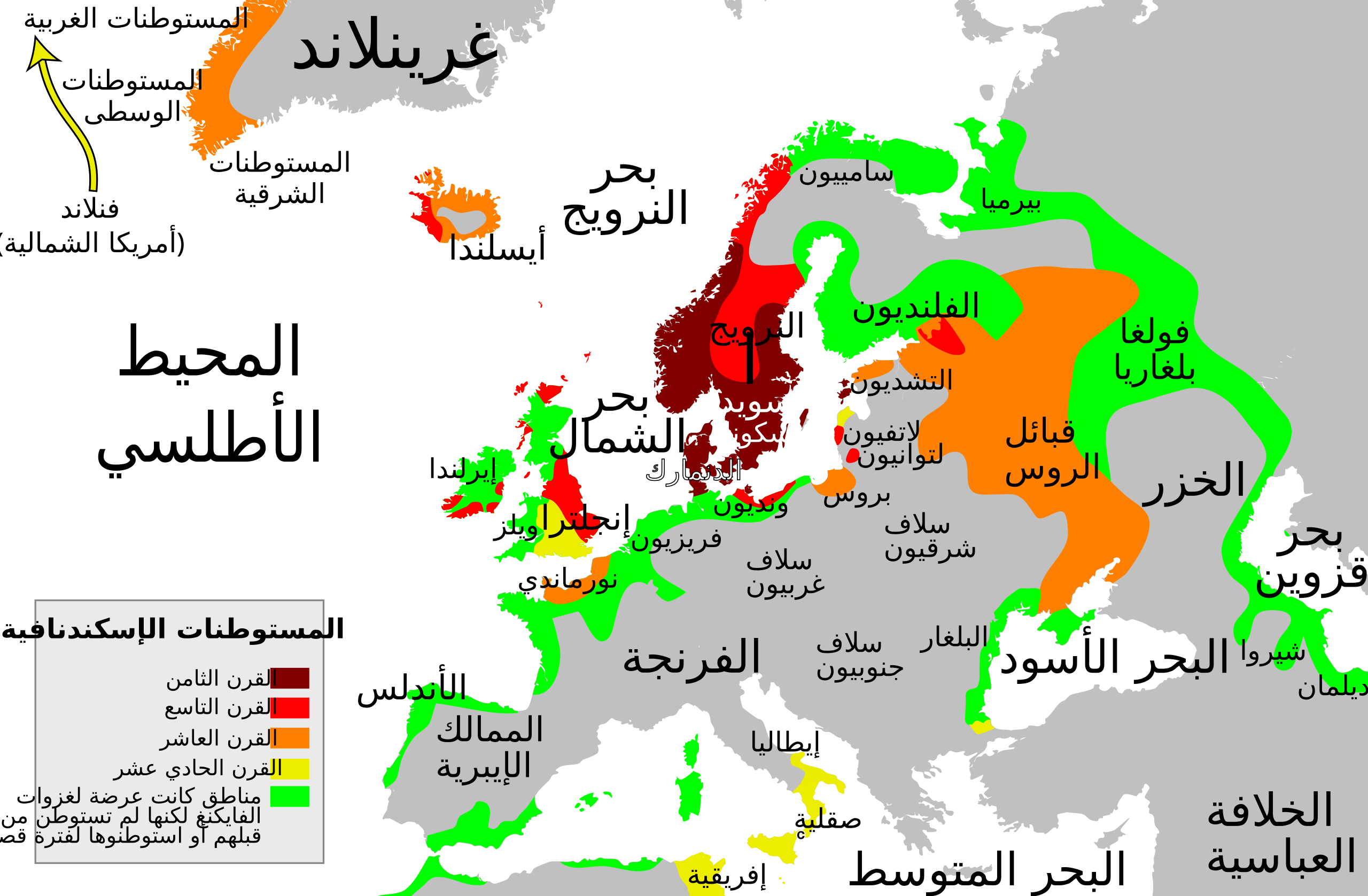
العربية: خريطة تظهر المستوطنات الإسكندنافية خلال القرون 8 إلى 11 |
| Date | |
| Source |
Own work based on  |
| Author | Jak |
| Other versions |
[]
|


Licensing[edit]
I, the copyright holder of this work, hereby publish it under the following license:
This file is licensed under the Creative Commons Attribution-Share Alike 4.0 International license.
- You are free:
- to share – to copy, distribute and transmit the work
- to remix – to adapt the work
- Under the following conditions:
- attribution – You must give appropriate credit, provide a link to the license, and indicate if changes were made. You may do so in any reasonable manner, but not in any way that suggests the licensor endorses you or your use.
- share alike – If you remix, transform, or build upon the material, you must distribute your contributions under the same or compatible license as the original.
File history
Click on a date/time to view the file as it appeared at that time.
| Date/Time | Thumbnail | Dimensions | User | Comment | |
|---|---|---|---|---|---|
| current | 22:06, 3 March 2018 | | 800 × 524 (662 KB) | Asmodim (talk | contribs) | Added the areas of the Norman "Kingdom of Africa" (see article on english wikipedia), conquest part of the Norman kingdom of Sicily under Roger II. |
| 21:43, 21 November 2017 |  | 800 × 524 (596 KB) | Jak (talk | contribs) | User created page with UploadWizard |
You cannot overwrite this file.
File usage on Commons
The following 11 pages use this file:
- File:Viking Expansion-es.svg
- File:Viking Expansion-fr.svg
- File:Viking Expansion-pt.svg
- File:Viking Expansion.svg
- File:Viking Expansion AR.svg
- File:Viking Expansion AR Vector.svg
- File:Viking Expansion He.svg
- File:Viking Expansion KO.svg
- File:Viking Expansion hu.svg
- File:Viking expansion.png
- Template:Other versions/Viking Expansion