File:Van-Mosul.jpg
Jump to navigation
Jump to search

Size of this preview: 800 × 512 pixels. Other resolutions: 320 × 205 pixels | 640 × 410 pixels | 1,024 × 655 pixels | 1,280 × 819 pixels | 2,560 × 1,638 pixels | 3,200 × 2,048 pixels.
Original file (3,200 × 2,048 pixels, file size: 3.66 MB, MIME type: image/jpeg)
Captions
Captions
Add a one-line explanation of what this file represents
Summary[edit]
| Description |
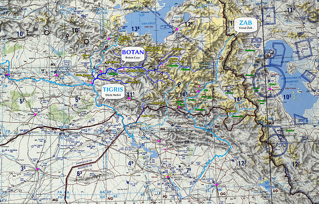
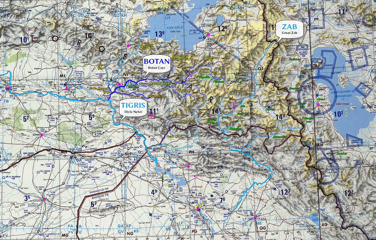
English: A map showing the area between Lake Van and Mosul, and between Diyarbakır and Lake Urmia. The Botan River and its tributaries are highlighted in blue; the Tigris and the Great Zab are highlighted in turquoise. Key place names appearing in Maclean’s Grammar of the Dialects of Vernacular Syriac [1][2] have been inserted (mostly historical names). |
| Date | |
| Source | Own work: Based on a public domain map, ONC [3] G-4 (1972). For the added names of the places and their location, I used various sources of information, including siirt.gov.tr, lib.utexas.edu, aina.org, and g151.ru. The “speech bubble” image was taken from OpenClipart.org, also public domain. |
| Author | Gyopi |
| Other versions |
 |
Licensing[edit]
I, the copyright holder of this work, hereby publish it under the following license:
| This file is made available under the Creative Commons CC0 1.0 Universal Public Domain Dedication. | |
| The person who associated a work with this deed has dedicated the work to the public domain by waiving all of their rights to the work worldwide under copyright law, including all related and neighboring rights, to the extent allowed by law. You can copy, modify, distribute and perform the work, even for commercial purposes, all without asking permission.
|
File history
Click on a date/time to view the file as it appeared at that time.
| Date/Time | Thumbnail | Dimensions | User | Comment | |
|---|---|---|---|---|---|
| current | 08:43, 4 July 2015 | | 3,200 × 2,048 (3.66 MB) | Gyopi (talk | contribs) | User created page with UploadWizard |
You cannot overwrite this file.
File usage on Commons
The following 2 pages use this file: