File:Uttar Pradesh Districts Gray.svg
Jump to navigation
Jump to search

Size of this PNG preview of this SVG file: 600 × 600 pixels. Other resolutions: 240 × 240 pixels | 480 × 480 pixels | 768 × 768 pixels | 1,024 × 1,024 pixels | 2,048 × 2,048 pixels | 1,500 × 1,500 pixels.
Original file (SVG file, nominally 1,500 × 1,500 pixels, file size: 105 KB)
Captions
Captions
Add a one-line explanation of what this file represents
Summary[edit]
| Description |
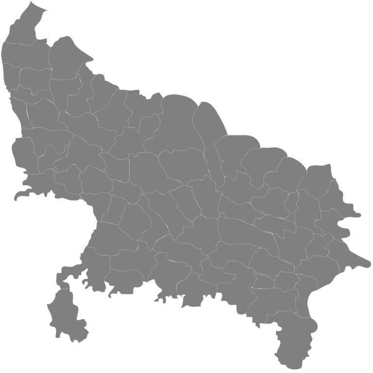
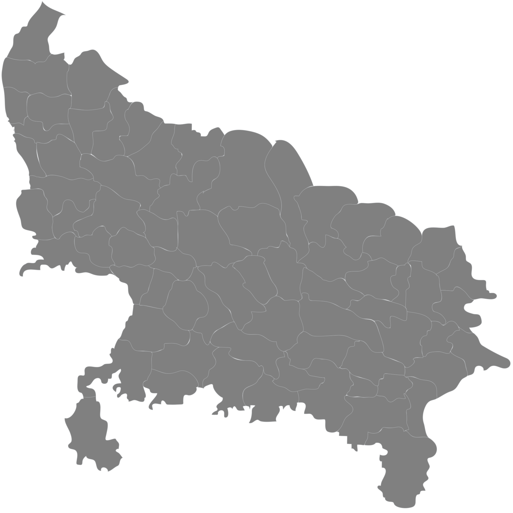
English: Current districts of the state of Uttar Pradesh in India. |
| Date | |
| Source | Own work |
| Author | Joshbaumgartner |
Licensing[edit]
Sayed Mohammad Faiz Haider, the copyright holder of this work, hereby publishes it under the following licenses:
This file is licensed under the Creative Commons Attribution-Share Alike 3.0 Unported license.
Attribution: Sayed Mohammad Faiz Haider
- You are free:
- to share – to copy, distribute and transmit the work
- to remix – to adapt the work
- Under the following conditions:
- attribution – You must give appropriate credit, provide a link to the license, and indicate if changes were made. You may do so in any reasonable manner, but not in any way that suggests the licensor endorses you or your use.
- share alike – If you remix, transform, or build upon the material, you must distribute your contributions under the same or compatible license as the original.

|
Permission is granted to copy, distribute and/or modify this document under the terms of the GNU Free Documentation License, Version 1.2 or any later version published by the Free Software Foundation; with no Invariant Sections, no Front-Cover Texts, and no Back-Cover Texts. A copy of the license is included in the section entitled GNU Free Documentation License. |
You may select the license of your choice.
File history
Click on a date/time to view the file as it appeared at that time.
| Date/Time | Thumbnail | Dimensions | User | Comment | |
|---|---|---|---|---|---|
| current | 07:59, 5 September 2016 | | 1,500 × 1,500 (105 KB) | Seuttarpradesh (talk | contribs) | Reverted to version as of 14:26, 31 January 2009 (UTC) |
| 07:59, 5 September 2016 |  | 699 × 692 (635 KB) | Seuttarpradesh (talk | contribs) | Reverted to version as of 05:19, 13 June 2008 (UTC) | |
| 14:26, 31 January 2009 |  | 1,500 × 1,500 (105 KB) | Faizhaider (talk | contribs) | Updated image on basis of map given on govt. of India portal : [http://india.gov.in/maps/up.php]. | |
| 05:19, 13 June 2008 |  | 699 × 692 (635 KB) | Joshbaumgartner (talk | contribs) | {{Information |Description={{en|1=Current districts of the state of Uttar Pradesh in India.}} |Source=Own work by uploader |Author=Joshbaumgartner |Date=12 June 2008 |Permission= |other_versions= }} {{ImageUpload|full}} |
You cannot overwrite this file.
File usage on Commons
The following 20 pages use this file:
- File:Asif muharram 1795 2.jpg
- File:Bara Imambara First Gateway 01.JPG
- File:Burning of a Widow.jpg
- File:Chhotaimambara.adnan.JPG
- File:Dayal-bagh-12.JPG
- File:Dilkusha6.jpg
- File:E. view of the Fort at Kalinjar. May 1814.jpg
- File:Entrance Dargah Shaheed-e-Salis Qazi Nurullah Shustari.jpg
- File:Fatehput Sikiri Buland Darwaza gate 2010.jpg
- File:Fort of Akbar, Allahabad, 1850s.jpg
- File:Jaunpur Atala Masjid.jpg
- File:Jaunpurbridge.jpg
- File:La Martiniere3-Lucknow.jpg
- File:La Martinière 02.jpg
- File:Nana Sahib with his escort.jpg
- File:Taj Mahal-11.jpg
- File:The Relief of Lucknow.jpg
- File:Uttar Pradesh administrative divisions.svg
- File:Uttar Pradesh administrative divisions .svg
- Template:SP India UP
File usage on other wikis
The following other wikis use this file:
- Usage on hi.wikipedia.org