File:U.S. Territorial Acquisitions-zh-classical.png
Jump to navigation
Jump to search

Size of this preview: 776 × 600 pixels. Other resolutions: 311 × 240 pixels | 621 × 480 pixels | 994 × 768 pixels | 1,280 × 989 pixels | 2,560 × 1,978 pixels | 3,960 × 3,060 pixels.
Original file (3,960 × 3,060 pixels, file size: 2.49 MB, MIME type: image/png)
Captions
Captions
Add a one-line explanation of what this file represents
| Description |
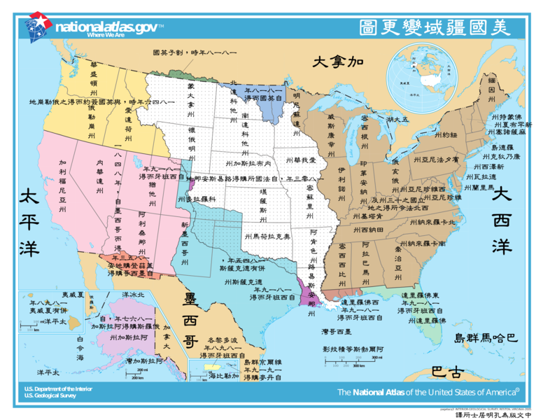
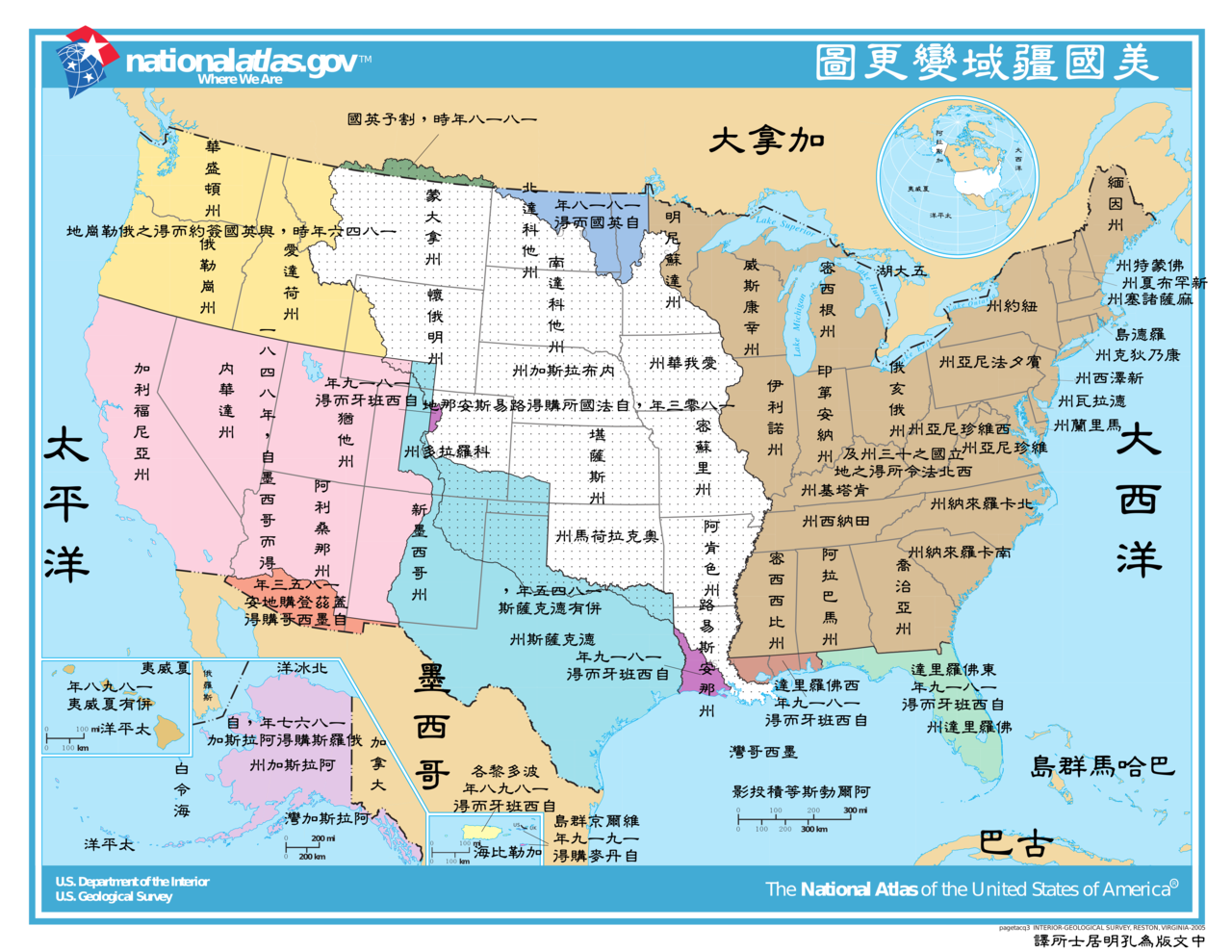
This image depicts the Territorial acquisitions of the United States, such as the Thirteen Colonies, the Louisiana Purchase, British and Spanish Cession, and so on. ErrorsThis map uses incorrect terms in that Great Britain didn't exist as a political entity in 1818 or 1846, having been superseded by the United Kingdom following the Act of Union with Ireland in 1801. This map does not show the full extent of the Oregon Territory into what is now Canada. The map shows a portion of the en:Isle of Orleans as part of the West Florida (Spanish Cession) 1819, but the area south of Lake Pontchartrain and east of the Amite River were part of the Louisiana Purchase 1803 (from France). |
|||
| Source | National Atlas of the United States [1] | |||
| Author | United States federal government (The Classical Chinese Translation is made by User:Itsmine.) | |||
| Permission (Reusing this file) |
|
|||
| Other versions | English Version: Image:U.S. Territorial Acquisitions.png |
File history
Click on a date/time to view the file as it appeared at that time.
| Date/Time | Thumbnail | Dimensions | User | Comment | |
|---|---|---|---|---|---|
| current | 10:51, 2 March 2008 | | 3,960 × 3,060 (2.49 MB) | Itsmine (talk | contribs) | |
| 09:39, 2 March 2008 |  | 3,960 × 3,060 (2.5 MB) | Itsmine (talk | contribs) | {{Information| |Description= This image depicts the Territorial acquisitions of the United States, such as the Thirteen Colonies, the Louisiana Purchase, British and Spanish Cession, and so on. === Er |
You cannot overwrite this file.
File usage on Commons
The following page uses this file:
File usage on other wikis
The following other wikis use this file:
- Usage on zh-classical.wikipedia.org
- Usage on zh.wikipedia.org