File:Tropical Storm Talas (2011), Mie Prefecture Miyagawa estuary discoloration range aerial photographs.jpg
Jump to navigation
Jump to search

Size of this preview: 800 × 405 pixels. Other resolutions: 320 × 162 pixels | 640 × 324 pixels | 1,024 × 519 pixels | 1,280 × 648 pixels | 2,560 × 1,297 pixels | 6,998 × 3,545 pixels.
Original file (6,998 × 3,545 pixels, file size: 5.25 MB, MIME type: image/jpeg)
Captions
Captions
Add a one-line explanation of what this file represents
Summary
[edit],_Mie_Prefecture_Miyagawa_estuary_discoloration_range_aerial_photographs.jpg&action=edit§ion=1)
| Description |
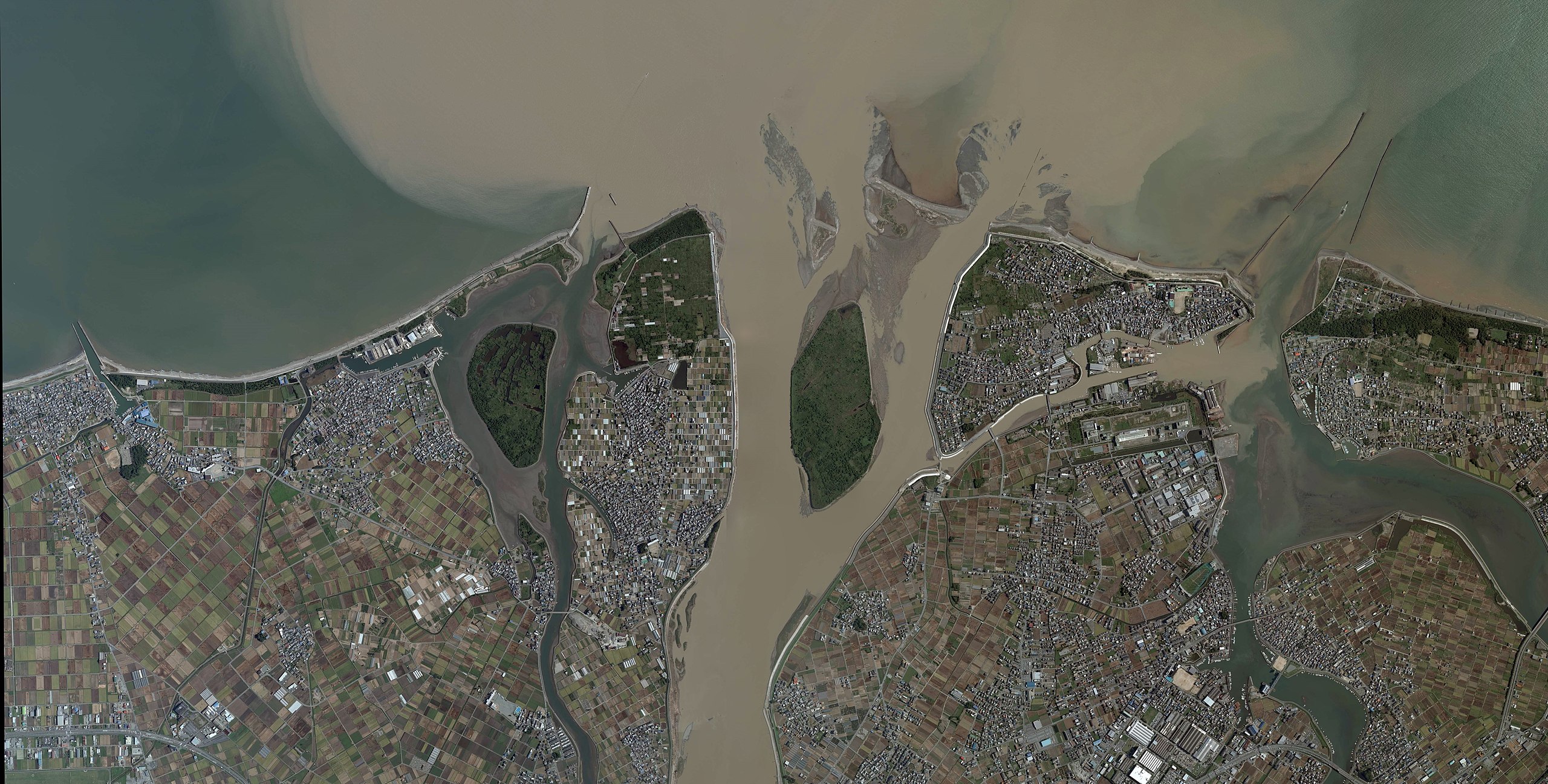
日本語: 平成23年(2011年)台風12号による三重県宮川河口周辺の変色水域空中写真。CKK20113X-C1-14、CKK20113X-C1-15、CKK20113X-C1-16、CKK20113X-C1-17、CKK20113X-C1-18、CKK20113X-C1-19の6枚を合成作成。
English: Tropical Storm Talas (2011), Mie Prefecture Miyagawa estuary discoloration range aerial photographs. |
| Date | |
| Source | 国土情報ウェブマッピングシステム |
| Author | 国土地理院 |
Licensing
[edit],_Mie_Prefecture_Miyagawa_estuary_discoloration_range_aerial_photographs.jpg&action=edit§ion=2)

|
The copyright holder of this file, the Ministry of Land, Infrastructure, Transport and Tourism of Japan, allows anyone to use it for any purpose, provided that the copyright holder is properly attributed. Redistribution, derivative work, commercial use, and all other use is permitted. |
Attribution:
Copyright © National Land Image Information (Color Aerial Photographs), Ministry of Land, Infrastructure, Transport and Tourism
|
 |
This image is copyrighted by the Ministry of Land, Infrastructure, Transport and Tourism of Japan. For terms of use, see the stipulation to use of National Land Information (in Japanese) and message from MLIT (in Japanese and English). When you display this image on an article, include the following phrase in the description: "Made based on National Land Image Information (Color Aerial Photographs), Ministry of Land, Infrastructure, Transport and Tourism".
|
File history
Click on a date/time to view the file as it appeared at that time.
| Date/Time | Thumbnail | Dimensions | User | Comment | |
|---|---|---|---|---|---|
| current | 17:35, 25 March 2018 | | 6,998 × 3,545 (5.25 MB) | さかおり (talk | contribs) | User created page with UploadWizard |
You cannot overwrite this file.
File usage on Commons
The following page uses this file:
File usage on other wikis
The following other wikis use this file:
- Usage on ja.wikipedia.org
,_Mie_Prefecture_Miyagawa_estuary_discoloration_range_aerial_photographs.jpg&oldid=592006855)