File:Treppe Laichinger Tiefenhöhle HDR.jpg
Jump to navigation
Jump to search
Size of this preview: 450 × 600 pixels. Other resolutions: 180 × 240 pixels | 360 × 480 pixels | 576 × 768 pixels | 768 × 1,024 pixels | 1,536 × 2,048 pixels | 3,888 × 5,184 pixels.
Original file (3,888 × 5,184 pixels, file size: 29.38 MB, MIME type: image/jpeg)
Captions
Captions
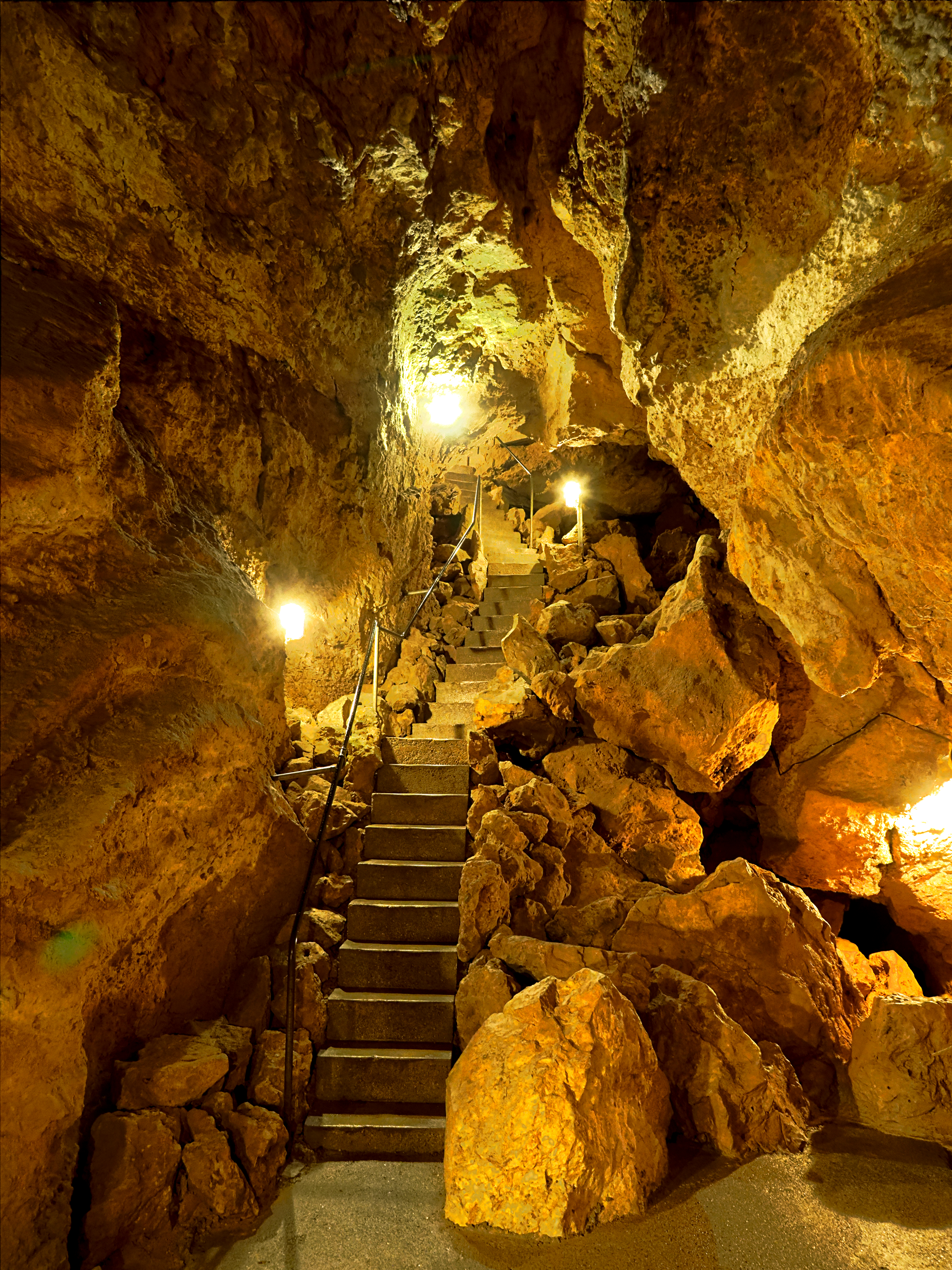
Stairs in Laichinger Tiefenhöhle HDR
Summary[edit]
| Description |
Deutsch: Treppe in der Laichinger Tiefenhöhle. HDR-Aufnahme aus mehreren Bilder mit unterschiedlicher Belichtung.
English: Stairs in the Laichinger Tiefenhöhle. HDR shot from several images with different exposure. |
| Date | |
| Source | Own work |
| Author | ThoBel-0043 |
| Camera location | | View this and other nearby images on: OpenStreetMap |
|---|
Licensing[edit]
I, the copyright holder of this work, hereby publish it under the following license:
This file is licensed under the Creative Commons Attribution-Share Alike 4.0 International license.
- You are free:
- to share – to copy, distribute and transmit the work
- to remix – to adapt the work
- Under the following conditions:
- attribution – You must give appropriate credit, provide a link to the license, and indicate if changes were made. You may do so in any reasonable manner, but not in any way that suggests the licensor endorses you or your use.
- share alike – If you remix, transform, or build upon the material, you must distribute your contributions under the same or compatible license as the original.
This image has been assessed using the Quality image guidelines and is considered a Quality image.
|
File history
Click on a date/time to view the file as it appeared at that time.
| Date/Time | Thumbnail | Dimensions | User | Comment | |
|---|---|---|---|---|---|
| current | 20:22, 18 April 2022 | | 3,888 × 5,184 (29.38 MB) | ThoBel-0043 (talk | contribs) | Uploaded own work with UploadWizard |
You cannot overwrite this file.
File usage on Commons
The following 9 pages use this file:
- User talk:ThoBel-0043
- Commons:Photo challenge/2022 - April - Stairs
- Commons:Photo challenge/2022 - April - Stairs/Voting
- Commons:Photo challenge/2022 - April - Stairs/Voting/Result
- Commons:Photo challenge/2022 - April - Stairs/Voting/de
- Commons:Photo challenge/2022 - April - Stairs/Voting/en
- Commons:Photo challenge/2022 - April - Stairs/Voting/nl
- Commons:Quality images/Subject/Places/Man made structures
- Commons:Quality images candidates/Archives April 21 2022