File:TierraDelFuego Satellite1 ValleTierraMayor.JPG
Jump to navigation
Jump to search
Size of this preview: 763 × 600 pixels. Other resolutions: 306 × 240 pixels | 611 × 480 pixels | 978 × 768 pixels | 1,280 × 1,006 pixels | 2,560 × 2,011 pixels | 2,800 × 2,200 pixels.
Original file (2,800 × 2,200 pixels, file size: 961 KB, MIME type: image/jpeg)
Captions
Captions
Add a one-line explanation of what this file represents
Summary[edit]
| Description |
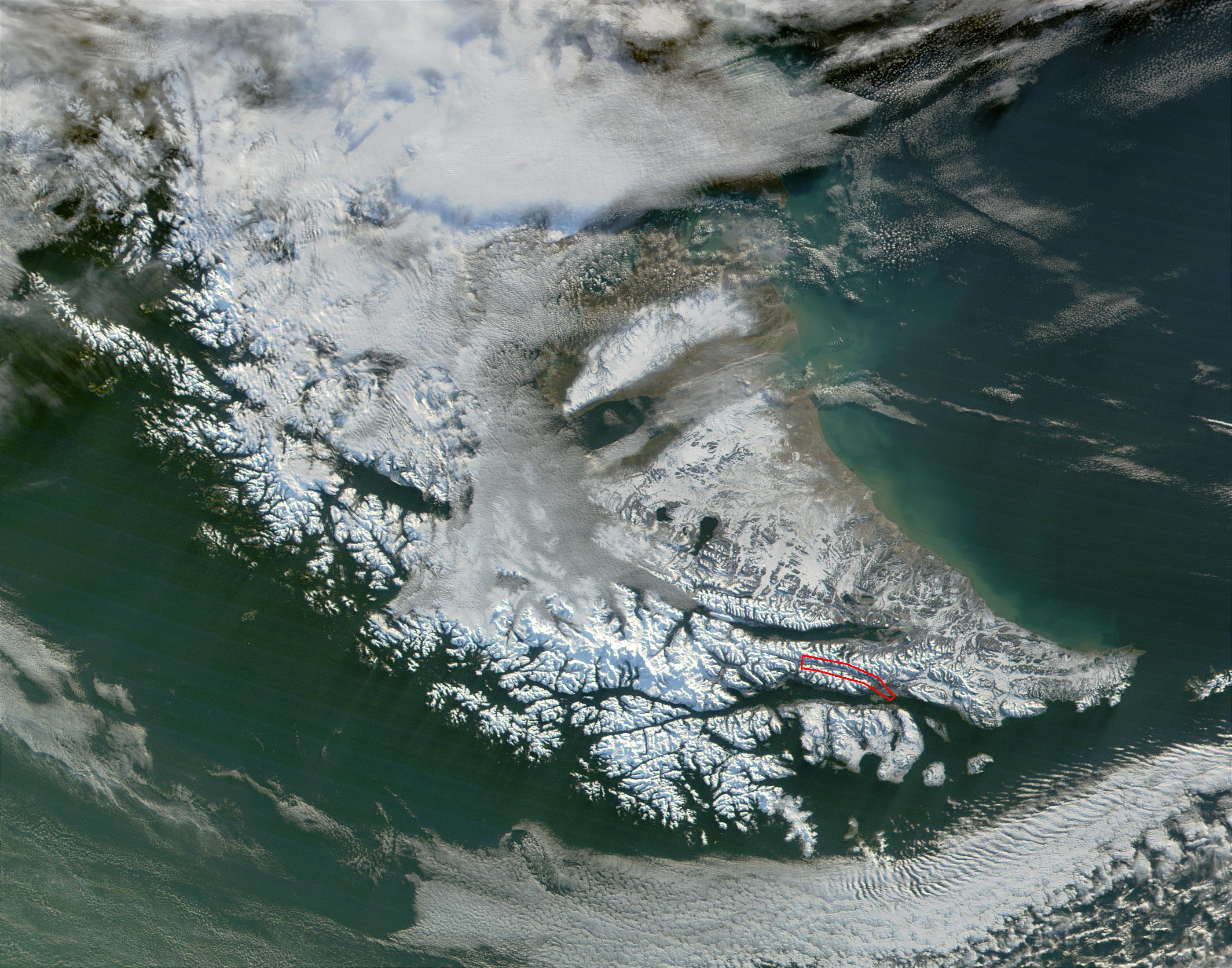
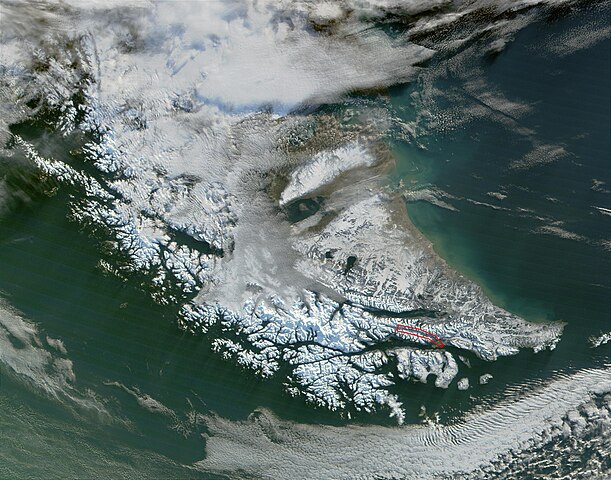
English: Satellite view of Tierra del Fuego. Valle de Tierra Mayor marked into a red line |
| Date | |
| Source | File:TierraDelFuego_Satellite1.jpg |
| Author | NASA |
Licensing[edit]
| This file is in the public domain in the United States because it was solely created by NASA. NASA copyright policy states that "NASA material is not protected by copyright unless noted". (See Template:PD-USGov, NASA copyright policy page or JPL Image Use Policy.) | ||
 |
Warnings:
|
File history
Click on a date/time to view the file as it appeared at that time.
| Date/Time | Thumbnail | Dimensions | User | Comment | |
|---|---|---|---|---|---|
| current | 19:11, 5 May 2012 | | 2,800 × 2,200 (961 KB) | Nachosan (talk | contribs) |
You cannot overwrite this file.
File usage on Commons
The following page uses this file:
File usage on other wikis
The following other wikis use this file:
- Usage on es.wikipedia.org
- Usage on fr.wikipedia.org