File:Szekesfehervar 20200522 B543.png
Jump to navigation
Jump to search

Size of this preview: 800 × 594 pixels. Other resolutions: 320 × 238 pixels | 640 × 476 pixels | 1,024 × 761 pixels | 1,280 × 951 pixels | 1,915 × 1,423 pixels.
Original file (1,915 × 1,423 pixels, file size: 2.97 MB, MIME type: image/png)
Captions
Captions
Add a one-line explanation of what this file represents
Summary[edit]
| Description |
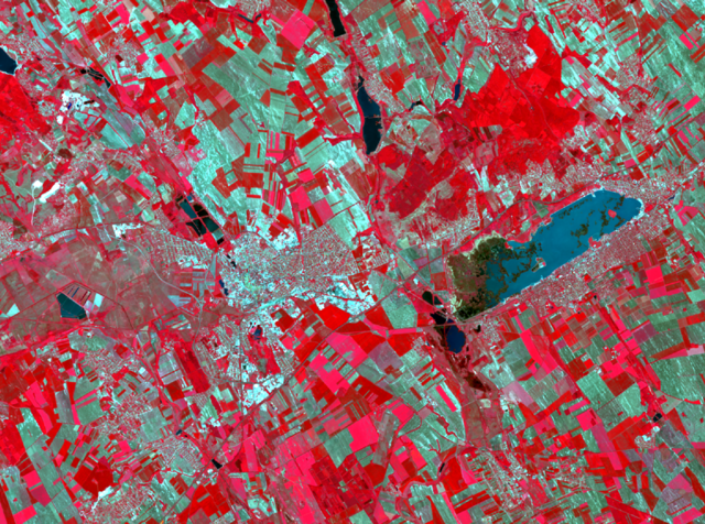
English: A false color infrared satellite image of Szekesfehervar, Hungary taken on NASA's Landsat 8 satellite |
| Date | |
| Source |
NASA, USGS https://earthexplorer.usgs.gov/ |
| Author |
Data available from the U.S. Geological Survey. See USGS Visual Identity System Guidance for further details. |
Licensing[edit]
| This file is in the public domain in the United States because it was solely created by NASA. NASA copyright policy states that "NASA material is not protected by copyright unless noted". (See Template:PD-USGov, NASA copyright policy page or JPL Image Use Policy.) | ||
 |
Warnings:
|
File history
Click on a date/time to view the file as it appeared at that time.
| Date/Time | Thumbnail | Dimensions | User | Comment | |
|---|---|---|---|---|---|
| current | 15:07, 13 April 2021 | | 1,915 × 1,423 (2.97 MB) | Henits László (talk | contribs) | Uploaded a work by Data available from the U.S. Geological Survey. See USGS Visual Identity System Guidance for further details. from NASA, USGS https://earthexplorer.usgs.gov/ with UploadWizard |
You cannot overwrite this file.
File usage on Commons
There are no pages that use this file.
File usage on other wikis
The following other wikis use this file:
- Usage on hu.wikipedia.org