File:Sunga-Border.jpg
Jump to navigation
Jump to search
Size of this preview: 536 × 599 pixels. Other resolutions: 215 × 240 pixels | 430 × 480 pixels | 792 × 885 pixels.
Original file (792 × 885 pixels, file size: 545 KB, MIME type: image/jpeg)
Captions
Captions
Add a one-line explanation of what this file represents
Summary[edit]
| Description |
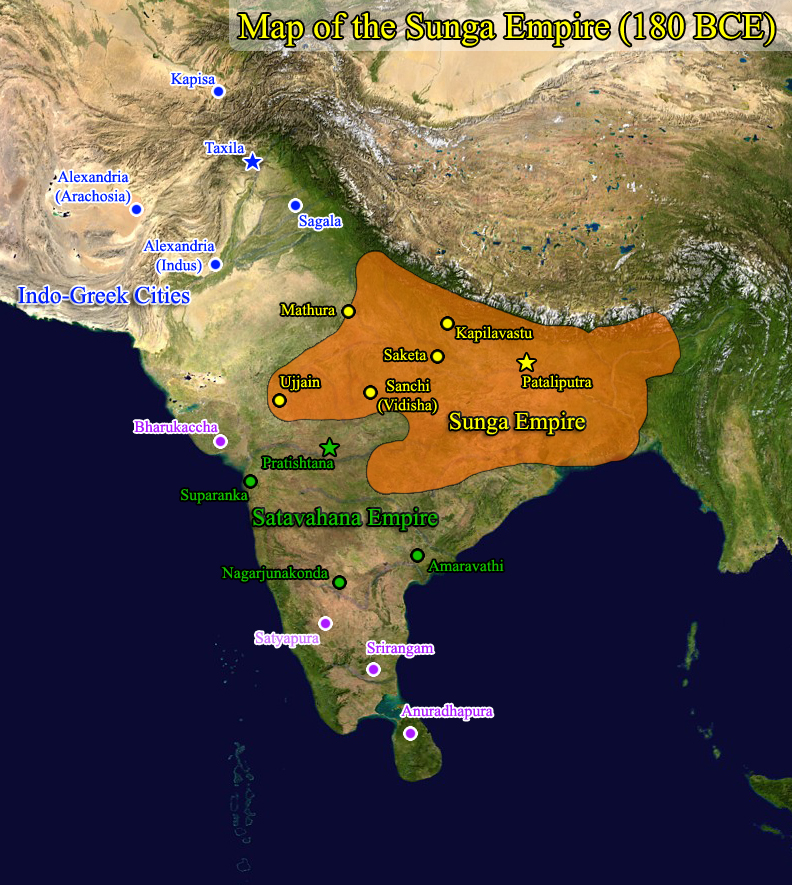
English: Map of the Sunga Empire based on Oxford University Atlas |
| Date | 10/02/2009 |
| Source | Own work (Original text: I (Windy City Dude (talk)) created this work entirely by myself.) |
| Author | Windy City Dude |
Licensing[edit]
| This work has been released into the public domain by its author, Windy City Dude at English Wikipedia. This applies worldwide. In some countries this may not be legally possible; if so: Windy City Dude grants anyone the right to use this work for any purpose, without any conditions, unless such conditions are required by law. |
Original upload log[edit]
Transferred from en.wikipedia to Commons by Alagos using CommonsHelper.
The original description page was here. All following user names refer to en.wikipedia.
- 2009-10-20 03:36 Windy City Dude 792×885× (557619 bytes) {{Information |Description = Map of the Sunga Empire based on Oxford University Atlas |Source = I (~~~) created this work entirely by myself. |Date = 10/02/2009 |Author = Windy City Dude |other_versions = }}
File history
Click on a date/time to view the file as it appeared at that time.
| Date/Time | Thumbnail | Dimensions | User | Comment | |
|---|---|---|---|---|---|
| current | 18:15, 19 November 2013 | | 792 × 885 (545 KB) | File Upload Bot (Magnus Manske) (talk | contribs) | Transfered from en.wikipedia by User:Alagos using CommonsHelper |
You cannot overwrite this file.
File usage on Commons
The following 2 pages use this file:
File usage on other wikis
The following other wikis use this file:
- Usage on ar.wikipedia.org
- Usage on azb.wikipedia.org
- Usage on bn.wikipedia.org
- Usage on ca.wikipedia.org
- Usage on cv.wikipedia.org
- Usage on en.wikipedia.org
- Usage on es.wikipedia.org
- Usage on fa.wikipedia.org
- Usage on fr.wikipedia.org
- Usage on hi.wikipedia.org
- Usage on hu.wikipedia.org
- Usage on id.wikibooks.org
- Usage on mr.wikipedia.org
- Usage on pnb.wikipedia.org
- Usage on pt.wikipedia.org
- Usage on ro.wikipedia.org
- Usage on ru.wikipedia.org
- Usage on ta.wikipedia.org
- Usage on te.wikipedia.org
- Usage on tl.wikipedia.org
- Usage on uk.wikipedia.org
- Usage on ur.wikipedia.org
- Usage on www.wikidata.org