File:Somaliland Physical map with National and Administrative boundaries.svg
Jump to navigation
Jump to search

Size of this PNG preview of this SVG file: 651 × 407 pixels. Other resolutions: 320 × 200 pixels | 640 × 400 pixels | 1,024 × 640 pixels | 1,280 × 800 pixels | 2,560 × 1,600 pixels.
Original file (SVG file, nominally 651 × 407 pixels, file size: 2.49 MB)
Captions
Captions
Add a one-line explanation of what this file represents
Summary[edit]
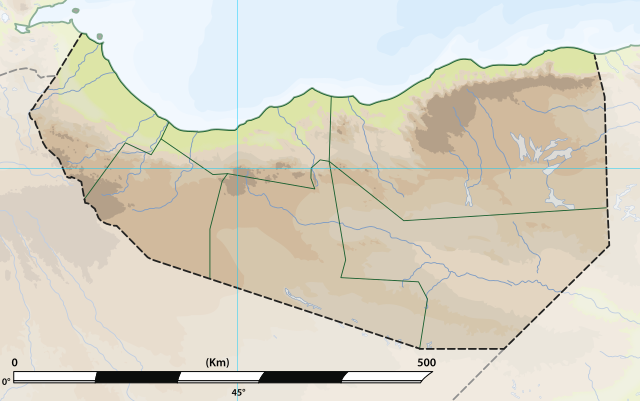
| Description | Somaliland: Physical map with National and Administrative boundaries.svg |
| Date | |
| Source | File:Somaliland relief location map.jpg |
| Author | MacMoreno |
Licensing[edit]
This file is licensed under the Creative Commons Attribution-Share Alike 4.0 International license.
- You are free:
- to share – to copy, distribute and transmit the work
- to remix – to adapt the work
- Under the following conditions:
- attribution – You must give appropriate credit, provide a link to the license, and indicate if changes were made. You may do so in any reasonable manner, but not in any way that suggests the licensor endorses you or your use.
- share alike – If you remix, transform, or build upon the material, you must distribute your contributions under the same or compatible license as the original.
File history
Click on a date/time to view the file as it appeared at that time.
| Date/Time | Thumbnail | Dimensions | User | Comment | |
|---|---|---|---|---|---|
| current | 09:18, 27 June 2021 | | 651 × 407 (2.49 MB) | MacMoreno (talk | contribs) | Updade image size |
| 23:14, 26 June 2021 |  | 866 × 538 (2.78 MB) | Siirski (talk | contribs) | Update file size | |
| 22:30, 26 June 2021 |  | 510 × 283 (3.25 MB) | Siirski (talk | contribs) | Reverted to version as of 20:45, 26 June 2021 (UTC) | |
| 22:29, 26 June 2021 |  | 866 × 538 (2.82 MB) | Siirski (talk | contribs) | Update file size | |
| 20:45, 26 June 2021 |  | 510 × 283 (3.25 MB) | MacMoreno (talk | contribs) | Update with distance measurements in kilometers | |
| 16:25, 26 June 2021 |  | 510 × 283 (3.24 MB) | MacMoreno (talk | contribs) | == {{int:filedesc}} == {{Information |Description= Somaliland: Physical map with National and Administrative boundaries.svg |Source= https://commons.wikimedia.org/wiki/File:Somaliland.png |Date= 26-06-2021 |Author= MacMoreno |Permission= |other_versions= }} |
You cannot overwrite this file.
File usage on Commons
The following 3 pages use this file:
File usage on other wikis
The following other wikis use this file:
- Usage on de.wikipedia.org
- Usage on el.wikipedia.org
- Usage on en.wikipedia.org
- Usage on fa.wikipedia.org
- Usage on id.wikipedia.org
- Usage on it.wikipedia.org
- Usage on no.wikipedia.org
- Usage on os.wikipedia.org
- Usage on pl.wikipedia.org
- Usage on si.wikipedia.org
- Usage on uz.wikipedia.org