File:Sirmien BV044705964 1.jpg

Original file (10,410 × 13,232 pixels, file size: 17.63 MB, MIME type: image/jpeg)
Captions
Captions
Summary[edit]
| Warning | The original file is very high-resolution. It might not load properly or could cause your browser to freeze when opened at full size. |
|---|
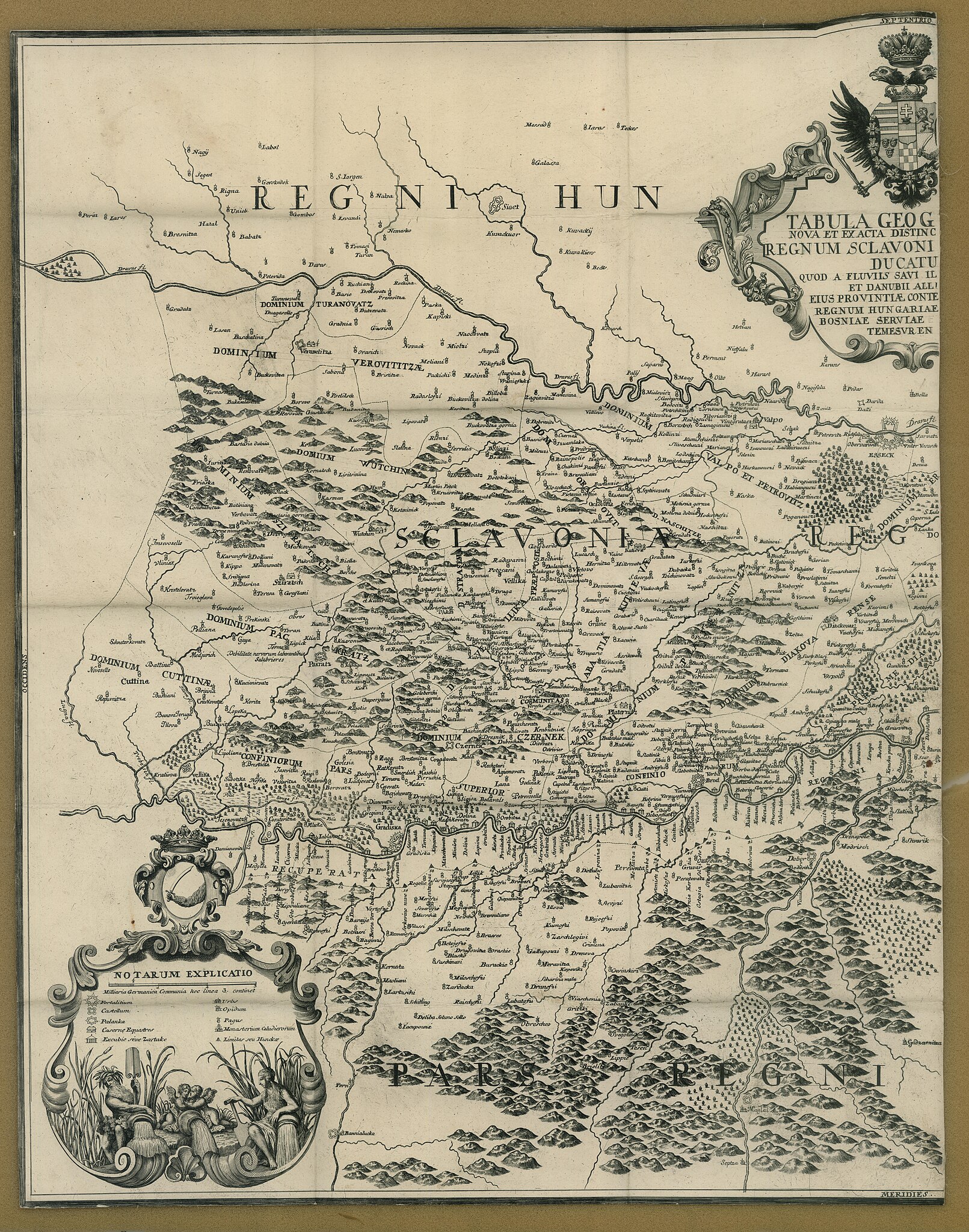
| Title |
Tabula Geographica Nova Et Exacta Distincte Exhibens Regnum Sclavoniae Cum Syrmii Ducatu Quod A Fluvus Savi Illovae Dravi Et Danubii Allitur Eius Provinitiae Conterminae Sunt Regnum Hungariae Croatiae Bosniae Serviae Et Bannatus Temesvrensis |
|||||||||||||||||||||||
| Description |
Deutsch: Sirmien, Bosnien, Požarevac/Friede |
|||||||||||||||||||||||
| Date | ||||||||||||||||||||||||
| Source | Leibniz-Institut für Ost- und Südosteuropaforschung (IOS) GeoPortOst | |||||||||||||||||||||||
| Creator |
Ludwig Andreas von Khevenhüller-Frankenburg |
|||||||||||||||||||||||
| Permission (Reusing this file) |
|
|||||||||||||||||||||||
| Geotemporal data | ||||||||||||||||||||||||
| Map location | Sirmien | |||||||||||||||||||||||
| Map type | Altkarte | |||||||||||||||||||||||
| Bounding box |
|
|||||||||||||||||||||||
| Georeferencing | ||||||||||||||||||||||||
| Bibliographic data | ||||||||||||||||||||||||
| Language | Latin | |||||||||||||||||||||||
| Archival data | ||||||||||||||||||||||||
| Collection |
|
|||||||||||||||||||||||
| Accession number |
BV044705964_1 |
|||||||||||||||||||||||

Licensing[edit]
|
This work is in the public domain in its country of origin and other countries and areas where the copyright term is the author's life plus 70 years or fewer.
| |
| This file has been identified as being free of known restrictions under copyright law, including all related and neighboring rights. | |
File history
Click on a date/time to view the file as it appeared at that time.
| Date/Time | Thumbnail | Dimensions | User | Comment | |
|---|---|---|---|---|---|
| current | 13:03, 19 February 2019 | | 10,410 × 13,232 (17.63 MB) | H.bauer26 (talk | contribs) | pattypan 18.02 |
You cannot overwrite this file.
File usage on Commons
There are no pages that use this file.