File:Shale-siltstone-sandstone (Logan Formation, Lower Mississippian; Jackson North roadcut, Ohio, USA) 2 (36806320014).jpg

Original file (3,000 × 4,000 pixels, file size: 5.08 MB, MIME type: image/jpeg)
Captions
Captions
Summary[edit]
_2_(36806320014).jpg&action=edit§ion=1)
| Description |
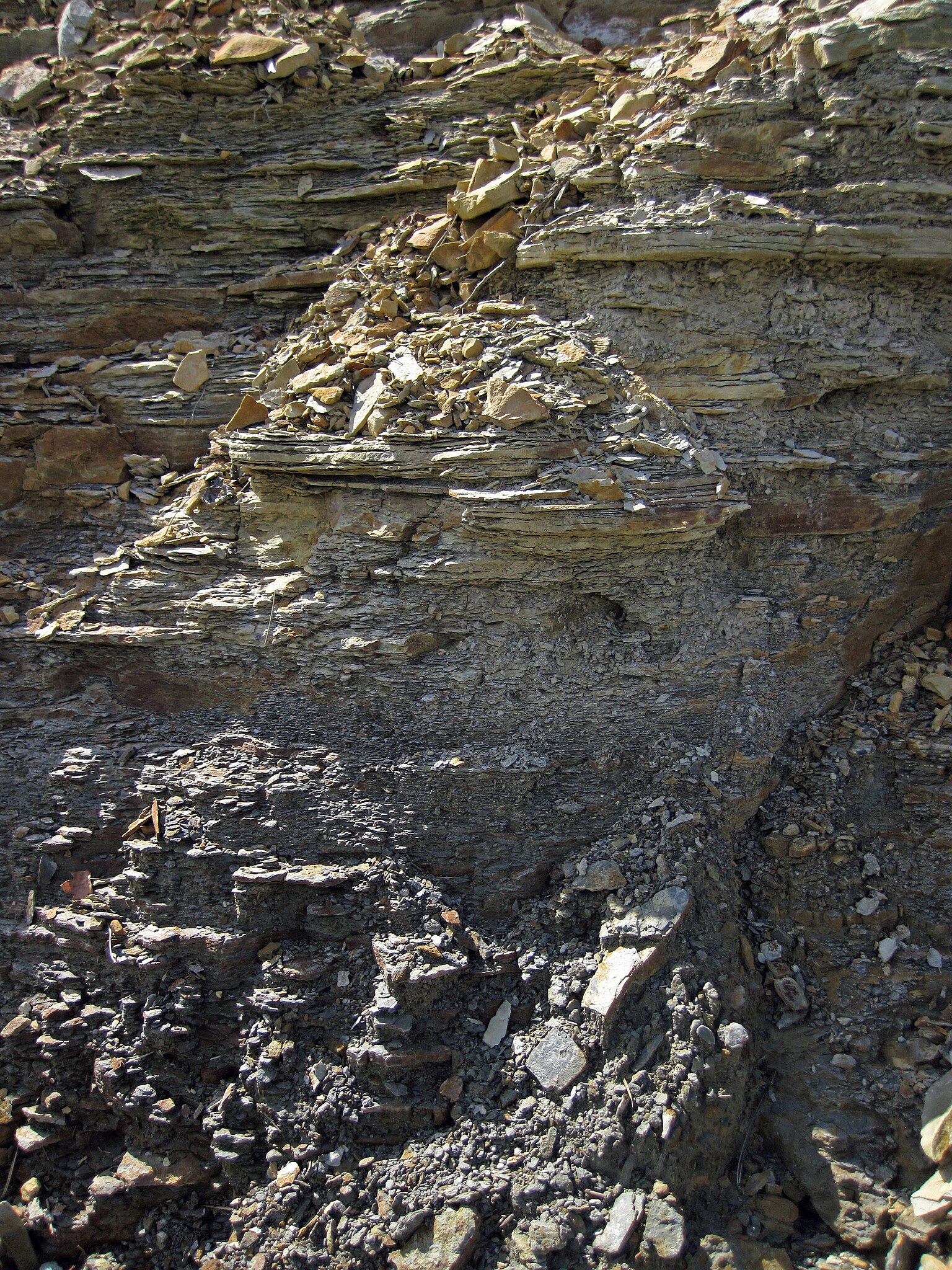
Mixed siliciclastics in the Mississippian of Ohio, USA. The Logan Formation is a succession of siliciclastic sedimentary rocks of Early Mississippian age in eastern Ohio, USA. It is subdivided into four units - ascending from the base, they are the Berne Conglomerate Member, the Byer Sandstone Member, the Allensville Member, and the Vinton Member. The basal Berne Conglomerate is a thin (sometimes absent) quartz-pebble conglomerate horizon. The overlying Byer is a moderately thick, yellowish-brown to brownish-colored, limonitic quartzose sandstone unit. The Allensville is a coarse-grained sandstone to granulestone horizon. The uppermost unit is the Vinton, which is dominated by siltstones but sandstones and shales are also present. The Byer is the most fossiliferous unit. The Vinton is usually sparsely fossiliferous at best, but fossil horizons are not uncommon in some sections. Fossiliferous horizons in the Logan Formation usually consist of limonite-stained molds, dominated by brachiopods and crinoid stem columnals. In the lower part of the section shown here, gray shale dominates, and grades upward into siltstones and sandstones. Stratigraphy: Logan Formation, upper Waverly Group, Osagean Stage, upper Lower Mississippian Locality: Jackson North Outcrop - roadcut along the southwestern side of Rt. 35, immediately southeast of the Rt. 35-Lloyds Bridge Road intersection (the northwestern intersection - there are two of them), north of the town of Jackson, northwest-central Jackson County, southern Ohio, USA (39° 06’ 33.80” North latitude, 82° 40’ 40.92” West longitude) |
| Date | |
| Source | Shale-siltstone-sandstone (Logan Formation, Lower Mississippian; Jackson North roadcut, Ohio, USA) 2 |
| Author | James St. John |
Licensing[edit]
_2_(36806320014).jpg&action=edit§ion=2)
- You are free:
- to share – to copy, distribute and transmit the work
- to remix – to adapt the work
- Under the following conditions:
- attribution – You must give appropriate credit, provide a link to the license, and indicate if changes were made. You may do so in any reasonable manner, but not in any way that suggests the licensor endorses you or your use.
| This image was originally posted to Flickr by James St. John at https://flickr.com/photos/47445767@N05/36806320014 (archive). It was reviewed on 10 October 2019 by FlickreviewR 2 and was confirmed to be licensed under the terms of the cc-by-2.0. |
File history
Click on a date/time to view the file as it appeared at that time.
| Date/Time | Thumbnail | Dimensions | User | Comment | |
|---|---|---|---|---|---|
| current | 02:19, 10 October 2019 | | 3,000 × 4,000 (5.08 MB) | Ser Amantio di Nicolao (talk | contribs) | Transferred from Flickr via #flickr2commons |
You cannot overwrite this file.
File usage on Commons
There are no pages that use this file.
_2_(36806320014).jpg&oldid=723086367)