File:Seattle - Aerial of Portage Bay, circa 1950s (50295792781).jpg
Jump to navigation
Jump to search

Size of this preview: 771 × 600 pixels. Other resolutions: 309 × 240 pixels | 617 × 480 pixels | 988 × 768 pixels | 1,280 × 995 pixels | 2,560 × 1,991 pixels | 3,086 × 2,400 pixels.
Original file (3,086 × 2,400 pixels, file size: 2.63 MB, MIME type: image/jpeg)
Captions
Captions
Add a one-line explanation of what this file represents
Summary[edit]
| Description |
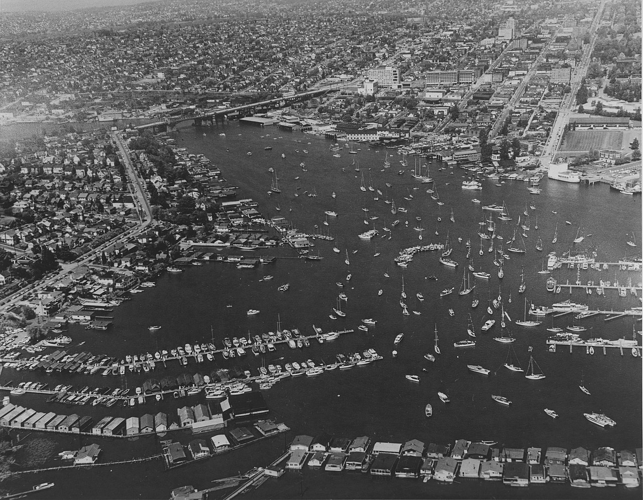
Item 31022, Don Sherwood Parks History Collection (Record Series 5801-01), Seattle Municipal Archives. English: Aerial of Portage Bay, Seattle, Washington, circa 1950s. |
||||||||||||||||||||
| Date | between May 1953 and May 1959 | ||||||||||||||||||||
| Source |
Aerial of Portage Bay, circa 1950s This image comes from the Seattle Municipal Archives, via Flickr.
|
||||||||||||||||||||
| Author | Seattle Municipal Archives from Seattle, WA | ||||||||||||||||||||
| Other versions | |||||||||||||||||||||
.jpg)
_(cropped).jpg)
.jpg&action=edit§ion=1)
| Camera location | | View this and other nearby images on: OpenStreetMap |
|---|
.jpg¶ms=047.646308_N_-122.313022_E_globe:Earth_type:camera_source:Flickr_&language=en)
Licensing[edit]
.jpg&action=edit§ion=2)
This file is licensed under the Creative Commons Attribution 2.0 Generic license.
- You are free:
- to share – to copy, distribute and transmit the work
- to remix – to adapt the work
- Under the following conditions:
- attribution – You must give appropriate credit, provide a link to the license, and indicate if changes were made. You may do so in any reasonable manner, but not in any way that suggests the licensor endorses you or your use.
| This image was originally posted to Flickr by Seattle Municipal Archives at https://flickr.com/photos/24256351@N04/50295792781. It was reviewed on 12 September 2020 by FlickreviewR 2 and was confirmed to be licensed under the terms of the cc-by-2.0. |
| Annotations | This image is annotated: View the annotations at Commons |
.jpg)
File history
Click on a date/time to view the file as it appeared at that time.
| Date/Time | Thumbnail | Dimensions | User | Comment | |
|---|---|---|---|---|---|
| current | 23:47, 12 September 2020 | | 3,086 × 2,400 (2.63 MB) | Jmabel (talk | contribs) | higher resolution |
| 23:34, 12 September 2020 |  | 699 × 544 (104 KB) | Jmabel (talk | contribs) | Transferred from Flickr via #flickr2commons |
You cannot overwrite this file.
File usage on Commons
The following page uses this file:
.jpg&oldid=709401800)