File:Schweriner Schloss 01 (MK).jpg
Jump to navigation
Jump to search

Size of this preview: 800 × 224 pixels. Other resolutions: 320 × 89 pixels | 640 × 179 pixels | 1,024 × 286 pixels | 1,280 × 358 pixels | 2,560 × 715 pixels | 17,895 × 5,000 pixels.
Original file (17,895 × 5,000 pixels, file size: 28.89 MB, MIME type: image/jpeg)
Captions
Captions
Add a one-line explanation of what this file represents
Summary
[edit]| Warning | The original file is very high-resolution. It might not load properly or could cause your browser to freeze when opened at full size. |
|---|
| Description |
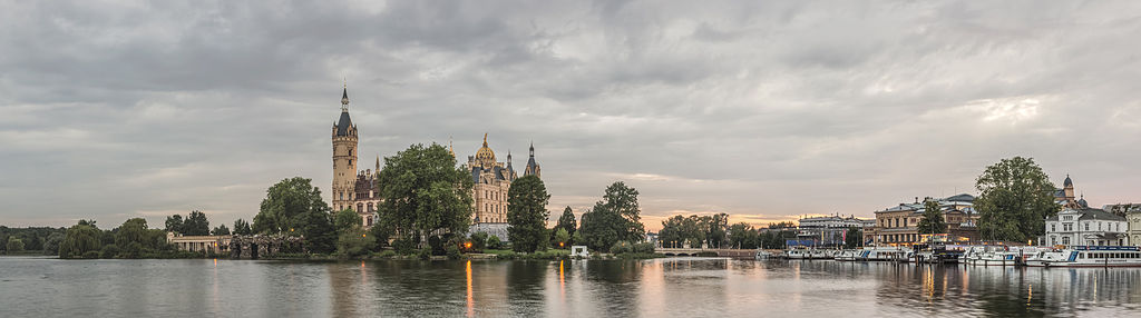
English: Schwerin Castle seen from the Schweriner See |
| Date | |
| Source | Own work |
| Author | Mathias Krumbholz |
| Other versions |
.jpg) |
.jpg)
.jpg&action=edit§ion=1)
.jpg&flash=no)
| Camera location | | View this and other nearby images on: OpenStreetMap |
|---|
.jpg¶ms=053.625677_N_0011.422448_E_globe:Earth_type:camera__&language=en)
Licensing
[edit].jpg&action=edit§ion=2)
I, the copyright holder of this work, hereby publish it under the following license:
This file is licensed under the Creative Commons Attribution-Share Alike 3.0 Unported license.
- You are free:
- to share – to copy, distribute and transmit the work
- to remix – to adapt the work
- Under the following conditions:
- attribution – You must give appropriate credit, provide a link to the license, and indicate if changes were made. You may do so in any reasonable manner, but not in any way that suggests the licensor endorses you or your use.
- share alike – If you remix, transform, or build upon the material, you must distribute your contributions under the same or compatible license as the original.
This image has been assessed using the Quality image guidelines and is considered a Quality image.
|
File history
Click on a date/time to view the file as it appeared at that time.
| Date/Time | Thumbnail | Dimensions | User | Comment | |
|---|---|---|---|---|---|
| current | 08:46, 11 August 2014 | 17,895 × 5,000 (28.89 MB) | Leviathan1983 (talk | contribs) | User created page with UploadWizard |
You cannot overwrite this file.
File usage on Commons
The following 7 pages use this file:
- User:Leviathan1983
- Commons:Featured picture candidates/File:Schweriner Schloss 01 (MK).jpg
- Commons:Featured picture candidates/Log/August 2014
- Commons:Quality images/Subject/Places/Mixed/Panorama/Archive 2008 to 2015
- Commons:Quality images candidates/Archives August 14 2014
- File:Schweriner Schloss 02 (MK).jpg
- File:Schweriner Schloss 03 (MK).jpg
.jpg)
.jpg&oldid=669960346)