File:Schinker 1989.png
Jump to navigation
Jump to search

Size of this preview: 780 × 600 pixels. Other resolutions: 312 × 240 pixels | 624 × 480 pixels | 784 × 603 pixels.
Original file (784 × 603 pixels, file size: 391 KB, MIME type: image/png)
Captions
Captions
Add a one-line explanation of what this file represents
Summary[edit]
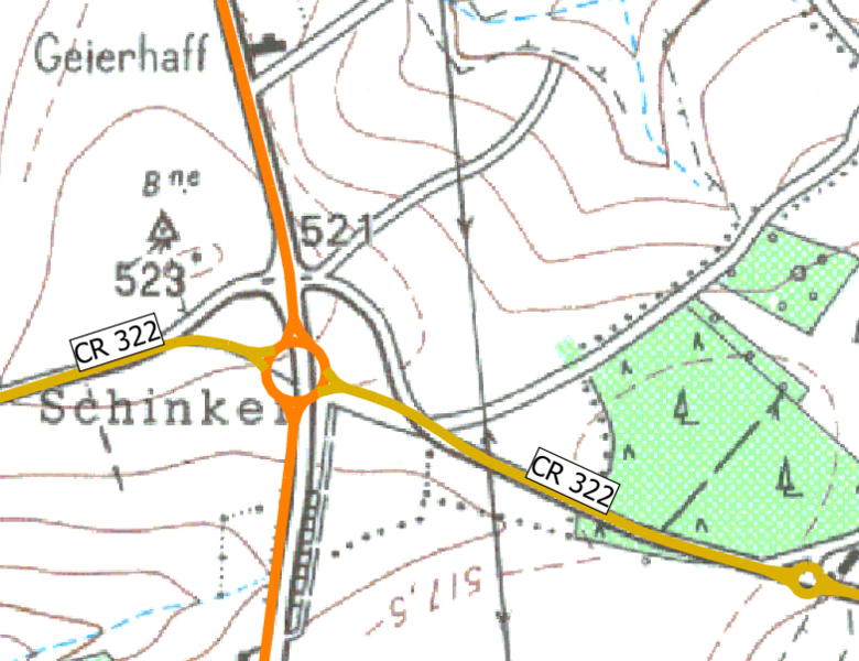
| Description |
Lëtzebuergesch: Haitege Verlaf vun der N7 op der 1:20 000 Topokaart vun 1989, nodeems déi ursprénglech Kräizung liicht entschäerft gouf. D'asphaltéiert Iwwerreschter stinn haut nach. |
| Date | |
| Source | http://g-o.lu/3/YdRP, osm.org |
| Author | Administration du cadastre et de la topographie, OpenStreetMap contributors |
Licensing[edit]
| This file is made available under the Creative Commons CC0 1.0 Universal Public Domain Dedication. | |
| The person who associated a work with this deed has dedicated the work to the public domain by waiving all of their rights to the work worldwide under copyright law, including all related and neighboring rights, to the extent allowed by law. You can copy, modify, distribute and perform the work, even for commercial purposes, all without asking permission.
|
File history
Click on a date/time to view the file as it appeared at that time.
| Date/Time | Thumbnail | Dimensions | User | Comment | |
|---|---|---|---|---|---|
| current | 19:43, 14 December 2021 | | 784 × 603 (391 KB) | R2lx (talk | contribs) | Uploaded a work by Administration du cadastre et de la topographie, OpenStreetMap contributors from http://g-o.lu/3/YdRP, osm.org with UploadWizard |
You cannot overwrite this file.
File usage on Commons
The following 3 pages use this file:
File usage on other wikis
The following other wikis use this file:
- Usage on lb.wikipedia.org