File:San Rafael Reef, UT 7-23-13zze (10519136603).jpg
Jump to navigation
Jump to search

Size of this preview: 800 × 496 pixels. Other resolutions: 320 × 198 pixels | 640 × 397 pixels | 1,024 × 635 pixels | 1,280 × 794 pixels | 1,850 × 1,147 pixels.
Original file (1,850 × 1,147 pixels, file size: 539 KB, MIME type: image/jpeg)
Captions
Captions
Add a one-line explanation of what this file represents
Summary[edit]
.jpg&action=edit§ion=1)
| Description |
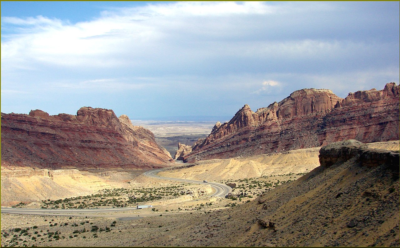
English: (1 in a multiple picture set) At this point, some miles west of Green River, UT (in the middle of a 120-mile stretch of interstate highway with no services), the badlands are giving way to an area called the San Rafael Swell. It is as the name implies. The land, when it was being formed, pushed up (or swelled) leaving sharp, slanted formations. If you stop at one of several pull-outs you will find sign boards explaining the formations and you will be able to visualize such violent beginnings. This reef area is one of the most spectacular sights in America. |
| Date | Taken on 23 July 2013, 16:07:02 |
| Source | https://www.flickr.com/photos/23155134@N06/10519136603/ |
| Author | inkknife_2000 (7.5 million views +) |
| Permission (Reusing this file) |
At the time of upload, the image license was automatically confirmed using the Flickr API. For more information see Flickr API detail. |
| Flickr sets |
|
| Flickr pools |
|
| Flickr tags |
|
| Camera location | | View this and other nearby images on: OpenStreetMap |
|---|
.jpg¶ms=038.928434_N_-110.456542_E_globe:Earth_type:camera__&language=en)
Licensing[edit]
.jpg&action=edit§ion=2)
This file is licensed under the Creative Commons Attribution-Share Alike 2.0 Generic license.
- You are free:
- to share – to copy, distribute and transmit the work
- to remix – to adapt the work
- Under the following conditions:
- attribution – You must give appropriate credit, provide a link to the license, and indicate if changes were made. You may do so in any reasonable manner, but not in any way that suggests the licensor endorses you or your use.
- share alike – If you remix, transform, or build upon the material, you must distribute your contributions under the same or compatible license as the original.
| This image was originally posted to Flickr by inkknife_2000 (7.5 million views +) at https://flickr.com/photos/23155134@N06/10519136603. It was reviewed on 31 March 2017 by FlickreviewR and was confirmed to be licensed under the terms of the cc-by-sa-2.0. |
File history
Click on a date/time to view the file as it appeared at that time.
| Date/Time | Thumbnail | Dimensions | User | Comment | |
|---|---|---|---|---|---|
| current | 16:55, 31 March 2017 | | 1,850 × 1,147 (539 KB) | Fæ (talk | contribs) | Don Graham, Set 72157637015643546, ID 10519136603, Original title San Rafael Reef, UT 7-23-13zze |
You cannot overwrite this file.
File usage on Commons
There are no pages that use this file.
.jpg&oldid=813128792)