File:Sal, Cabo Verde, Sentinel-2.jpg
Jump to navigation
Jump to search
Size of this preview: 346 × 599 pixels. Other resolutions: 139 × 240 pixels | 504 × 872 pixels.
Original file (504 × 872 pixels, file size: 262 KB, MIME type: image/jpeg)
Captions
Captions
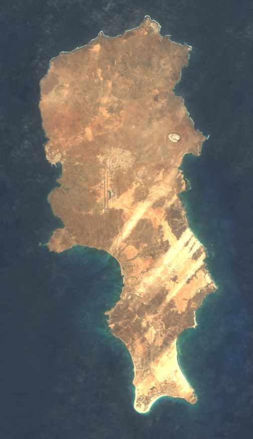
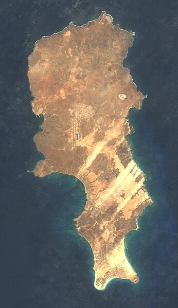
Satellite picture of Sal, Cape Verde
Summary[edit]
| Description |
English: Satellite picture of Sal, Cape Verde, from Sentinel-2; cropped by User:Zollwurf |
| Date | between 2016 and 2017 |
| Source | Sentinel-2 cloudless - https://maps.eox.at/# by EOX IT Services GmbH (Contains modified Copernicus Sentinel data 2016 & 2017) |
| Author | Sentinel-2 cloudless 2016 by EOX IT Services GmbH is licensed under a Creative Commons Attribution 4.0 International License. |
| Camera location | | View this and other nearby images on: OpenStreetMap |
|---|
Licensing[edit]
This file is licensed under the Creative Commons Attribution-Share Alike 4.0 International license.
- You are free:
- to share – to copy, distribute and transmit the work
- to remix – to adapt the work
- Under the following conditions:
- attribution – You must give appropriate credit, provide a link to the license, and indicate if changes were made. You may do so in any reasonable manner, but not in any way that suggests the licensor endorses you or your use.
- share alike – If you remix, transform, or build upon the material, you must distribute your contributions under the same or compatible license as the original.
File history
Click on a date/time to view the file as it appeared at that time.
| Date/Time | Thumbnail | Dimensions | User | Comment | |
|---|---|---|---|---|---|
| current | 20:56, 6 June 2020 | | 504 × 872 (262 KB) | Sänger (talk | contribs) | Lizenzkompatible Version 2016 |
You cannot overwrite this file.
File usage on Commons
The following page uses this file:
File usage on other wikis
The following other wikis use this file:
- Usage on de.wikipedia.org