File:Ruta 23-CH km 191.jpg
Jump to navigation
Jump to search

Size of this preview: 800 × 600 pixels. Other resolutions: 320 × 240 pixels | 640 × 480 pixels | 1,024 × 768 pixels | 1,280 × 960 pixels | 2,560 × 1,920 pixels | 5,184 × 3,888 pixels.
Original file (5,184 × 3,888 pixels, file size: 4.55 MB, MIME type: image/jpeg)
Captions
Captions
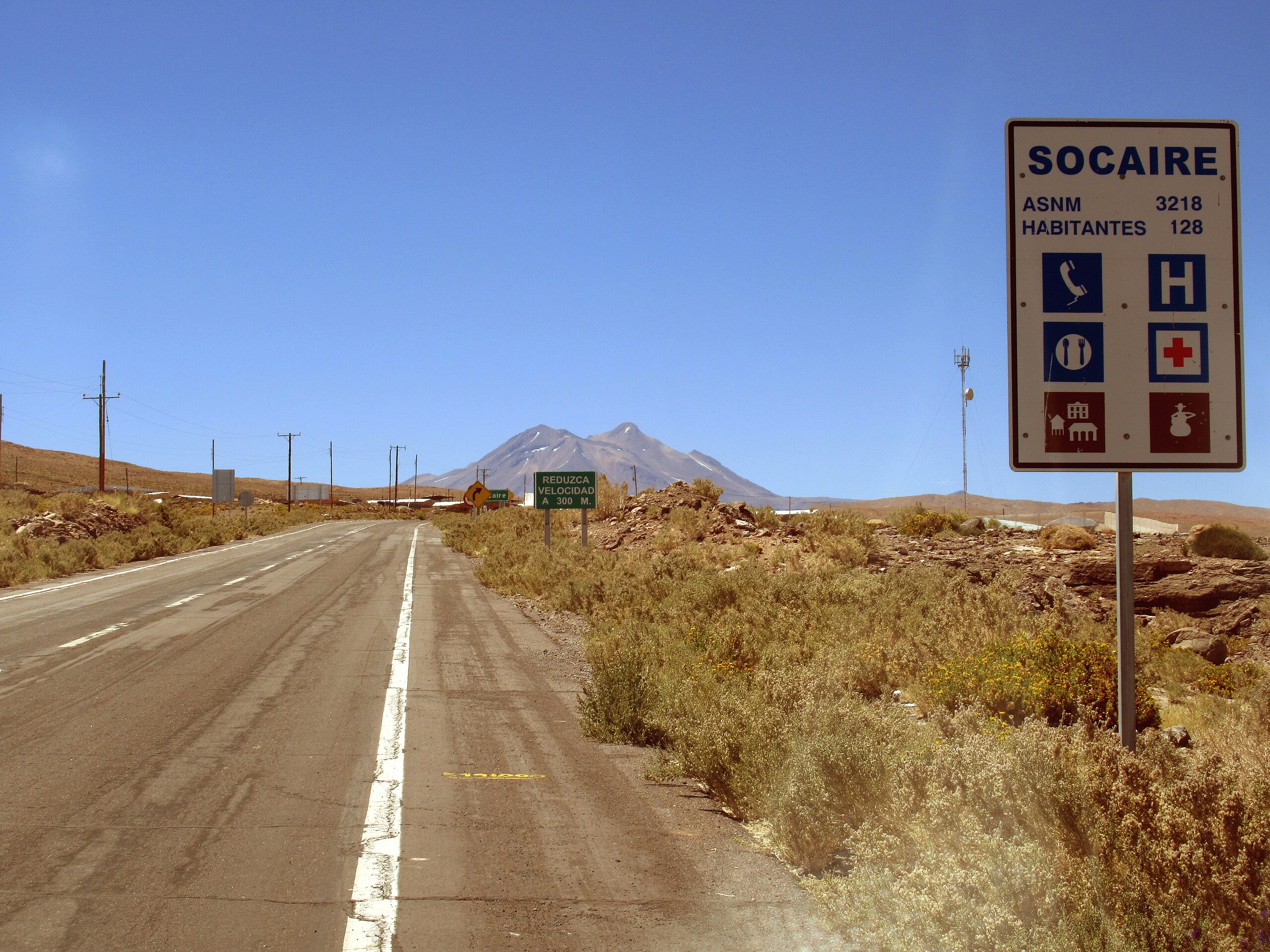
Km 191 Ruta 23-CH, 3240 m a.s.l.: Arriving at Socaire, in the background the Miñiques volcano at about 30 km distance.
Summary[edit]
| Description |
Deutsch: Km 191 Ruta 23-CH, 3240 m ü.M.: Am Ortseingang von Socaire, im Hintergrund der Vulkan Miñiques in rund 30 km Entfernung.
Español: Km 191 Ruta 23-CH, 3240 m s.n.m.: Llegando a Socaire, el volcán Miñiques en el horizonte a una distancia de 30 km.
English: Km 191 Ruta 23-CH, 3240 m a.s.l.: Arriving at Socaire, in the background the Miñiques volcano at about 30 km distance. |
| Date | |
| Source | Own work |
| Author | WeHaKa |
| Permission (Reusing this file) |
This file is licensed under the Creative Commons Attribution-Share Alike 3.0 Unported license. Attribution: WeHaKa
|
| Camera location | | View this and other nearby images on: OpenStreetMap |
|---|
| Object location | | View this and other nearby images on: OpenStreetMap |
|---|
File history
Click on a date/time to view the file as it appeared at that time.
| Date/Time | Thumbnail | Dimensions | User | Comment | |
|---|---|---|---|---|---|
| current | 20:36, 17 March 2018 | | 5,184 × 3,888 (4.55 MB) | WeHaKa (talk | contribs) | {{Information |description = {{de|Km 191 Ruta 23-CH, 3240 m ü.M.: Am Ortseingang von Socaire, im Hintergrund der Vulkan Miñiques in rund 30 km Entfernung.}} {{es|Km 191 Ruta 23-CH, 3240 m s.n.m.: Llegando a Socaire, el volcán Miñiques en el horizonte a una distancia de 30 km.}} {{en|Km 191 Ruta 23-CH, 3240 m a.s.l.: Arriving at Socaire, in the background the Miñiques volcano at about 30 km distance.}} |date = 2017-12-08 11:42 |source = {{own}} |author = WeHaKa |permission = {{cc-by-sa-3.0|WeHaKa}} |other versions = }} {{location|22|35|1.1|S|67|53|35.3|W|prec=15|region:CL-AN_heading:SE}} {{object location|23|49|0|S|67|45|30|W|region:CL-AN}} Category:Ruta 23-CH Category:Socaire Category:Miñiques |
You cannot overwrite this file.
File usage on Commons
The following page uses this file:
File usage on other wikis
The following other wikis use this file:
- Usage on de.wikipedia.org