File:Romania Valcea Location map.jpg
Jump to navigation
Jump to search

Size of this preview: 425 × 599 pixels. Other resolutions: 170 × 240 pixels | 341 × 480 pixels | 739 × 1,041 pixels.
Original file (739 × 1,041 pixels, file size: 99 KB, MIME type: image/jpeg)
Captions
Captions
Add a one-line explanation of what this file represents

|
This map image could be re-created using vector graphics as an SVG file. This has several advantages; see Commons:Media for cleanup for more information. If an SVG form of this image is available, please upload it and afterwards replace this template with
{{vector version available|new image name}}.
It is recommended to name the SVG file “Romania Valcea Location map.svg”—then the template Vector version available (or Vva) does not need the new image name parameter. |


Summary[edit]
| Description |
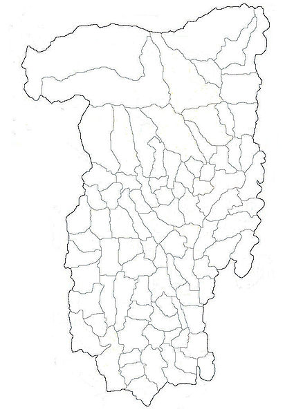
English: Map of Vâlcea County with limits of communes
Română: Harta judeţului Vâlcea cu limitele comunelor |
| Date | |
| Source | Own work |
| Author | Afil |
Licensing[edit]
This file is licensed under the Creative Commons Attribution-Share Alike 3.0 Unported license.
- You are free:
- to share – to copy, distribute and transmit the work
- to remix – to adapt the work
- Under the following conditions:
- attribution – You must give appropriate credit, provide a link to the license, and indicate if changes were made. You may do so in any reasonable manner, but not in any way that suggests the licensor endorses you or your use.
- share alike – If you remix, transform, or build upon the material, you must distribute your contributions under the same or compatible license as the original.
File history
Click on a date/time to view the file as it appeared at that time.
| Date/Time | Thumbnail | Dimensions | User | Comment | |
|---|---|---|---|---|---|
| current | 23:29, 8 November 2011 | | 739 × 1,041 (99 KB) | Afil (talk | contribs) | |
| 03:20, 8 November 2011 |  | 739 × 1,041 (104 KB) | Afil (talk | contribs) | {{Information |Description ={{en|1=Map of Vâlcea County with limits of communes}} {{ro|1=Harta judeţului Vâlcea cu limitele comunelor}} |Source ={{own}} |Author =Afil |Date =7 nov. 2011 |Permission =GFDL | |
You cannot overwrite this file.
File usage on Commons
The following 3 pages use this file:
File usage on other wikis
The following other wikis use this file:
- Usage on ar.wikipedia.org
- Usage on ceb.wikipedia.org
- Usage on en.wikipedia.org
- Usage on fa.wikipedia.org
- Usage on fr.wikipedia.org
- Usage on kn.wikipedia.org
- Usage on pl.wikipedia.org
- Horezu
- Râmnicu Vâlcea
- Drăgășani
- Băile Govora
- Băile Olănești
- Călimănești
- Tomșani
- Monastyr Cozia
- Brezoi
- Ocnele Mari
- Băbeni
- Bălcești
- Berbești
- Sobór św. Mikołaja w Râmnicu Vâlcea
- Moduł:Mapa/dane/Vâlcea
- Moduł:Mapa/dane/RO-VL
- Râmnicu Vâlcea (stacja kolejowa)
- Monaster Turnu
- Monaster Arnota
- Monaster Dintr-un Lemn
- Monaster Govora
- Alunu
- Bodești (okręg Vâlcea)
- Coltești
- Igoiu
- Ilaciu
- Ocracu
- Roșia (okręg Vâlcea)
- Amărăști
- Mereșești
- Nemoiu
- Padina (okręg Vâlcea)
- Palanga (okręg Vâlcea)
- Teiul
- Bărbătești (okręg Vâlcea)
- Bârzești (okręg Vâlcea)
- Bodești (gmina Bărbătești)
- Negrulești
- Berislăvești
- Brădișor
- Dângești
View more global usage of this file.