File:Rentwertshausen-Römhild-railway-line.png
Jump to navigation
Jump to search

Size of this preview: 800 × 559 pixels. Other resolutions: 320 × 223 pixels | 640 × 447 pixels | 1,024 × 715 pixels | 1,170 × 817 pixels.
Original file (1,170 × 817 pixels, file size: 351 KB, MIME type: image/png)
Captions
Captions
Add a one-line explanation of what this file represents
Summary[edit]
| Description |
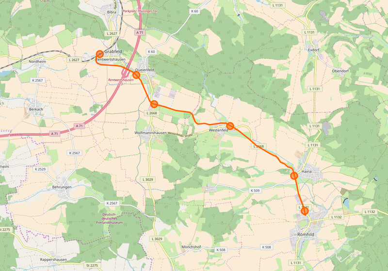
Deutsch: Verlauf der Anfang der 1970-er Jahre abgebauten Bahnstrecke Rentwertshausen–Römhild auf einer Grundkarte mit Stand 2017. Die nach Karte zu vermutende Unterquerung der Autobahn 71 hat es in Wirklichkeit nie gegeben.
English: Map of Rentwertshausen–Römhild railway line, which was dismanteled in the early 1970s. The map itself dates from 2017, so the crossing of this railway line with today's motorway A71, which could be assumed from the map, never existed. |
| Date | |
| Source | OpenStreetMap |
| Author |
Deutsch: OpenStreetMap-Mitwirkende English: Contributors to OpenStreetMap |
Licensing[edit]
| Description |
This map was created from OpenStreetMap project data, collected by the community. This map may be incomplete, and may contain errors. Don't rely solely on it for navigation. |
|||
| Date | ||||
| Source | openstreetmap.org | |||
| Creator |
OpenStreetMap contributors |
|||
| Permission (Reusing this file) |
OpenStreetMap data is available under the Open Database License (details). Map tiles are licensed under the Creative Commons Attribution-ShareAlike 2.0 license (CC-BY-SA 2.0).
This file is licensed under the Creative Commons Attribution-Share Alike 2.0 Generic license.
|
|||
| Georeferencing | If inappropriate please set warp_status = skip to hide. |
File history
Click on a date/time to view the file as it appeared at that time.
| Date/Time | Thumbnail | Dimensions | User | Comment | |
|---|---|---|---|---|---|
| current | 12:32, 16 December 2017 | | 1,170 × 817 (351 KB) | Kleeblatt187 (talk | contribs) | User created page with UploadWizard |
You cannot overwrite this file.
File usage on Commons
The following 5 pages use this file:
- User:Aschroet/Uploads/Thuringia/2017 December 11-20
- User:Chumwa/OgreBot/Potential transport maps/2017 December 11-20
- User:Chumwa/OgreBot/Public transport information/2017 December 11-20
- User:Chumwa/OgreBot/Transport Maps/2017 December 11-20
- User:Chumwa/OgreBot/Travel and communication maps/2017 December 11-20
File usage on other wikis
The following other wikis use this file:
- Usage on de.wikipedia.org
- Usage on en.wikipedia.org
- Usage on www.wikidata.org