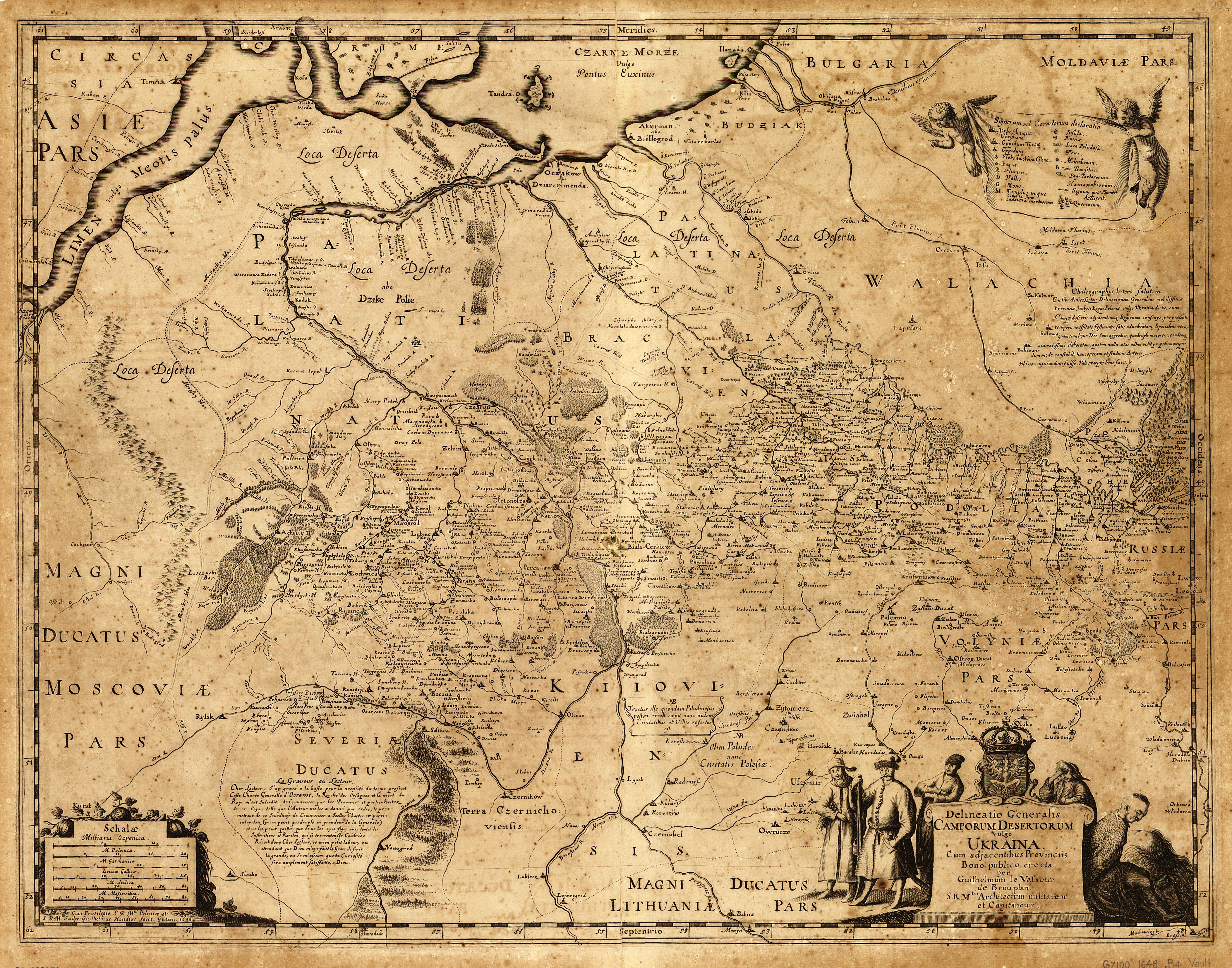
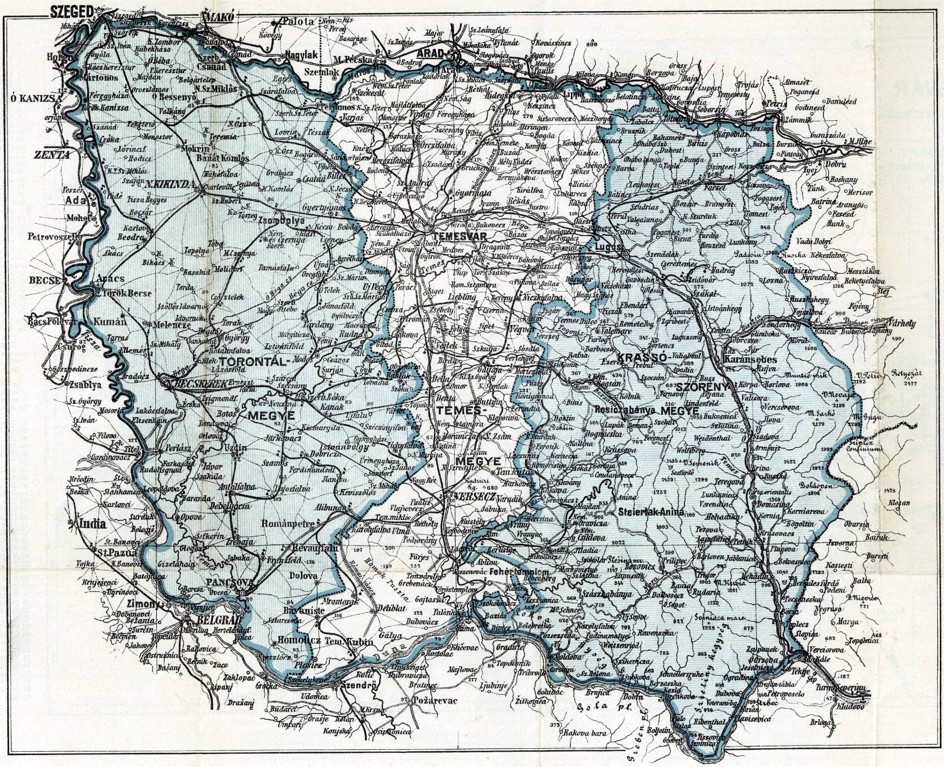
File:Regiuni Româneşti.png

Original file (979 × 883 pixels, file size: 398 KB, MIME type: image/png)
Captions
Captions
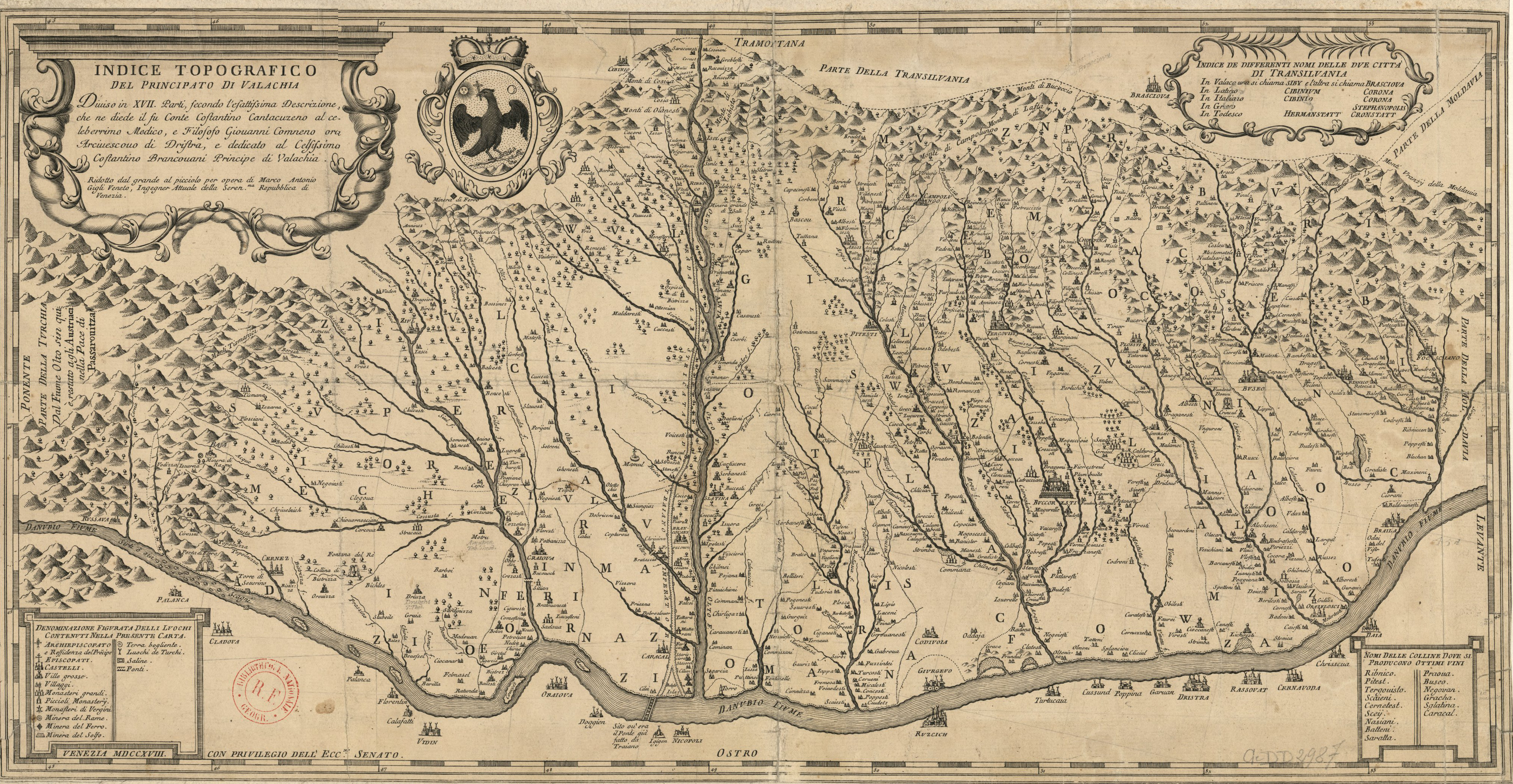
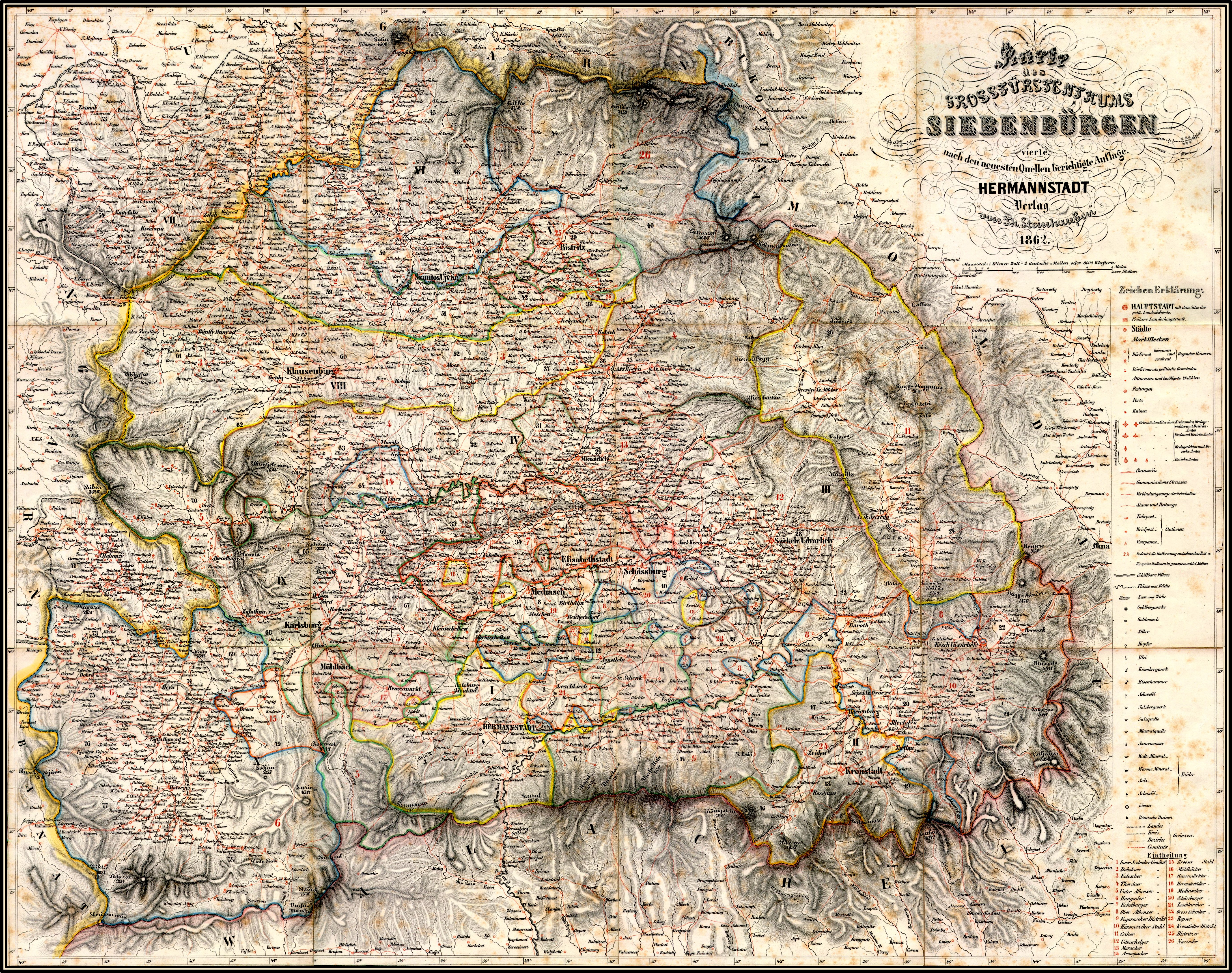
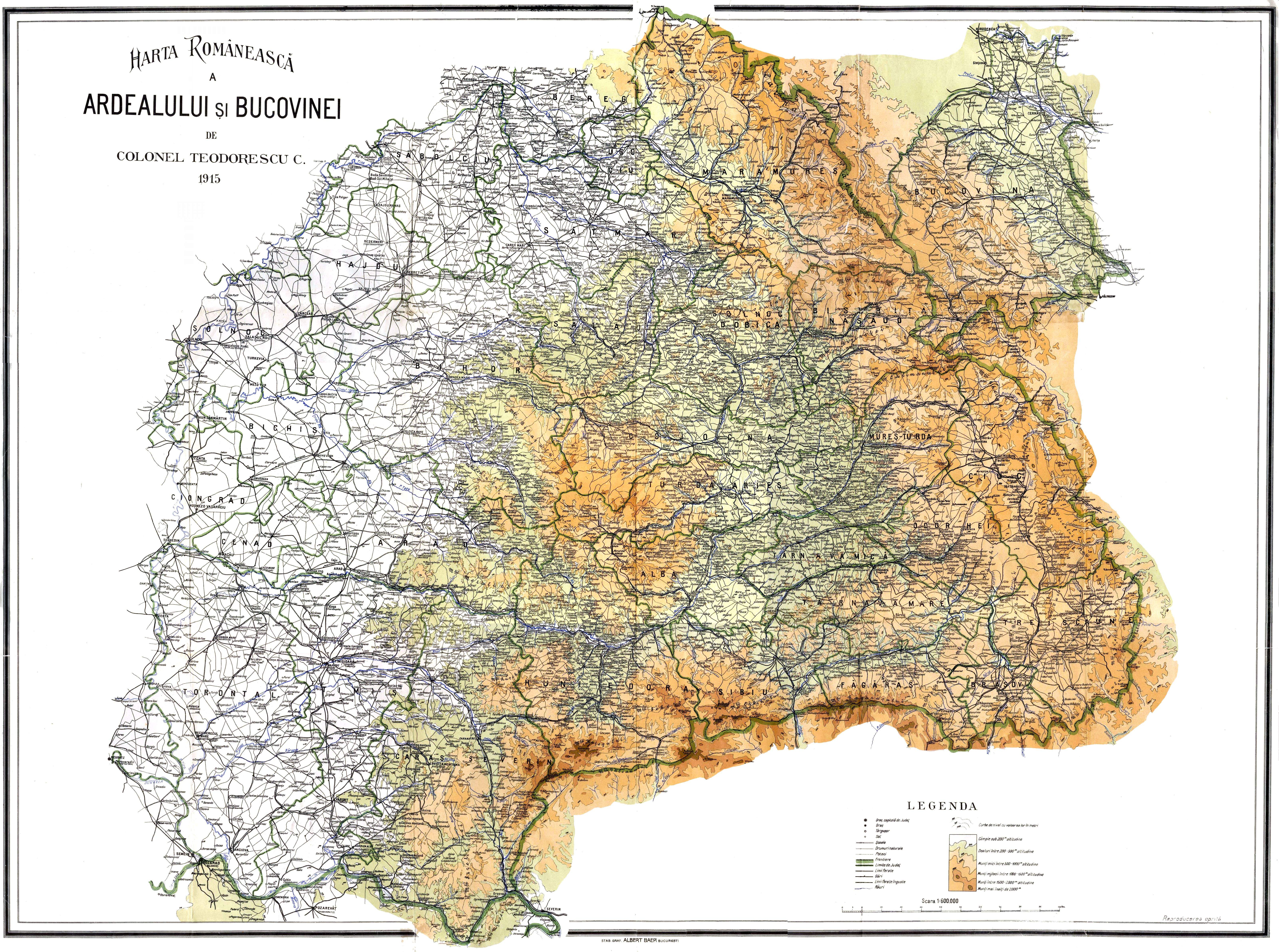
Summary[edit]
| Description |
English: Romanian Regions
My map is not focusing on political provinces of Romanians in 1918 or of other states where Romanians lived. I created a map who follows ethnographic and geographical regions as Romanians view them, or as they politically created them when the international situation allow them to do so. Many of these regions where lived, or still lived by Romanians and the map do not claim that those regions belong only to a nation. I tried to exclude borders or provinces who wore a consequence of foreign rule as Bukovina, or regions who wore purely political ones, with no link to the Romanian population as Partium(many confusing Partium with Crişana). I will put ethnic data for the regions who includes parts of other states, just in case, to avoid debate(Take out „_” from the tiny url). •Moldova: |
| Date | |
| Source | Own work |
| Author | Vasile iuga |
Licensing[edit]
- You are free:
- to share – to copy, distribute and transmit the work
- to remix – to adapt the work
- Under the following conditions:
- attribution – You must give appropriate credit, provide a link to the license, and indicate if changes were made. You may do so in any reasonable manner, but not in any way that suggests the licensor endorses you or your use.
- share alike – If you remix, transform, or build upon the material, you must distribute your contributions under the same or compatible license as the original.
- ↑ Ioan Mihalyi de Apșa, Máramaros Vármegye Története, I Kötet - MÁRAMAROSI DIPLOMAK- A. XIV. ES XV SZÁLBÓL, Mayer és Berger Könyvnyomdája, Máramoros-Sziget, 1900, p.3
File history
Click on a date/time to view the file as it appeared at that time.
| Date/Time | Thumbnail | Dimensions | User | Comment | |
|---|---|---|---|---|---|
| current | 15:00, 27 October 2015 | | 979 × 883 (398 KB) | Viuser (talk | contribs) | . |
| 11:47, 27 October 2015 |  | 979 × 883 (398 KB) | Viuser (talk | contribs) | Mistakes corrected in town names, rivers flow, international borders, heraldic finishing. Final version | |
| 15:44, 18 May 2015 |  | 979 × 860 (375 KB) | Viuser (talk | contribs) | Update Greater Wallachia coa | |
| 01:51, 18 May 2015 |  | 979 × 860 (375 KB) | Viuser (talk | contribs) | Adăugare O.L. Câmpulung. Standardizare stemă Muntenia. | |
| 15:35, 16 May 2015 |  | 979 × 860 (374 KB) | Viuser (talk | contribs) | Ştergere râuri la nord de Savranca. | |
| 15:18, 16 May 2015 |  | 979 × 860 (374 KB) | Viuser (talk | contribs) | Corectare şi îmbunătăţire steme. Versiune finală. | |
| 21:38, 15 May 2015 |  | 979 × 860 (369 KB) | Viuser (talk | contribs) | Versiune finală | |
| 13:31, 15 May 2015 |  | 979 × 860 (329 KB) | Viuser (talk | contribs) | Corectare | |
| 10:23, 15 May 2015 |  | 979 × 860 (328 KB) | Viuser (talk | contribs) | Reverted to version as of 14:58, 6 December 2014 | |
| 10:20, 15 May 2015 |  | 979 × 860 (328 KB) | Viuser (talk | contribs) | Reverted to version as of 14:58, 6 December 2014 |
You cannot overwrite this file.
File usage on Commons
There are no pages that use this file.
File usage on other wikis
The following other wikis use this file:
- Usage on vi.wikipedia.org