File:Railway Clearing House Map of Scotland 1923.jpg
Jump to navigation
Jump to search

Size of this preview: 387 × 599 pixels. Other resolutions: 155 × 240 pixels | 310 × 480 pixels | 496 × 768 pixels | 661 × 1,024 pixels | 1,322 × 2,048 pixels | 9,033 × 13,992 pixels.
Original file (9,033 × 13,992 pixels, file size: 22.22 MB, MIME type: image/jpeg)
Captions
Captions
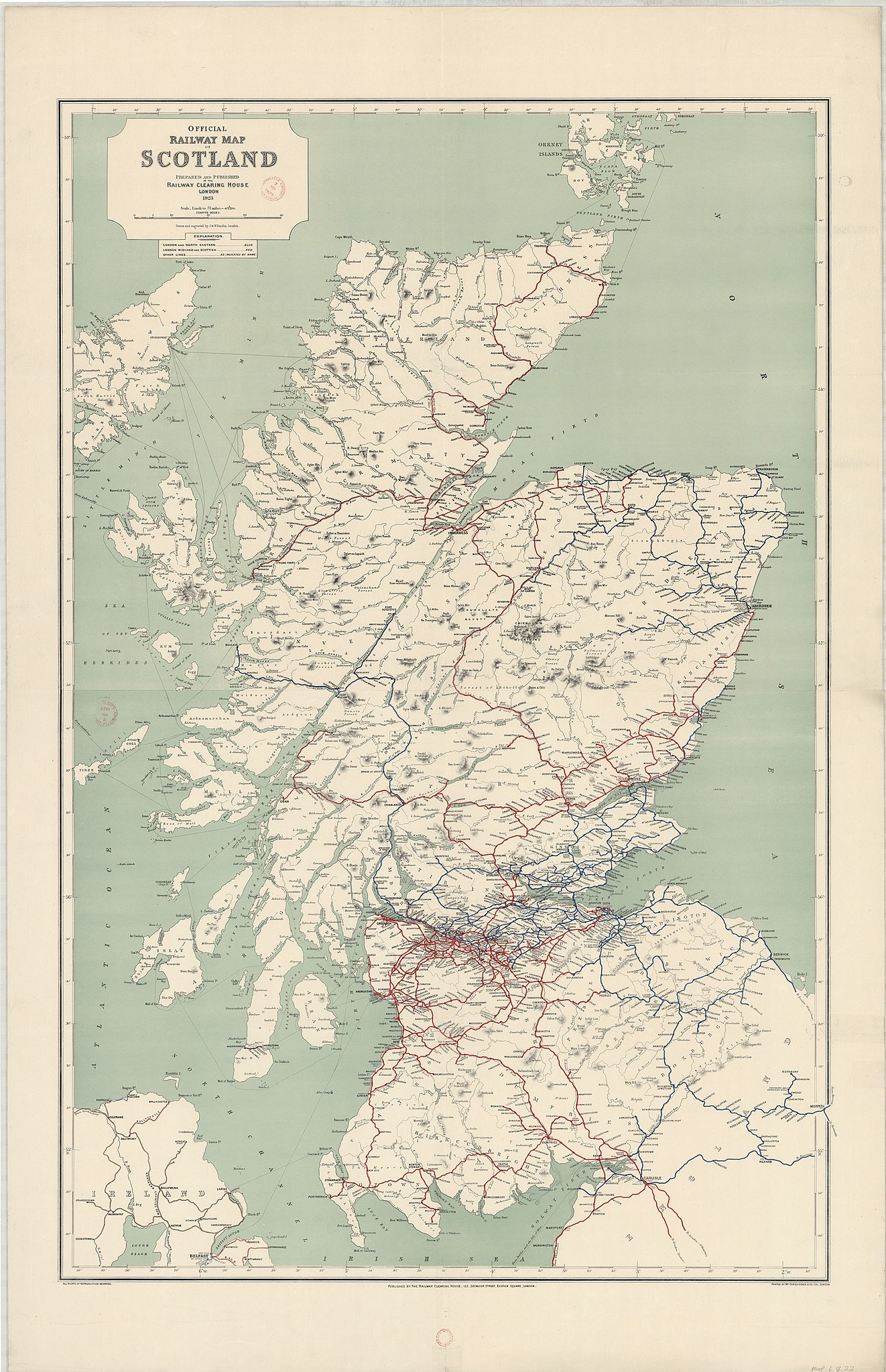
Railway Clearing House Map of Scotland 1923
Summary[edit]
| Description |
English: Railway Clearing House Map of Scotland 1923 |
|||||||||
| Date | ||||||||||
| Source |
https://maps.nls.uk/view/142841595 https://maps.nls.uk/view/144481858 |
|||||||||
| Creator |
Railway Clearing House |
|||||||||
| Geotemporal data | ||||||||||
| Bounding box |
|
|||||||||
| Georeferencing | ||||||||||
| Other versions | scale=475200 | |||||||||
Licensing[edit]
This file is licensed under the Creative Commons Attribution 4.0 International license.
Attribution: National Library of Scotland
- You are free:
- to share – to copy, distribute and transmit the work
- to remix – to adapt the work
- Under the following conditions:
- attribution – You must give appropriate credit, provide a link to the license, and indicate if changes were made. You may do so in any reasonable manner, but not in any way that suggests the licensor endorses you or your use.
File history
Click on a date/time to view the file as it appeared at that time.
| Date/Time | Thumbnail | Dimensions | User | Comment | |
|---|---|---|---|---|---|
| current | 22:23, 23 October 2022 | | 9,033 × 13,992 (22.22 MB) | Kognos (talk | contribs) | Uploaded a work by Railway Clearing House from https://maps.nls.uk/view/142841595 https://maps.nls.uk/view/144481858 with UploadWizard |
You cannot overwrite this file.
File usage on Commons
The following 3 pages use this file: