File:RéalisationsUrbaines2ndEmpire.jpg
Jump to navigation
Jump to search
Size of this preview: 800 × 460 pixels. Other resolutions: 320 × 184 pixels | 640 × 368 pixels | 1,024 × 589 pixels | 1,280 × 736 pixels | 2,560 × 1,473 pixels | 4,500 × 2,589 pixels.
Original file (4,500 × 2,589 pixels, file size: 2.55 MB, MIME type: image/jpeg)
Captions
Captions
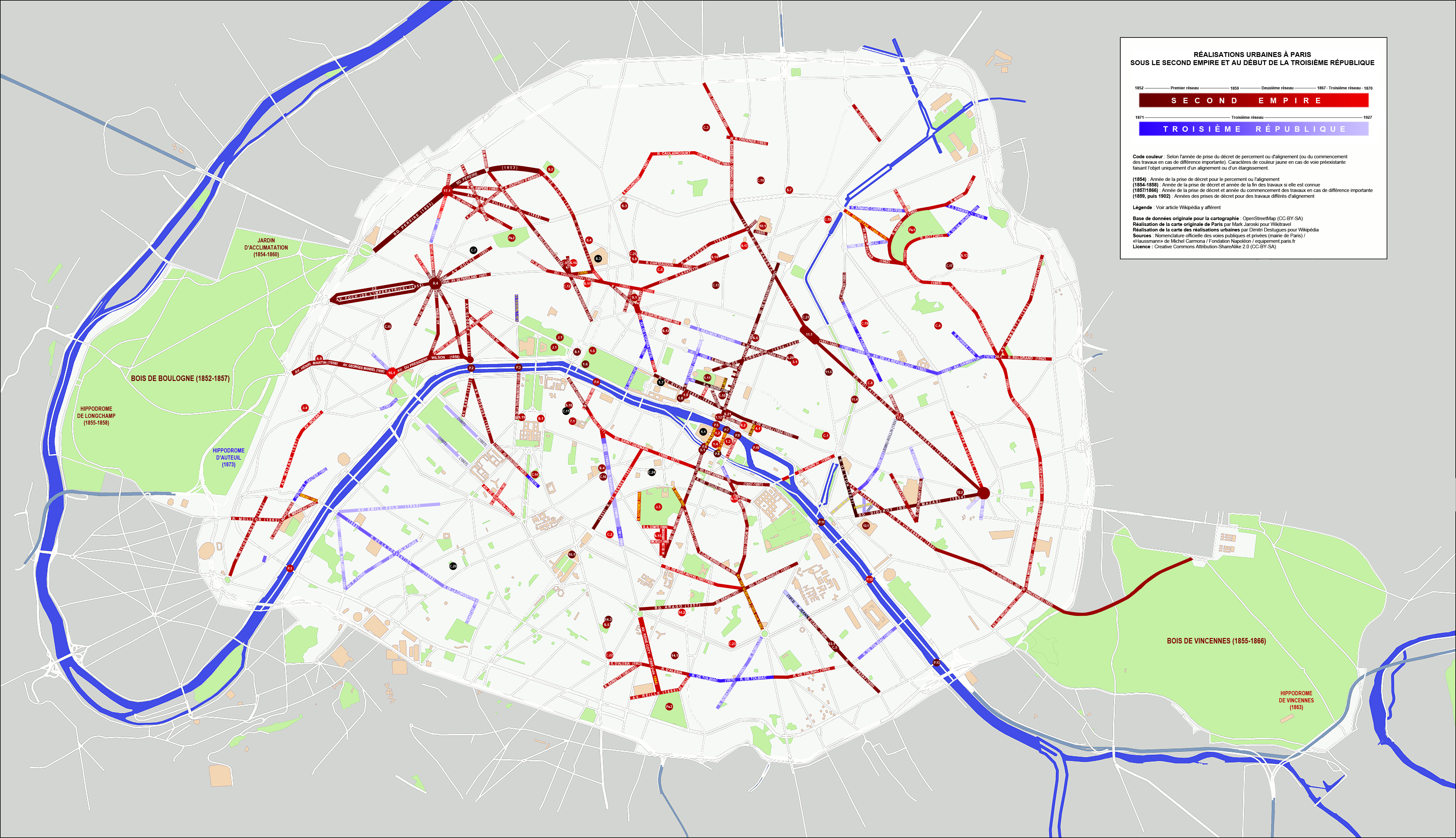
Map of urban realisations in Paris under the Second Empire. On a an original map created by Mark Jaroski for Wikitravel
Summary[edit]
| Description |
Français : Carte des réalisations urbaines à Paris sous le Second Empire. Sur une carte originale réalisée par Mark Jaroski pour Wikitravel. |
| Date | |
| Source | Own work |
| Author | Dimitri Destugues |
Licensing[edit]
I, the copyright holder of this work, hereby publish it under the following license:
This file is licensed under the Creative Commons Attribution-Share Alike 3.0 Unported license.
- You are free:
- to share – to copy, distribute and transmit the work
- to remix – to adapt the work
- Under the following conditions:
- attribution – You must give appropriate credit, provide a link to the license, and indicate if changes were made. You may do so in any reasonable manner, but not in any way that suggests the licensor endorses you or your use.
- share alike – If you remix, transform, or build upon the material, you must distribute your contributions under the same or compatible license as the original.
File history
Click on a date/time to view the file as it appeared at that time.
| Date/Time | Thumbnail | Dimensions | User | Comment | |
|---|---|---|---|---|---|
| current | 01:18, 6 July 2011 | | 4,500 × 2,589 (2.55 MB) | Dimitri Destugues (talk | contribs) |
You cannot overwrite this file.
File usage on Commons
The following page uses this file:
File usage on other wikis
The following other wikis use this file:
- Usage on ca.wikipedia.org
- Usage on el.wikipedia.org
- Usage on en.wikipedia.org
- Usage on es.wikipedia.org
- Usage on eu.wikipedia.org
- Usage on fi.wikipedia.org
- Usage on fr.wikipedia.org
- Usage on ja.wikipedia.org
- Usage on lij.wikipedia.org
- Usage on uk.wikipedia.org
- Usage on zh.wikipedia.org