File:Quartzite (roadcut west of Vandola, Virginia, USA) 2 (51724960071).jpg
Original file (4,288 × 2,848 pixels, file size: 7.54 MB, MIME type: image/jpeg)
Captions
Captions
Summary[edit]
_2_(51724960071).jpg&action=edit§ion=1)
| Description |
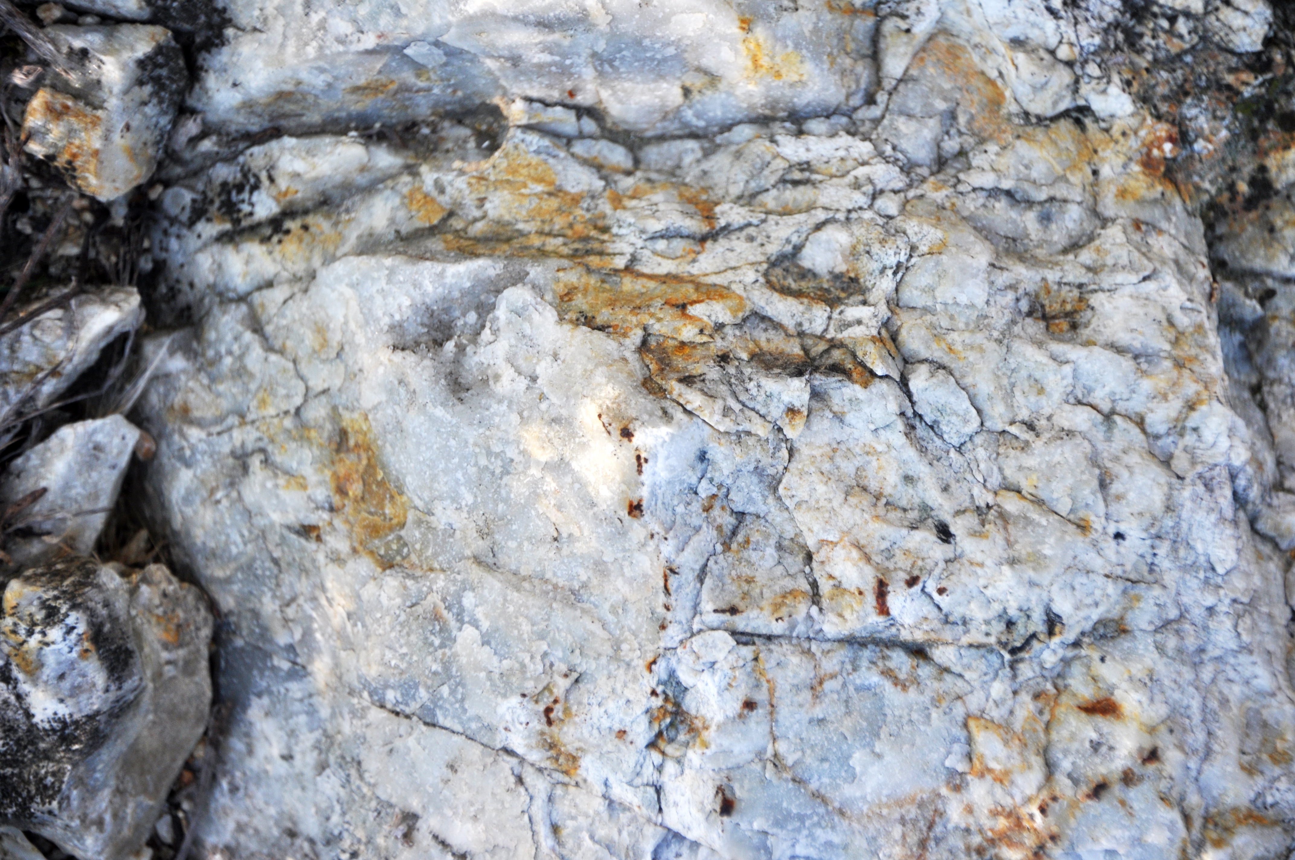
Quartzite is a common, crystalline-textured, intermediate- to high-grade metamorphic rock. It forms by metamorphism of quartzose sandstones or siltstones. Quartzite can be entirely composed of interlocking quartz crystals, or the original sand grains may still be visible. This rock is hard (H = 7), will not bubble in acid (unlike marble), and can be almost any color. The term “quartzite” has been used in geology to refer to crystalline, quartzose metamorphic rocks and to hard, well-cemented quartzose sandstones that have not been subjected to metamorphism. It is difficult to not call hard, well-cemented sandstones “quartzite” - for example, the Clinch Quartzite in the Appalachian Mountains and the Eureka Quartzite of the Great Basin in western USA, but the Clinch and Eureka aren’t metamorphic rocks. The term "metaquartzite" has been used by some geologists to refer to crystalline-textured, quartzose rocks that have been metamorphosed. This implies that “quartzite” be restricted to well-cemented, non-metamorphosed sandstones. I don’t often see the term metaquartzite in the geologic literature. The whitish quartzites seen here (interpreted as part of a metavolcanic unit) are Piedmont metamorphic basement rocks in Virginia. They are exposed in the footwall almost adjacent to a half-graben's eastern boundary fault, a normal fault (= obscured by vegetation at this locality). The hanging wall (a little north of this spot) consists of siliciclastic sedimentary rocks representing Triassic rift basin fill. The half-graben is the Danville Basin (Dan River Basin). Locality: Oak Ridge Farms Road Exit Ramp Outcrop - roadcut along both sides of north-bound exit ramp off Route 58, just west of the town of Vandola & west of Danville, southern Pittsylvania County, southern Virginia, USA (36° 34’ 30.09” North latitude, 79° 31’ 20.13” West longitude) |
| Date | |
| Source | Quartzite (roadcut west of Vandola, Virginia, USA) 2 |
| Author | James St. John |
Licensing[edit]
_2_(51724960071).jpg&action=edit§ion=2)
- You are free:
- to share – to copy, distribute and transmit the work
- to remix – to adapt the work
- Under the following conditions:
- attribution – You must give appropriate credit, provide a link to the license, and indicate if changes were made. You may do so in any reasonable manner, but not in any way that suggests the licensor endorses you or your use.
| This image was originally posted to Flickr by James St. John at https://flickr.com/photos/47445767@N05/51724960071. It was reviewed on 19 January 2022 by FlickreviewR 2 and was confirmed to be licensed under the terms of the cc-by-2.0. |
File history
Click on a date/time to view the file as it appeared at that time.
| Date/Time | Thumbnail | Dimensions | User | Comment | |
|---|---|---|---|---|---|
| current | 22:00, 19 January 2022 | | 4,288 × 2,848 (7.54 MB) | SeichanGant (talk | contribs) | Transferred from Flickr via #flickr2commons |
You cannot overwrite this file.
File usage on Commons
There are no pages that use this file.
_2_(51724960071).jpg&oldid=879037494)