File:Pennoyer v Neff Map.png
Jump to navigation
Jump to search

Size of this preview: 800 × 428 pixels. Other resolutions: 320 × 171 pixels | 640 × 342 pixels | 1,024 × 547 pixels | 1,280 × 684 pixels | 2,136 × 1,142 pixels.
Original file (2,136 × 1,142 pixels, file size: 2.21 MB, MIME type: image/png)
Captions
Captions
Add a one-line explanation of what this file represents
Summary[edit]
| Description |
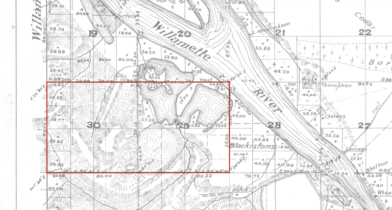
English: Map of what will become part of Portland showing the property in question from the 1874 US Supreme Court case Pennoyer v. Neff |
| Date | |
| Source | Bureau of Land Management 1852 Cadastral Survey of Oregon https://www.blm.gov/or/landrecords/survey/ySrvy2.php?tr=01300S00200W |
| Author | United States Bureau of Land Management |
Licensing[edit]
This work is in the public domain in the United States because it was published (or registered with the U.S. Copyright Office) before January 1, 1929.
Public domain works must be out of copyright in both the United States and in the source country of the work in order to be hosted on the Commons. If the work is not a U.S. work, the file must have an additional copyright tag indicating the copyright status in the source country.
Note: This tag should not be used for sound recordings. |
File history
Click on a date/time to view the file as it appeared at that time.
| Date/Time | Thumbnail | Dimensions | User | Comment | |
|---|---|---|---|---|---|
| current | 06:38, 30 September 2021 | | 2,136 × 1,142 (2.21 MB) | CaptainEek (talk | contribs) | Uploaded a work by United States Bureau of Land Management from Bureau of Land Management 1852 Cadastral Survey of Oregon https://www.blm.gov/or/landrecords/survey/ySrvy2.php?tr=01300S00200W with UploadWizard |
You cannot overwrite this file.
File usage on Commons
There are no pages that use this file.
File usage on other wikis
The following other wikis use this file:
- Usage on en.wikipedia.org