File:Pauline Vanier Park stand.jpg
Original file (3,264 × 2,448 pixels, file size: 2.39 MB, MIME type: image/jpeg)
Captions
Summary[edit]
DescriptionPauline Vanier Park stand.jpg |
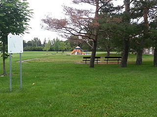
English: View of a small stand of trees at Pauline Vanier Park, in Ottawa's Riverside Park East neighborhood. During the late 1980s and 1990s, this was the site of a wooden play structure. General Vanier Public School and its play structure are visible in the background. |
Date | |
Source | Own work |
Author | Dvermeirre |
Camera location | 45° 22′ 16.8″ N, 75° 40′ 27.78″ W | View this and other nearby images on: OpenStreetMap | 45.371334; -75.674382 |
---|
Looking northeast
Licensing[edit]
This file is made available under the Creative Commons CC0 1.0 Universal Public Domain Dedication. | |
The person who associated a work with this deed has dedicated the work to the public domain by waiving all of their rights to the work worldwide under copyright law, including all related and neighboring rights, to the extent allowed by law. You can copy, modify, distribute and perform the work, even for commercial purposes, all without asking permission.
http://creativecommons.org/publicdomain/zero/1.0/deed.enCC0Creative Commons Zero, Public Domain Dedicationfalsefalse |
File history
Click on a date/time to view the file as it appeared at that time.
Date/Time | Thumbnail | Dimensions | User | Comment | |
---|---|---|---|---|---|
current | 12:21, 26 August 2015 | 3,264 × 2,448 (2.39 MB) | Dvermeirre (talk | contribs) | User created page with UploadWizard |
You cannot overwrite this file.
File usage on Commons
There are no pages that use this file.
Metadata
This file contains additional information such as Exif metadata which may have been added by the digital camera, scanner, or software program used to create or digitize it. If the file has been modified from its original state, some details such as the timestamp may not fully reflect those of the original file. The timestamp is only as accurate as the clock in the camera, and it may be completely wrong.
Camera manufacturer | SAMSUNG |
---|---|
Camera model | SGH-T999V |
Exposure time | 1/100 sec (0.01) |
F-number | f/2.6 |
ISO speed rating | 125 |
Date and time of data generation | 07:17, 26 August 2015 |
Lens focal length | 3.7 mm |
User comments | ¥ùdxV4xV4xV4xV4`‚á
èôÿÿˆ(#„ýýCALZDFE02Cur.ZDFI02CML018001001509FD0901090109010D010D010D090Dï'ë&TUNAХؓ “ /§•Ô”²Xÿÿzÿ×ÿÿJrÝÿÿ
ëZÿÿ˜FLFLSVN#
®Ð¥Ø ““ G M ?ÿ?¶wÝÿ
8JKJK #ò+šv¢ÂB…¥Ø“0p• /§•Ô”²Xÿÿzÿ×ÿÿJrÝÿÿ ëZÿÿ˜JKJK"w"D’™ ’™ """""‘"‘‘"D"""""‘""‘‘""w"‘‘‘‘‘""""w"w"D"""‘!"!"!"!"‘‘"""D""""‘‘‘‘‘‘‘"""!"!"!"!"‘‘‘!"‘’™ ‘‘‘"""!"!"!""wQ3A"‘!"‘’™ ’™ ‘!""D!""D"D"D"D"D1"1"!""w!"‘"w!"!""w"D!""D"D"D"D2D1"1"1"1"‘2w"w"w"w"w"w"w"w"w"w"w"w"w"w"w"w"w"w"w"w"w"w"w"w"w"w"w"w"w"w"w"w"w"w"w"w"w"w"w"w"w"w"w"w"w"w"w"w"w"w"w"w"w"w"w"w"w"w"w"w"w"w"w"w"w"w"w"w"w"w"w"w"w"w"w"w"w"w"w"w"w"w"w"w"w"w"w"w"w"w"w"w"w"w"w"w"w"w"w"w"w"w"w"w"w"w"w"w"w"w"w"w"w"w"wJKJKKôÿÚ”+>çÿõŠ*Sþÿxñòͧíÿÿ*̓0n•*0z•*0z•*0z• ýAFAF4œy—?(Nê †@êÒEЫðйd²`²îÐÐî Çî ô¥/oô6"¦L"$ò tŠ ÈÐ A ,üý ²üýö% þ¦ñžAFAFøZD’AFAFäÞ°ô€ 8¤xR¼)Þ)Þss\&ºÆ³6n××ÙÛÝßΊFß›WðÞ¼šz'&4ƒ yƒ y |
Latitude | 45° 22′ 16.8″ N |
Longitude | 75° 40′ 27.78″ W |
Altitude | 0 meters above sea level |
Width | 3,264 px |
Height | 2,448 px |
Orientation | Normal |
Horizontal resolution | 72 dpi |
Vertical resolution | 72 dpi |
Software used | T999VVLUFNH2 |
File change date and time | 07:17, 26 August 2015 |
Y and C positioning | Centered |
Exposure Program | Aperture priority |
Exif version | 2.2 |
Date and time of digitizing | 07:17, 26 August 2015 |
Meaning of each component |
|
APEX shutter speed | 6.64453125 |
APEX aperture | 2.76 |
APEX brightness | 3.97265625 |
APEX exposure bias | 0 |
Maximum land aperture | 2.76 APEX (f/2.6) |
Metering mode | Center weighted average |
Light source | Unknown |
Flash | Flash did not fire |
Supported Flashpix version | 1 |
Color space | sRGB |
Sensing method | One-chip color area sensor |
Scene type | 49 |
Exposure mode | Auto exposure |
White balance | Auto white balance |
Scene capture type | Standard |
Unique image ID | ZDFI02 |
GPS time (atomic clock) | 11:17 |
GPS date | 26 August 2015 |
GPS tag version | 0.0.2.2 |