File:Parahyaena brunnea range map.png
Jump to navigation
Jump to search
No higher resolution available.
Parahyaena_brunnea_range_map.png (456 × 473 pixels, file size: 17 KB, MIME type: image/png)
Captions
Captions
Add a one-line explanation of what this file represents
Summary[edit]
| Description |
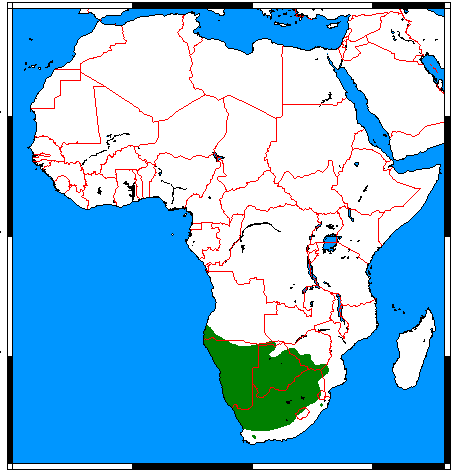
English: Range map for Brown Hyena (Parahyaena brunnea), made by me with help of www.aquarius.geomar.de, Map depending on the range map at IUCN red list. |
| Date | |
| Source | Own work |
| Author | Udo Schröter |

|
This biogeographical map image could be re-created using vector graphics as an SVG file. This has several advantages; see Commons:Media for cleanup for more information. If an SVG form of this image is available, please upload it and afterwards replace this template with
{{vector version available|new image name}}.
It is recommended to name the SVG file “Parahyaena brunnea range map.svg”—then the template Vector version available (or Vva) does not need the new image name parameter. |
Licensing[edit]
I, the copyright holder of this work, hereby publish it under the following licenses:
This file is licensed under the Creative Commons Attribution-Share Alike 3.0 Unported, 2.5 Generic, 2.0 Generic and 1.0 Generic license.
- You are free:
- to share – to copy, distribute and transmit the work
- to remix – to adapt the work
- Under the following conditions:
- attribution – You must give appropriate credit, provide a link to the license, and indicate if changes were made. You may do so in any reasonable manner, but not in any way that suggests the licensor endorses you or your use.
- share alike – If you remix, transform, or build upon the material, you must distribute your contributions under the same or compatible license as the original.

|
Permission is granted to copy, distribute and/or modify this document under the terms of the GNU Free Documentation License, Version 1.2 or any later version published by the Free Software Foundation; with no Invariant Sections, no Front-Cover Texts, and no Back-Cover Texts. A copy of the license is included in the section entitled GNU Free Documentation License. |
You may select the license of your choice.
File history
Click on a date/time to view the file as it appeared at that time.
| Date/Time | Thumbnail | Dimensions | User | Comment | |
|---|---|---|---|---|---|
| current | 01:13, 18 March 2018 | | 456 × 473 (17 KB) | Maphobbyist (talk | contribs) | Border updates: Eritrea and Lebanon added, the former Waalvisbai removed, and all border gaps filled. |
| 09:13, 15 March 2018 |  | 456 × 473 (18 KB) | Nordelch (talk | contribs) | with South Sudan | |
| 15:40, 21 April 2009 |  | 456 × 473 (19 KB) | Nordelch (talk | contribs) | {{Information |Description={{en|1=Range map for Brown Hyena (''Parahyaena brunnea''), made by me with help of [http://www.aquarius.geomar.de/omc_intro.html www.aquarius.geomar.de], Map depending on the [http://www.iucnredlist.org/details/10276 range map a |
You cannot overwrite this file.
File usage on Commons
There are no pages that use this file.
File usage on other wikis
The following other wikis use this file:
- Usage on sv.wikipedia.org