File:Palestine in 1721.jpg
Jump to navigation
Jump to search
Size of this preview: 633 × 599 pixels. Other resolutions: 254 × 240 pixels | 507 × 480 pixels | 811 × 768 pixels | 1,082 × 1,024 pixels | 1,308 × 1,238 pixels.
Original file (1,308 × 1,238 pixels, file size: 268 KB, MIME type: image/jpeg)
Captions
Captions
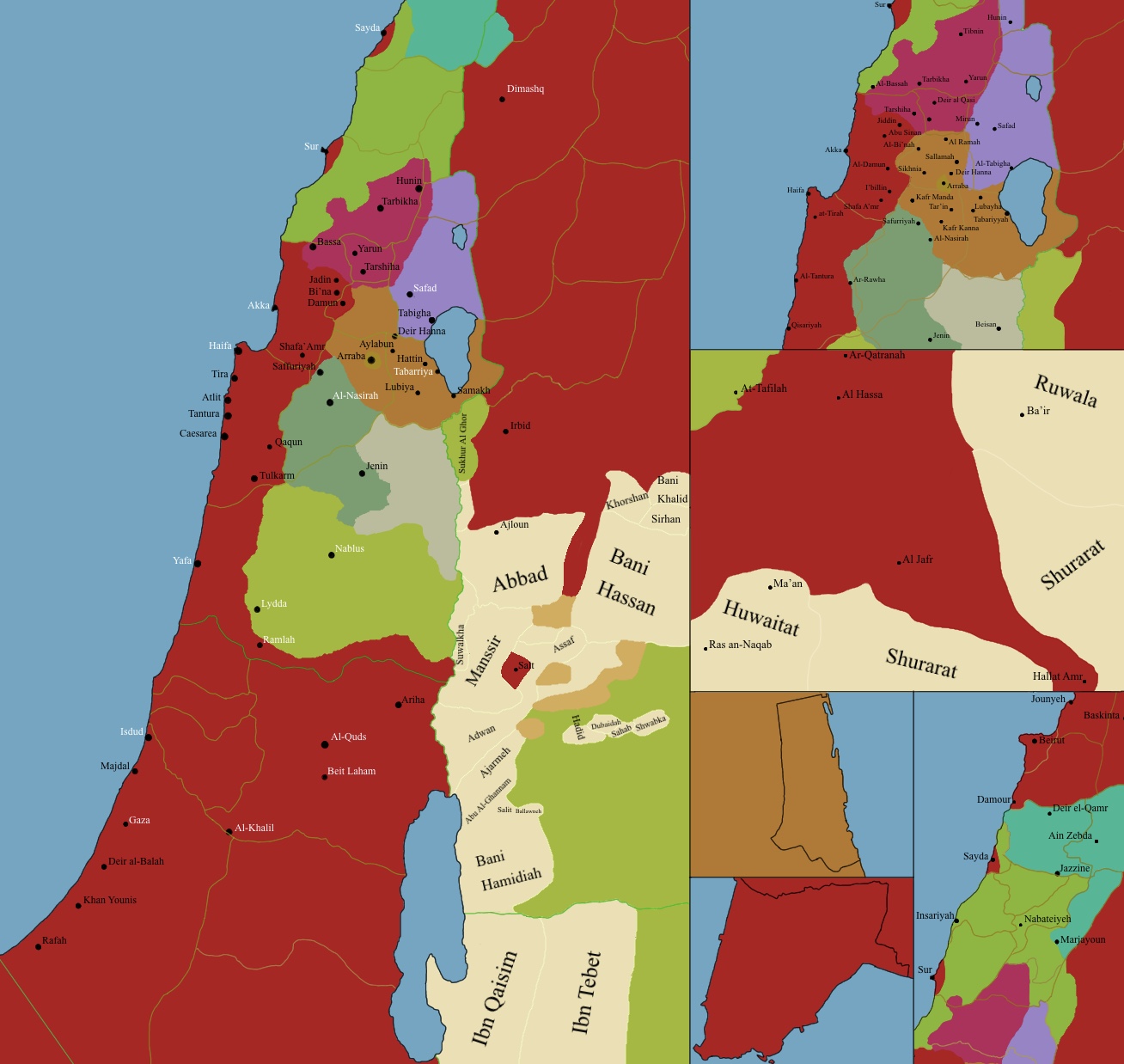
Map of Palestine in January 1721 just before Zahir Al Umar Al Zaydani would start consolidating power
Summary[edit]
| Description |
English: Map of Palestine in January 1721, showing Bani Saqr (Tabariyah) Metuwalis of Nassif an Nassar (Jabal Amil), Metuwalis of Sur, Kingdom of the Druze (Deir Al Qamar),Domains of Muhammad Naf’i (Safed), Zayadina Holdings (Arraba),Jarrari Clan holdings (Jenin), Sanur Tribe (Tubas), Bani Sakher (Nablus and Beyond the Jordan) as well as various Bedouin Tribes of the Karak and Jordan Valley |
| Date | |
| Source | Own work |
| Author | A.H.T Videomapping |
Licensing[edit]
I, the copyright holder of this work, hereby publish it under the following license:
This file is licensed under the Creative Commons Attribution-Share Alike 4.0 International license.
- You are free:
- to share – to copy, distribute and transmit the work
- to remix – to adapt the work
- Under the following conditions:
- attribution – You must give appropriate credit, provide a link to the license, and indicate if changes were made. You may do so in any reasonable manner, but not in any way that suggests the licensor endorses you or your use.
- share alike – If you remix, transform, or build upon the material, you must distribute your contributions under the same or compatible license as the original.
File history
Click on a date/time to view the file as it appeared at that time.
| Date/Time | Thumbnail | Dimensions | User | Comment | |
|---|---|---|---|---|---|
| current | 02:34, 18 July 2022 | | 1,308 × 1,238 (268 KB) | A.H.T Videomapping (talk | contribs) | Uploaded own work with UploadWizard |
You cannot overwrite this file.
File usage on Commons
There are no pages that use this file.