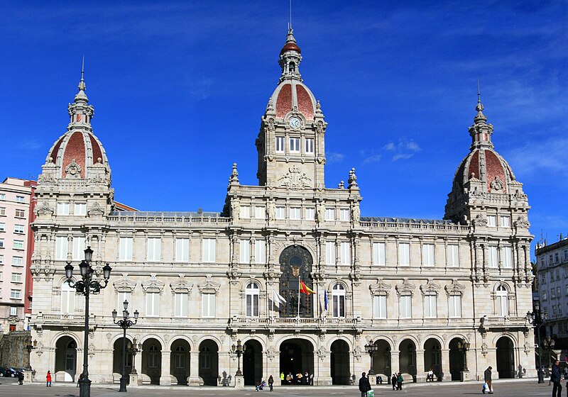
File:Palacio Municipal de María Pita - A Coruña - 31-01-09.jpg

Original file (2,905 × 2,034 pixels, file size: 3.19 MB, MIME type: image/jpeg)
Captions
Captions
| DescriptionPalacio Municipal de María Pita - A Coruña - 31-01-09.jpg |
Palacio Municipal de María Pita - A Coruña dificio modernista construido entre los años 1908 y 1912 que ocupa el frente norte de la Plaza de María Pita. Fue inaugurado por el Rey Alfonso XIII en el año 1927. En el se encuentran varios servicios administrativos del Ayuntamiento.
|
||
| Date | |||
| Source | originally posted to Flickr as Palacio Municipal de María Pita - La Coruña - 31-01-09 | ||
| Author | Ramon Piñeiro | ||
| Permission (Reusing this file) |
This file is licensed under the Creative Commons Attribution-Share Alike 2.0 Generic license.
|
| Camera location | 43° 22′ 15.24″ N, 8° 23′ 45.78″ W | View this and other nearby images on: OpenStreetMap |
|---|
File history
Click on a date/time to view the file as it appeared at that time.
| Date/Time | Thumbnail | Dimensions | User | Comment | |
|---|---|---|---|---|---|
| current | 17:25, 21 March 2010 |  | 2,905 × 2,034 (3.19 MB) | Lmbuga (talk | contribs) | watermark & border |
| 17:21, 21 March 2010 |  | 2,925 × 2,053 (870 KB) | Flickr upload bot (talk | contribs) | Uploaded from http://flickr.com/photo/22625483@N04/3244255142 using Flickr upload bot |
You cannot overwrite this file.
File usage on Commons
There are no pages that use this file.
File usage on other wikis
The following other wikis use this file:
- Usage on ca.wikipedia.org
- Usage on gl.wikipedia.org
Metadata
This file contains additional information such as Exif metadata which may have been added by the digital camera, scanner, or software program used to create or digitize it. If the file has been modified from its original state, some details such as the timestamp may not fully reflect those of the original file. The timestamp is only as accurate as the clock in the camera, and it may be completely wrong.
| Orientation | Normal |
|---|---|
| Horizontal resolution | 72 dpi |
| Vertical resolution | 72 dpi |
| Software used | Adobe Photoshop CS3 Windows |
| File change date and time | 18:24, 21 March 2010 |
| Y and C positioning | Centered |
| Color space | Uncalibrated |