File:Old meander, River Ouse - geograph.org.uk - 1780629.jpg
Jump to navigation
Jump to search
No higher resolution available.
Old_meander,_River_Ouse_-_geograph.org.uk_-_1780629.jpg (640 × 428 pixels, file size: 181 KB, MIME type: image/jpeg)
Captions
Captions
Add a one-line explanation of what this file represents
Summary[edit]
| Description |
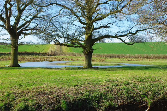
English: Old meander, River Ouse The present river course is much straighter here, the far bank is in the foreground. Victorian parish boundaries followed this and several other meanders above Upper Ryelands Bridge which were bypassed then and now. There is thus a suspicion that some work was done for the Ouse Navigation this far up, although all authorities state that the bridge was the limit of the completed navigation. |
| Date | |
| Source | From geograph.org.uk |
| Author | Robin Webster |
| Attribution (required by the license) | Robin Webster / Old meander, River Ouse / |
| Camera location | | View this and other nearby images on: OpenStreetMap |
|---|
_heading:225.00&language=en)
| Object location | | View this and other nearby images on: OpenStreetMap |
|---|
_heading:225.00&language=en)
Licensing[edit]

|
This image was taken from the Geograph project collection. See this photograph's page on the Geograph website for the photographer's contact details. The copyright on this image is owned by Robin Webster and is licensed for reuse under the Creative Commons Attribution-ShareAlike 2.0 license.
|
This file is licensed under the Creative Commons Attribution-Share Alike 2.0 Generic license.
Attribution: Robin Webster
- You are free:
- to share – to copy, distribute and transmit the work
- to remix – to adapt the work
- Under the following conditions:
- attribution – You must give appropriate credit, provide a link to the license, and indicate if changes were made. You may do so in any reasonable manner, but not in any way that suggests the licensor endorses you or your use.
- share alike – If you remix, transform, or build upon the material, you must distribute your contributions under the same or compatible license as the original.
File history
Click on a date/time to view the file as it appeared at that time.
| Date/Time | Thumbnail | Dimensions | User | Comment | |
|---|---|---|---|---|---|
| current | 12:14, 14 March 2011 | | 640 × 428 (181 KB) | GeographBot (talk | contribs) | == {{int:filedesc}} == {{Information |description={{en|1=Old meander, River Ouse The present river course is much straighter here, the far bank is in the foreground. Victorian parish boundaries followed this and several other meanders above Upper Ryelands |
You cannot overwrite this file.
File usage on Commons
There are no pages that use this file.