File:Ok-hwy-sys.png
Jump to navigation
Jump to search
Size of this preview: 800 × 474 pixels. Other resolutions: 320 × 190 pixels | 640 × 380 pixels | 1,024 × 607 pixels | 1,280 × 759 pixels | 3,425 × 2,031 pixels.
Original file (3,425 × 2,031 pixels, file size: 1.09 MB, MIME type: image/png)
Captions
Captions
Add a one-line explanation of what this file represents
Summary[edit]
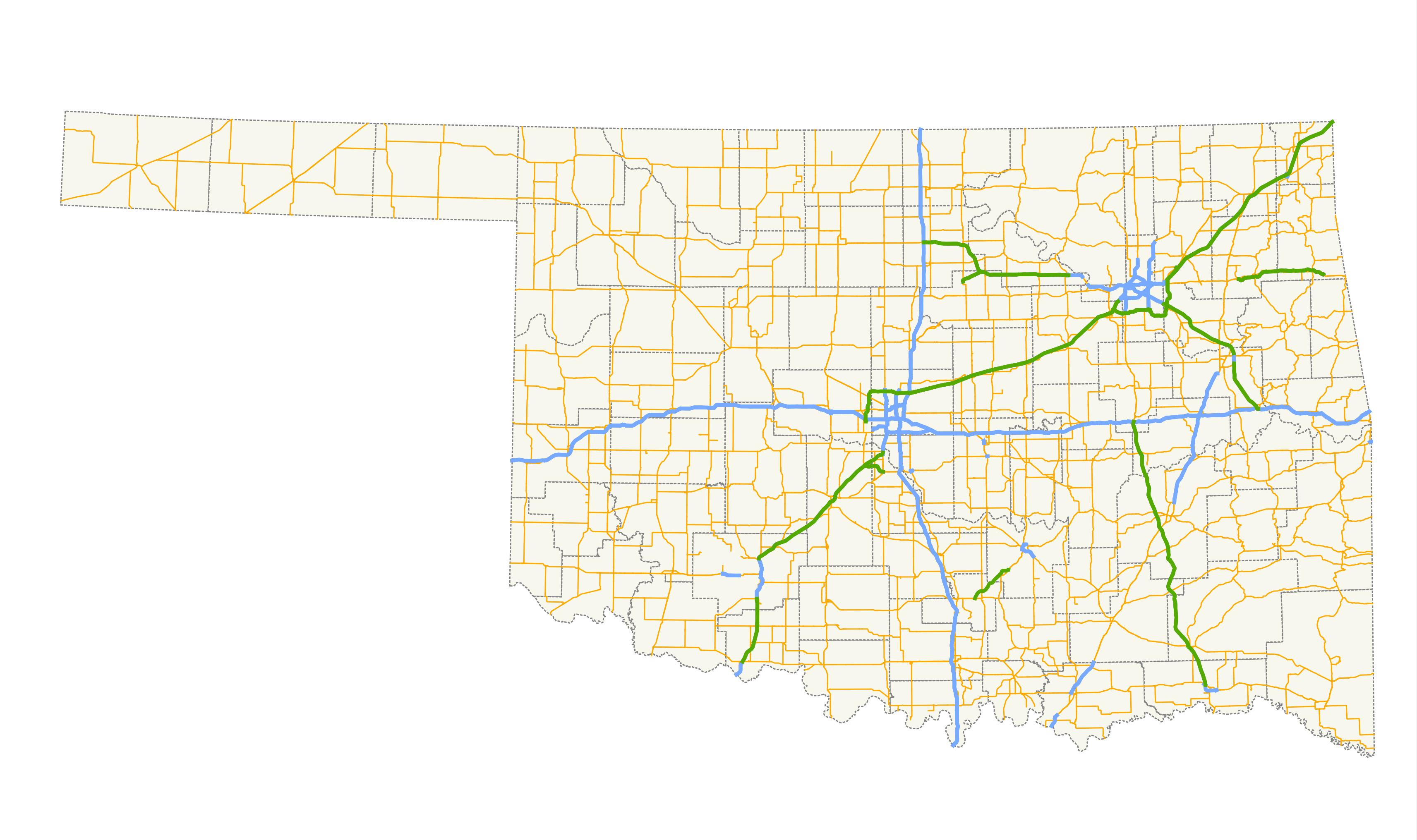
| Description | A map showing the path of all state highways and their spurs in Oklahoma. |
| Date | |
| Source |
Created by me in Quantum GIS 1.3.0 based on data collected from the Oklahoma Department of Transportation. |
| Author | Scott Nazelrod |
| Permission (Reusing this file) |
Public domain, credit appreciated but not required |
Licensing[edit]
| I, the copyright holder of this work, release this work into the public domain. This applies worldwide. In some countries this may not be legally possible; if so: I grant anyone the right to use this work for any purpose, without any conditions, unless such conditions are required by law. |
File history
Click on a date/time to view the file as it appeared at that time.
| Date/Time | Thumbnail | Dimensions | User | Comment | |
|---|---|---|---|---|---|
| current | 04:23, 5 January 2010 | | 3,425 × 2,031 (1.09 MB) | Scott5114 (talk | contribs) | Even more freeways, dashed lines for c/ls |
| 08:48, 23 January 2009 |  | 3,425 × 2,031 (162 KB) | Scott5114 (talk | contribs) | Better projection, more freeways | |
| 05:18, 18 February 2008 | 944 × 375 (41 KB) | Scott5114 (talk | contribs) | Reverted to version as of 19:15, 6 February 2007 | ||
| 05:17, 18 February 2008 |  | 2,205 × 1,286 (107 KB) | Scott5114 (talk | contribs) | Stratosphere version | |
| 19:15, 6 February 2007 | 944 × 375 (41 KB) | Scott5114 (talk | contribs) | Crop | ||
| 19:12, 6 February 2007 |  | 944 × 789 (34 KB) | Scott5114 (talk | contribs) | Will Rogers, Cherokee, Norman Spur Turnpikes | |
| 19:03, 31 January 2007 | 944 × 376 (41 KB) | Scott5114 (talk | contribs) | Crop | ||
| 18:45, 31 January 2007 |  | 944 × 789 (34 KB) | Scott5114 (talk | contribs) | {{Information |Description=A map showing the path of all state highways and their spurs in Oklahoma. |Source=Created by me in Quantum GIS 0.8.0 based on data collected from http://www.geo.ou.edu/. |Date=31 January 2007 |Author=[[User:Scott5114|Sc |
You cannot overwrite this file.
File usage on Commons
The following page uses this file:
File usage on other wikis
The following other wikis use this file:
- Usage on de.wikipedia.org
- Usage on en.wikipedia.org
- Usage on fr.wikipedia.org
- Usage on www.wikidata.org