File:OR140 Exit 35 to Blackwell utility relocates (51417680458).jpg
Jump to navigation
Jump to search
Size of this preview: 800 × 533 pixels. Other resolutions: 320 × 213 pixels | 640 × 427 pixels | 1,024 × 683 pixels | 1,280 × 853 pixels | 2,560 × 1,707 pixels | 5,472 × 3,648 pixels.
Original file (5,472 × 3,648 pixels, file size: 9.45 MB, MIME type: image/jpeg)
Captions
Captions
Add a one-line explanation of what this file represents
Summary[edit]
.jpg&action=edit§ion=1)
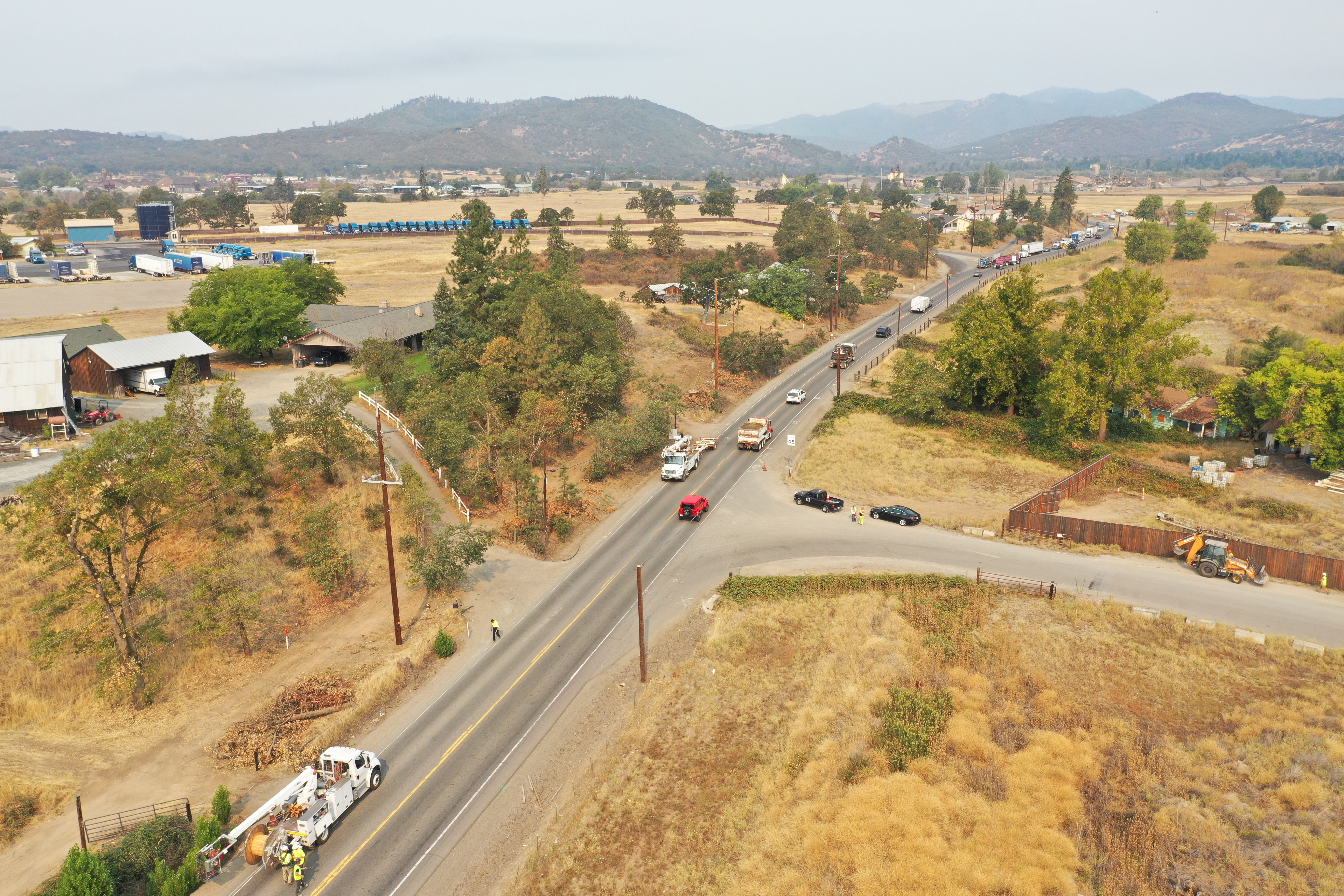
| Description | Traffic is placed in single lane so utility crews can relocate power lines. Utilities are typically relocated prior to construction projects. In this case, it's the OR140: Exit 35 to Blackwell project, scheduled to begin late this year or early 2022. Aug. 31, 2021 |
| Date | |
| Source | OR140: Exit 35 to Blackwell utility relocates |
| Author | Oregon Department of Transportation |
| Camera location | | View this and other nearby images on: OpenStreetMap |
|---|
.jpg¶ms=042.414977_N_-122.949356_E_globe:Earth_type:camera_source:Flickr_&language=en)
Licensing[edit]
.jpg&action=edit§ion=2)
This file is licensed under the Creative Commons Attribution 2.0 Generic license.
- You are free:
- to share – to copy, distribute and transmit the work
- to remix – to adapt the work
- Under the following conditions:
- attribution – You must give appropriate credit, provide a link to the license, and indicate if changes were made. You may do so in any reasonable manner, but not in any way that suggests the licensor endorses you or your use.
| This image was originally posted to Flickr by OregonDOT at https://flickr.com/photos/28364885@N02/51417680458. It was reviewed on 5 October 2021 by FlickreviewR 2 and was confirmed to be licensed under the terms of the cc-by-2.0. |
File history
Click on a date/time to view the file as it appeared at that time.
| Date/Time | Thumbnail | Dimensions | User | Comment | |
|---|---|---|---|---|---|
| current | 21:06, 4 October 2021 | | 5,472 × 3,648 (9.45 MB) | Tm (talk | contribs) | Transferred from Flickr via #flickr2commons |
You cannot overwrite this file.
File usage on Commons
There are no pages that use this file.
.jpg&oldid=803474678)