File:Niger, Dosso (55), Route Nationale 7 Gaya-Dosso.jpg
Jump to navigation
Jump to search

Size of this preview: 800 × 450 pixels. Other resolutions: 320 × 180 pixels | 640 × 360 pixels | 1,024 × 576 pixels | 1,280 × 720 pixels | 2,560 × 1,440 pixels | 3,700 × 2,081 pixels.
Original file (3,700 × 2,081 pixels, file size: 2.22 MB, MIME type: image/jpeg)
Captions
Captions
Add a one-line explanation of what this file represents
Summary[edit]
,_Route_Nationale_7_Gaya-Dosso.jpg&action=edit§ion=1)
| Description |
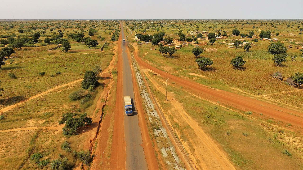
English: Aerial view of the Route Nationale 7 (RN7) from Gaya -at the Benin border- to Dosso, seen here some 5 km south of Dosso and looking toward Dosso (Dosso Department, Dosso Region, Niger). On the right is the last stretch of the Niamey-Dosso railway and the village of Zamadey.
Français : Vue aérienne de la Route Nationale 7 (RN7) de Gaya -à la frontière béninoise- à Dosso, ici à environ 5 km au sud de Dosso et regardant vers Dosso (département de Dosso, région de Dosso, au Niger). Sur la droite, le dernier tronçon de la voie ferrée Niamey-Dosso et le village de Zamadey. |
| Date | |
| Source | Own work |
| Author | NigerTZai |
Looking to the north from:
| Camera location | | View this and other nearby images on: OpenStreetMap |
|---|
,_Route_Nationale_7_Gaya-Dosso.jpg¶ms=012.995897_N_0003.198361_E_globe:Earth_type:camera__&language=en)
Licensing[edit]
,_Route_Nationale_7_Gaya-Dosso.jpg&action=edit§ion=2)
I, the copyright holder of this work, hereby publish it under the following licenses:
This file is licensed under the Creative Commons Attribution-Share Alike 4.0 International license.
- You are free:
- to share – to copy, distribute and transmit the work
- to remix – to adapt the work
- Under the following conditions:
- attribution – You must give appropriate credit, provide a link to the license, and indicate if changes were made. You may do so in any reasonable manner, but not in any way that suggests the licensor endorses you or your use.
- share alike – If you remix, transform, or build upon the material, you must distribute your contributions under the same or compatible license as the original.

|
Permission is granted to copy, distribute and/or modify this document under the terms of the GNU Free Documentation License, Version 1.2 or any later version published by the Free Software Foundation; with no Invariant Sections, no Front-Cover Texts, and no Back-Cover Texts. A copy of the license is included in the section entitled GNU Free Documentation License. |
You may select the license of your choice.
File history
Click on a date/time to view the file as it appeared at that time.
| Date/Time | Thumbnail | Dimensions | User | Comment | |
|---|---|---|---|---|---|
| current | 17:21, 4 December 2020 | | 3,700 × 2,081 (2.22 MB) | NigerTZai (talk | contribs) | {{Information |Description={{en|1=Aerial view of the Route Nationale 7 (RN7) from Gaya -at the Benin border- to Dosso, seen here some 5 km south of Dosso and looking toward Dosso (Dosso Department, Dosso Region, Niger). On the right is the last stretch of the Niamey-Dosso railway and the village of Zamadey.}} {{fr|1=Vue aérienne de la Route Nationale 7 (RN7) de Gaya -à la frontière béninoise- à Dosso, ici à environ 5 km au sud de Dosso et regardant vers Dosso (département de Dosso, région de... |
You cannot overwrite this file.
File usage on Commons
There are no pages that use this file.
File usage on other wikis
The following other wikis use this file:
- Usage on de.wikipedia.org
- Usage on fr.wikipedia.org
- Usage on www.wikidata.org
,_Route_Nationale_7_Gaya-Dosso.jpg&oldid=868583121)