File:Ncisles Val Mont dal Ega Gherdeina.jpg
Jump to navigation
Jump to search
Size of this preview: 800 × 534 pixels. Other resolutions: 320 × 214 pixels | 640 × 427 pixels | 1,024 × 683 pixels | 1,280 × 854 pixels | 2,560 × 1,709 pixels | 7,360 × 4,912 pixels.
Original file (7,360 × 4,912 pixels, file size: 21.83 MB, MIME type: image/jpeg)
Captions
Captions
Add a one-line explanation of what this file represents
Summary[edit]
| Description |
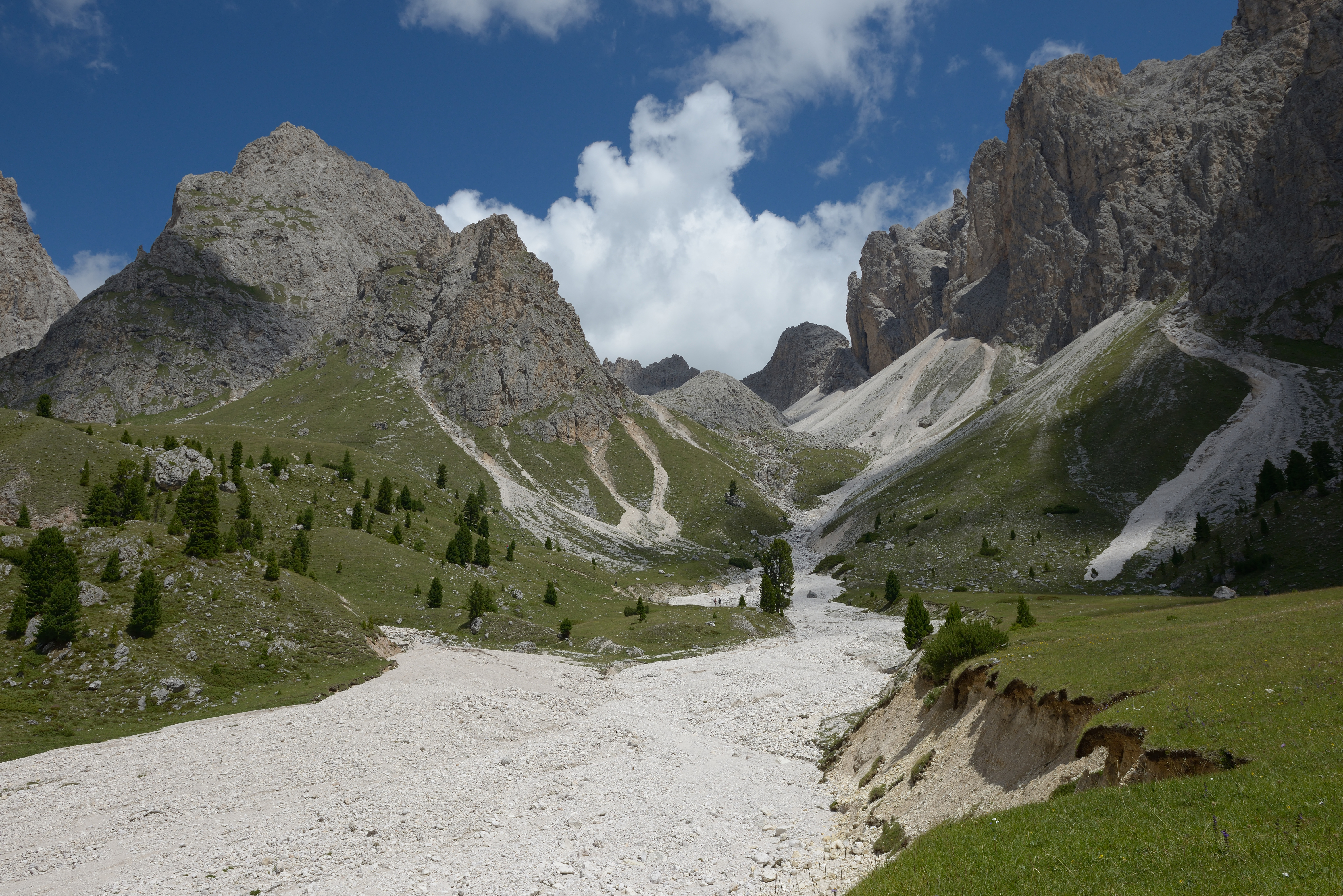
English: The Pastura de Ncisles pasture and the Mont dal Ega valley in the Puez-Geisler Nature Park, Dolomites UNESCO World Heritage Site.
Deutsch: Pastura de Ncisles Weide und das Mont dal Ega Tal im Naturpark Puez-Geisler in den Südtiroler Dolomiten
Italiano: Pascolo Pastura de Ncisles e il Mont dal Ega nel Parco naturale Puez-Odle nelle Dolomiti |
||||||
| Date | |||||||
| Source | Own work | ||||||
| Author |
|
||||||
| Permission (Reusing this file) |
Own work, attribution required (Multi-license with GFDL and Creative Commons CC-BY 2.5). Capture: Photo by Wolfgang Moroder | ||||||
| Other versions |
 |

|
| Camera location | | View this and other nearby images on: OpenStreetMap |
|---|
Licensing[edit]
This file is licensed under the Creative Commons Attribution-Share Alike 3.0 Unported license.
- You are free:
- to share – to copy, distribute and transmit the work
- to remix – to adapt the work
- Under the following conditions:
- attribution – You must give appropriate credit, provide a link to the license, and indicate if changes were made. You may do so in any reasonable manner, but not in any way that suggests the licensor endorses you or your use.
- share alike – If you remix, transform, or build upon the material, you must distribute your contributions under the same or compatible license as the original.
| Annotations | This image is annotated: View the annotations at Commons |
This image has been assessed using the Quality image guidelines and is considered a Quality image.
|
File history
Click on a date/time to view the file as it appeared at that time.
| Date/Time | Thumbnail | Dimensions | User | Comment | |
|---|---|---|---|---|---|
| current | 18:59, 22 July 2017 | | 7,360 × 4,912 (21.83 MB) | Moroder (talk | contribs) | bottom crop |
| 08:37, 22 July 2017 |  | 7,360 × 4,912 (30.33 MB) | Moroder (talk | contribs) | == {{int:filedesc}} == {{Information |Description= {{en|1=The ''Pastura de Ncisles'' pasture and the ''Mont dal Ega'' valley in the Puez-Geisler Nature Park, Dolomites UNESCO World Heritage Site.}} {{de|1=''Pastu... |
You cannot overwrite this file.
File usage on Commons
The following 17 pages use this file:
- User:Mai-Sachme/South Tyrol/2017 July 21-31
- User:Moroder
- User talk:Moroder/Archives 2017-3
- Commons:Featured picture candidates/File:Ncisles Val Mont dal Ega Gherdeina.jpg
- Commons:Featured picture candidates/Log/July 2017
- Commons:Featured pictures/Places/Natural/Italy
- Commons:Featured pictures/chronological/2017-B
- Commons:Picture of the Year/2017/Candidates
- Commons:Picture of the Year/2017/R1/Gallery/2017-B
- Commons:Picture of the Year/2017/R1/Gallery/ALL
- Commons:Picture of the Year/2017/R1/Gallery/M07
- Commons:Picture of the Year/2017/R1/Gallery/Nature views
- Commons:Picture of the Year/2017/R1/v/Ncisles Val Mont dal Ega Gherdeina.jpg
- Commons:Quality images/Subject/Places/Natural structures/archive 2017
- Commons:Quality images candidates/Archives July 25 2017
- File:Ncisles Odles Sas Rigais Cansles Gherdeina.jpg
- File:Ncisles Val Mont dal Ega Gherdeina.jpg
File usage on other wikis
The following other wikis use this file:
- Usage on ca.wikipedia.org
- Usage on lld.wikipedia.org