File:NY Route 22 map.png
Jump to navigation
Jump to search
Size of this preview: 800 × 474 pixels. Other resolutions: 320 × 190 pixels | 640 × 380 pixels | 1,024 × 607 pixels | 1,280 × 759 pixels | 2,283 × 1,354 pixels.
Original file (2,283 × 1,354 pixels, file size: 65 KB, MIME type: image/png)
Captions
Captions
Add a one-line explanation of what this file represents
Summary[edit]
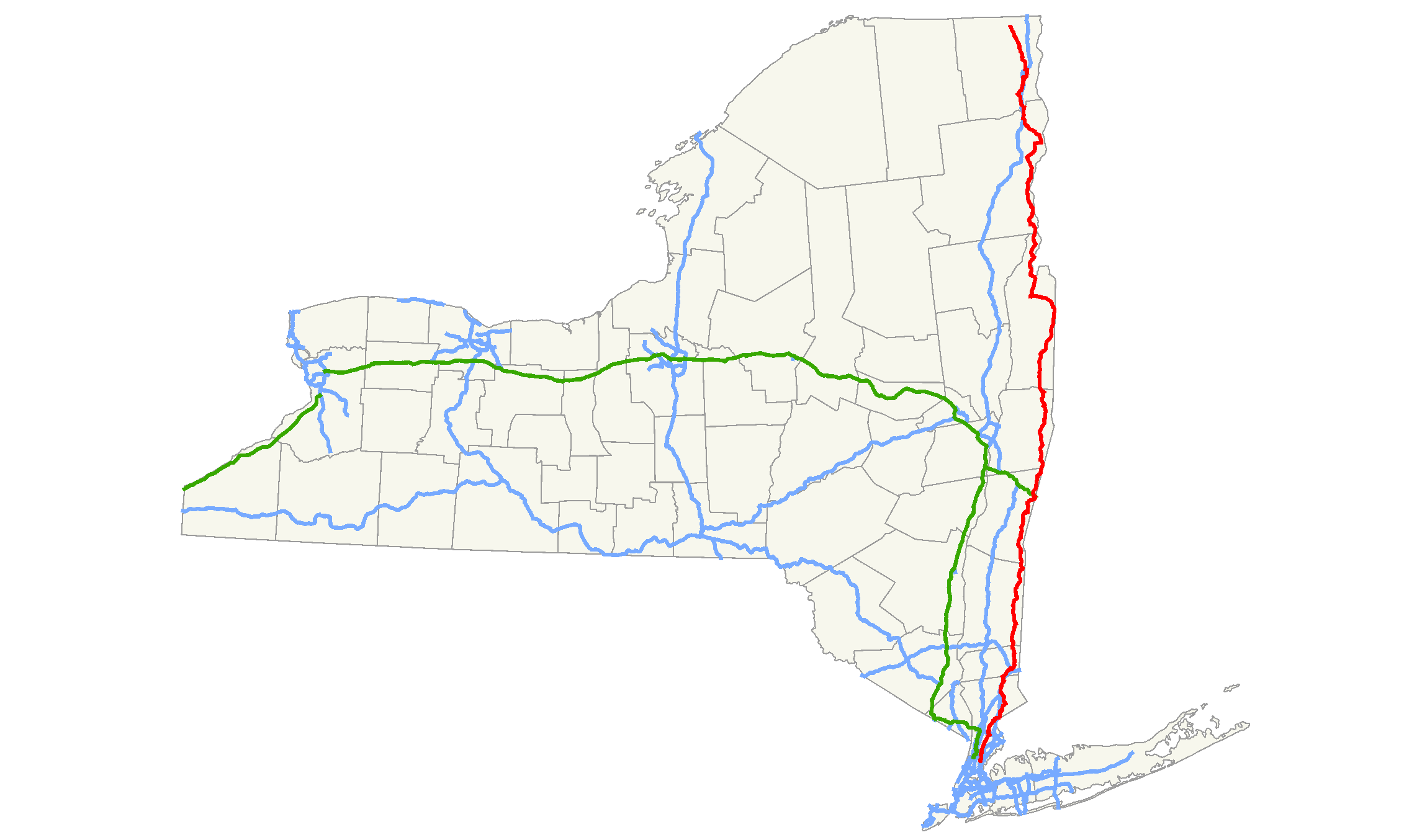
| Description | Map of New York State Route 22. Information attained from the New York State Geographical Information System via Quantum GIS programs. |
| Date | |
| Source |
Own work |
| Author | TwinsMetsFan |
Licensing[edit]
| I, the copyright holder of this work, release this work into the public domain. This applies worldwide. In some countries this may not be legally possible; if so: I grant anyone the right to use this work for any purpose, without any conditions, unless such conditions are required by law. |
File history
Click on a date/time to view the file as it appeared at that time.
| Date/Time | Thumbnail | Dimensions | User | Comment | |
|---|---|---|---|---|---|
| current | 17:35, 3 August 2008 | | 2,283 × 1,354 (65 KB) | Algorerhythms (talk | contribs) | == Summary == {{Information |Description=Map of New York State Route 22, with modifications by Algorerhythms to reflect the route being truncated to US 11. |Source=self-made |Date=December 6, 2007 |Auth |
| 17:56, 6 December 2007 |  | 2,283 × 1,354 (66 KB) | TwinsMetsFan (talk | contribs) | {{Information |Description=Map of w:New York State Route 22. |Source=self-made |Date=December 6, 2007 |Author= TwinsMetsFan |Permission= |other_versions= }} |
You cannot overwrite this file.
File usage on Commons
The following 2 pages use this file:
File usage on other wikis
The following other wikis use this file:
- Usage on en.wikipedia.org
- Usage on id.wikipedia.org
- Usage on nl.wikipedia.org
- Usage on www.wikidata.org