File:NOAA Satellite of 2019 Australia bushfire.jpg
Jump to navigation
Jump to search

Size of this preview: 800 × 450 pixels. Other resolutions: 320 × 180 pixels | 640 × 360 pixels | 1,024 × 576 pixels | 1,280 × 720 pixels | 1,920 × 1,080 pixels.
Original file (1,920 × 1,080 pixels, file size: 1.88 MB, MIME type: image/jpeg)
Captions
Captions
Add a one-line explanation of what this file represents
Summary
[edit]
| Description |
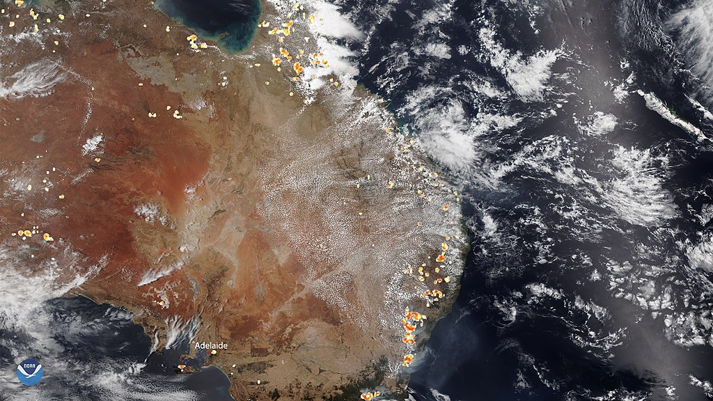
English: NOAA-20 captured this image of Australia on Dec. 26, where historic bushfires still rage in the southeastern states and territories and are especially intense around the South Australian city of Adelaide. Meanwhile, fires around Sydney have mostly been brought under control, but the New South Wales Rural Fire Service (NSWRFS) advised affected residents that “weather conditions are forecast to deteriorate over the coming days... [and to]...monitor the changing conditions.” |
| Date | |
| Source | https://www.nesdis.noaa.gov/content/fires-continue-burn-australia%E2%80%99s-southeastern-states |
| Author | NOAA / NESDiS |
Licensing
[edit]
This image is in the public domain because it contains materials that originally came from the U.S. National Oceanic and Atmospheric Administration, taken or made as part of an employee's official duties.
|
File history
Click on a date/time to view the file as it appeared at that time.
| Date/Time | Thumbnail | Dimensions | User | Comment | |
|---|---|---|---|---|---|
| current | 08:06, 6 January 2020 | | 1,920 × 1,080 (1.88 MB) | A1Cafel (talk | contribs) | User created page with UploadWizard |
You cannot overwrite this file.
File usage on Commons
The following page uses this file:
File usage on other wikis
The following other wikis use this file:
- Usage on en.wikipedia.org