File:Mexico (MODIS 2016-03-18).jpg
Jump to navigation
Jump to search

Size of this preview: 800 × 444 pixels. Other resolutions: 320 × 178 pixels | 640 × 356 pixels | 1,024 × 569 pixels | 1,280 × 711 pixels | 2,560 × 1,422 pixels | 7,200 × 4,000 pixels.
Original file (7,200 × 4,000 pixels, file size: 5.93 MB, MIME type: image/jpeg)
Captions
Captions
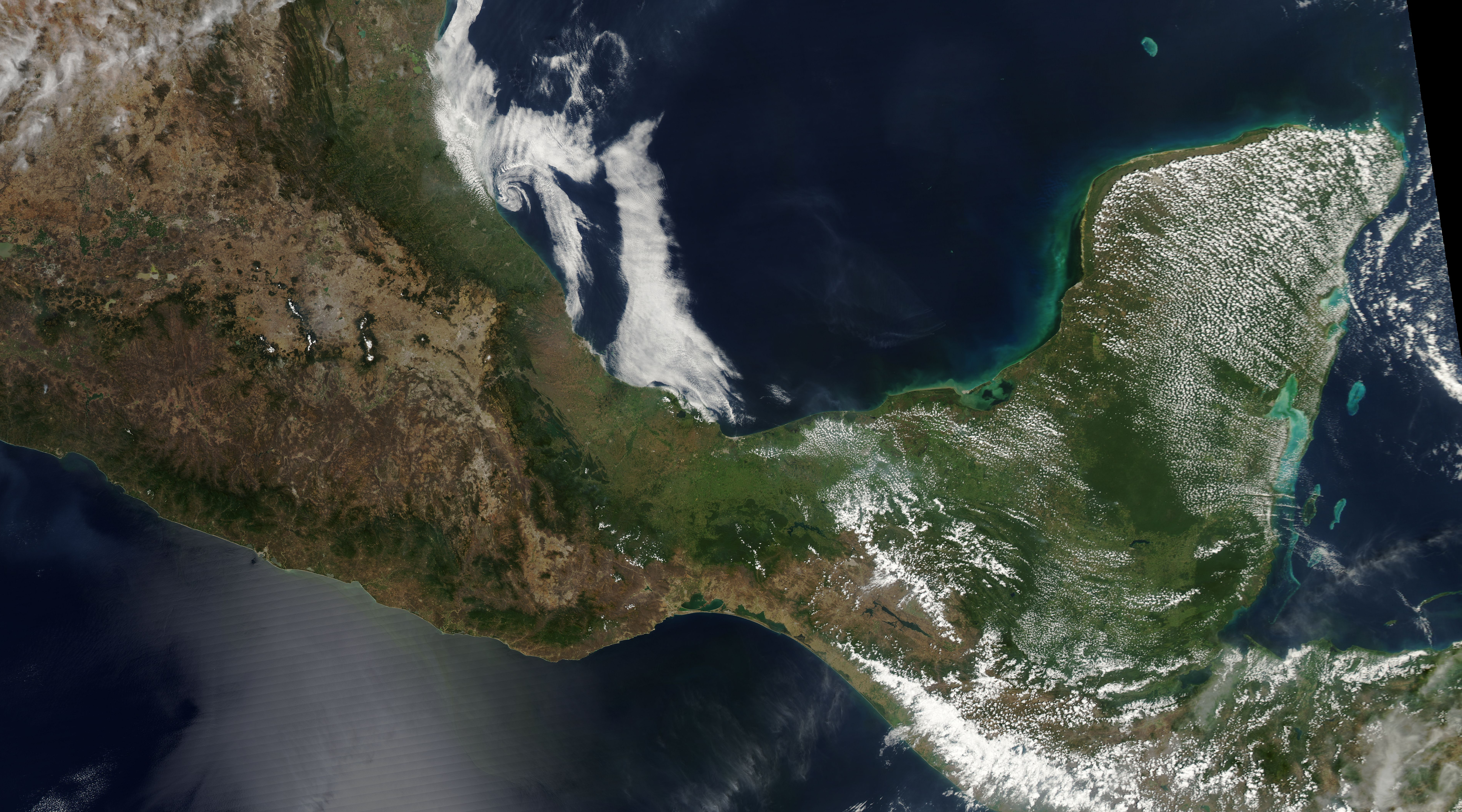
The Moderate Resolution Imaging Spectroradiometer (MODIS) aboard NASA�s Aqua satellite passed over southern Mexico on March 14, 2016, and acquired this true-color image of the region.
Summary[edit]
.jpg&action=edit§ion=1)
| Description |
English: The Moderate Resolution Imaging Spectroradiometer (MODIS) aboard NASA�s Aqua satellite passed over southern Mexico on March 14, 2016, and acquired this true-color image of the region.
Mexico borders the United States in the north and Belize and Guatemala in the south. The long coastlines lie along the Pacific Ocean in the west and the Gulf of Mexico in the east. Covering about 1,964,275 sq km (748,410 sq mi), Mexico�s size is slightly less than the state of Texas. The climate varies from tropical to desert, with vegetation ranging from rich and diverse jungles to the scant plants of the high, dry desert. Central Mexico, captured in the northern section of this image, features a volcanic plateau surrounded by mountains. The mountain chain roughly paralleling the coastline in the southwest are the Sierra Madre del Sur while the chain at the eastern edge of the southern Mexican Plateau are the Sierra Madre Occidental. Along the Gulf lies a broad, sometimes marshy plain. Known as the Gulf Coastal Plain, it extends about 1,450 km (900 mi) from the Texas border through the states of Veracruz and Tabasco all the way to the Yucat�n Peninsula. |
||
| Date | Taken on 14 March 2016 | ||
| Source |
|
||
| Author | Jeff Schmaltz, MODIS Land Rapid Response Team, NASA GSFC |
| This media is a product of the Aqua mission Credit and attribution belongs to the mission team, if not already specified in the "author" row |
Licensing[edit]
.jpg&action=edit§ion=2)
| This file is in the public domain in the United States because it was solely created by NASA. NASA copyright policy states that "NASA material is not protected by copyright unless noted". (See Template:PD-USGov, NASA copyright policy page or JPL Image Use Policy.) | ||
 |
Warnings:
|
File history
Click on a date/time to view the file as it appeared at that time.
| Date/Time | Thumbnail | Dimensions | User | Comment | |
|---|---|---|---|---|---|
| current | 19:42, 15 February 2024 | | 7,200 × 4,000 (5.93 MB) | OptimusPrimeBot (talk | contribs) | #Spacemedia - Upload of http://modis.gsfc.nasa.gov/gallery/images/image03182016_250m.jpg via Commons:Spacemedia |
You cannot overwrite this file.
File usage on Commons
There are no pages that use this file.
.jpg&oldid=855865687)