File:Mediterranean chart fourteenth century.jpg

Original file (5,486 × 4,009 pixels, file size: 15.29 MB, MIME type: image/jpeg)
Captions
Captions
| Description |
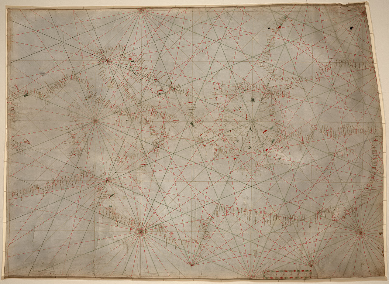
Anonymous nautical chart in portolan style probably drawn in Genoa. Covers Mediterranean Sea from the Balearic Islands to the Levantine coast; also covers western part of Black Sea. Oldest original cartographic artifact in the Library of Congress. Title from printed label on box in which the map is housed. Pen-and-ink (red/green/brown). Matted and mounted between sheets of transparent lucite. Sheet cut into the shape of an irregular rectangle. Imperfect: Vertically fold-lined at center, cracked, annotated in pencil on verso. Includes bar scale with unidentified divisions. The green rhumb lines on the recto are also visible on the verso. Scale [ca. 1:5,500,000]. |
| Date | between circa 1320 and circa 1350 |
| Source | Library of Congress[1] |
| Author | anonymous, probably Genoan |
| Other versions | Unrestored version of File:Mediterranean chart fourteenth century2.jpg. |
|
This work is in the public domain in its country of origin and other countries and areas where the copyright term is the author's life plus 70 years or fewer.
| |
| This file has been identified as being free of known restrictions under copyright law, including all related and neighboring rights. | |
File history
Click on a date/time to view the file as it appeared at that time.
| Date/Time | Thumbnail | Dimensions | User | Comment | |
|---|---|---|---|---|---|
| current | 02:49, 18 January 2009 | | 5,486 × 4,009 (15.29 MB) | Durova (talk | contribs) | {{Information |Description=Anonymous nautical chart in portolan style probably drawn in Genoa. Covers Mediterranean Sea from the Balearic Islands to the Levantine coast; also covers western part of Black Sea. Oldest original cartographic artifact in t |
You cannot overwrite this file.
File usage on Commons
The following page uses this file: